MyTopo
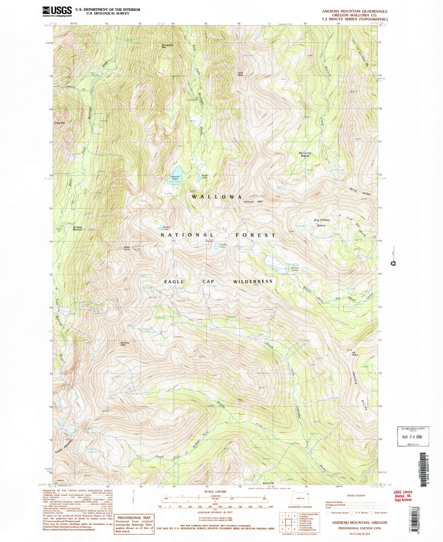
USGS Classic Aneroid Mountain Oregon 7.5'x7.5' Topo Map
Couldn't load pickup availability
Historical USGS topographic quad map of Aneroid Mountain in the state of Oregon. Scale: 1:24000. Print size: 24" x 27"
This quadrangle is in the following counties: Wallowa.
The map contains contour lines, roads, rivers, towns, lakes, and grids including latitude / longitude and UTM / MGRS. Printed on high-quality waterproof paper with UV fade-resistant inks.
Contains the following named places: Six Mile Meadow, Adam Creek, Aneroid Lake, Aneroid Mountain, Bonneville Mountain, Bonny Lakes, Cusick Mountain, Dollar Lake, East Peak, Imnaha Divide, Jewett Lake, Lake Creek, McCully Basin, Middle Fork Imhaha River, Mount Nebo, Petes Point, Sentinel Peak, South Fork Middle Fork Imhaha River, Wing Ridge, Big Sheep Basin, North Fork of Middle Fork Imnaha River, Tenderfoot Pass, Rogers Lake, Joseph Division