MyTopo
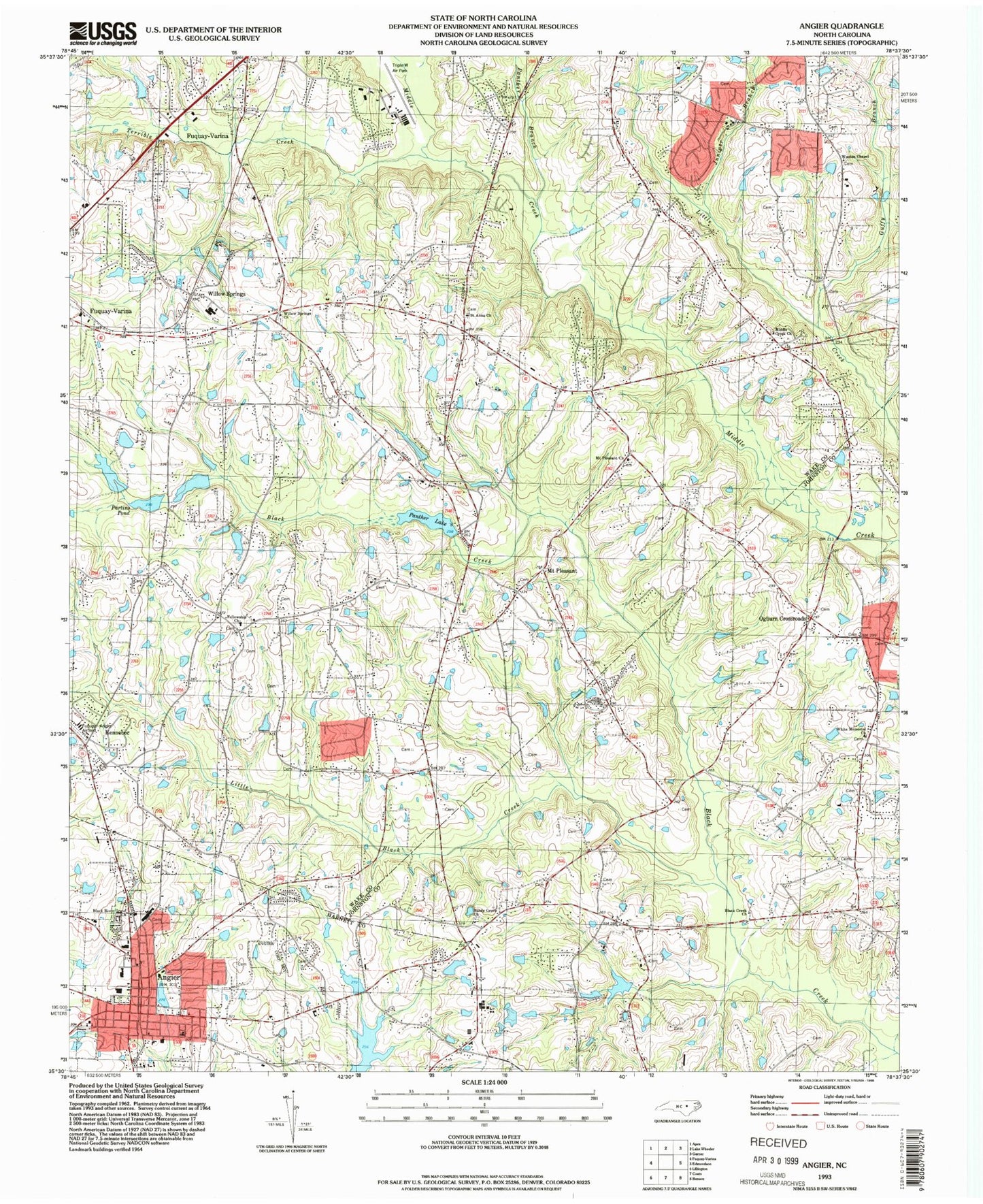
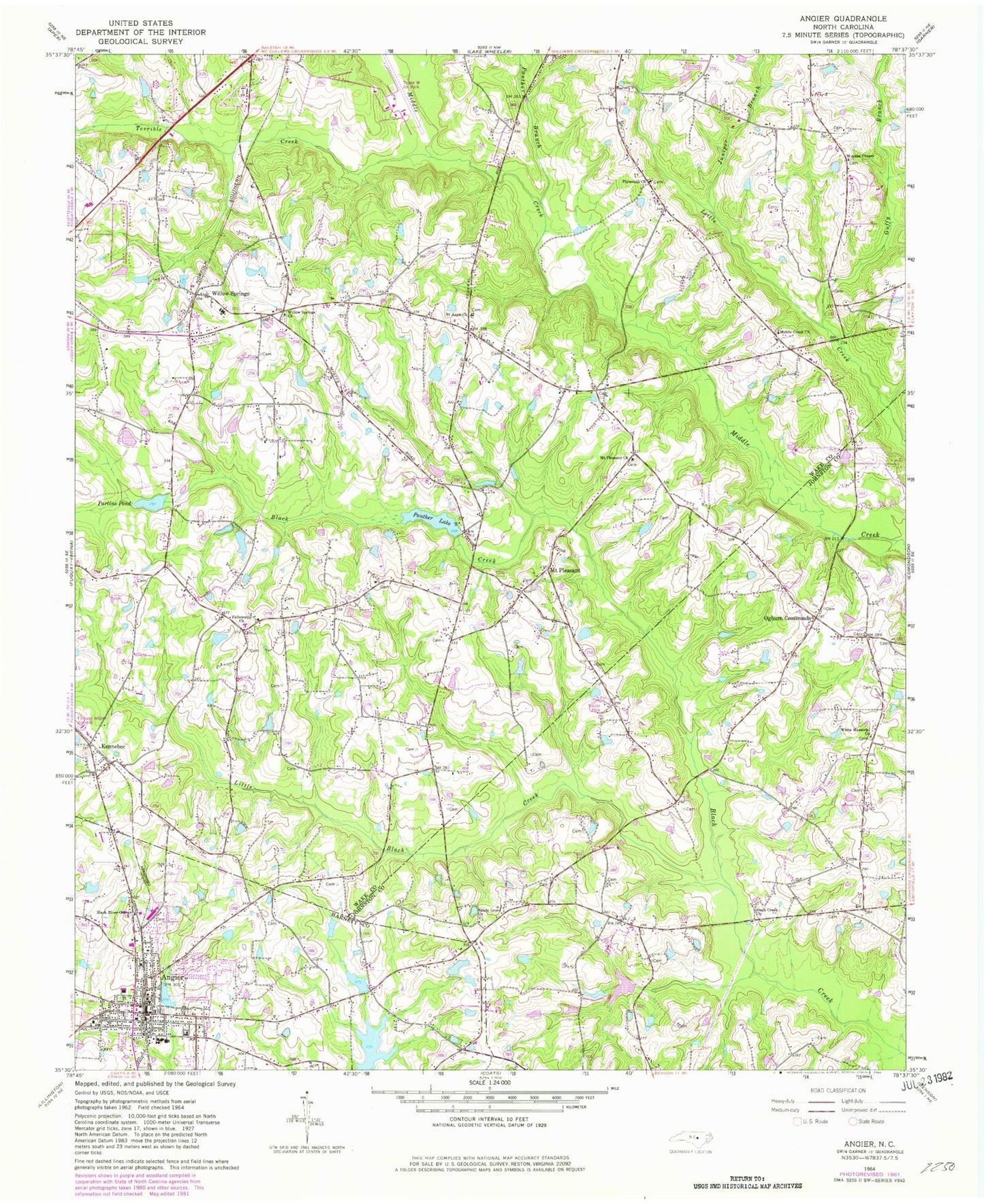
Classic USGS Angier North Carolina 7.5'x7.5' Topo Map
Couldn't load pickup availability
Historical USGS topographic quad map of Angier in the state of North Carolina. Map scale may vary for some years, but is generally around 1:24,000. Print size is approximately 24" x 27"
This quadrangle is in the following counties: Harnett, Johnston, Wake.
The map contains contour lines, roads, rivers, towns, and lakes. Printed on high-quality waterproof paper with UV fade-resistant inks, and shipped rolled.
Contains the following named places: 50 - 210 Fire Department Station 2, Angier, Angier and Black River Fire Department, Angier Middle School, Angier Police Department, Angier Post Office, Angier Rescue Squad, Black Creek Church, Black River Grave Church, Cannon Grove Church, Ditch Branch, Fellowship Church, Fuquay - Varina Fire Department Station 2, Fuquay - Varina Fire Department Station 3, Fuquay/Angier Field, Guffy Branch, Johnson Pond Dam, Julians Lake, Julians Lake Dam, Juniper Branch, Kennebec, Little Black Creek, Middle Creek Church, Mount Pleasant, Mount Pleasant Church, Myatts Mill, Ogburn Crossroads, Panther Branch, Panther Lake, Panther Lake Dam, Partins Mill, Partins Pond Dam, Plymouth Church, Powell Lake Dam, Roses Pond, Saint Anna Church, Sandy Grove Church, Saunders Lake, Saunders Lake Dam, Terrible Creek, Town of Angier, Township of Panther Branch, Triple W Airport, True-Way Holiness Church, W I Rowland Pond Dam, White Memorial Church, Willow Spring Post Office, Willow Springs, Willow Springs Church, Willow Springs Elementary School, Wooten Chapel, Youngs Pond, Youngs Pond Dam, ZIP Code: 27592