MyTopo
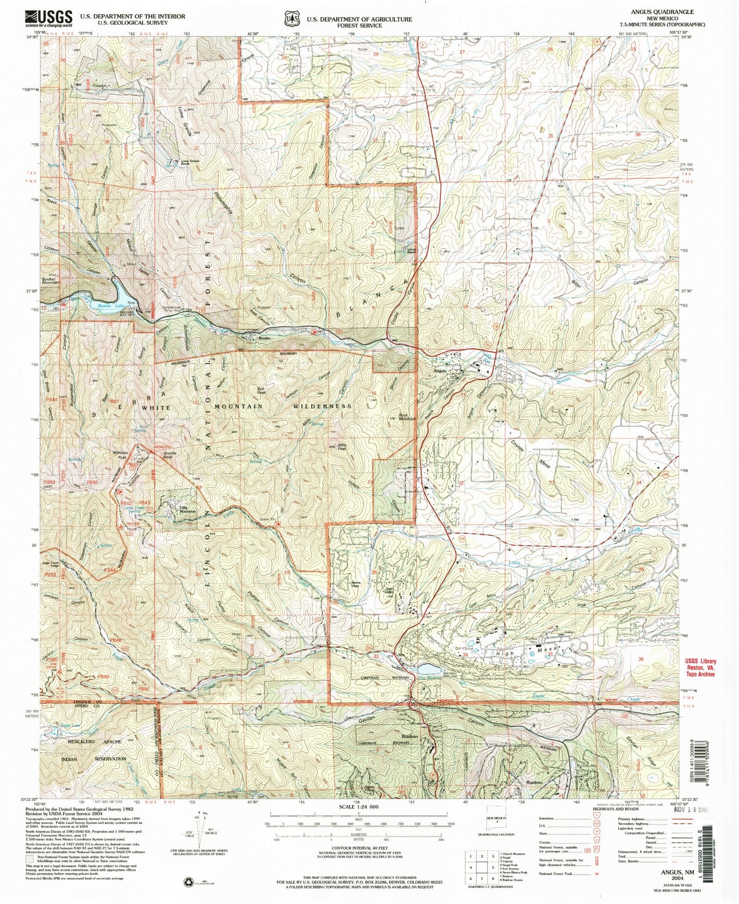
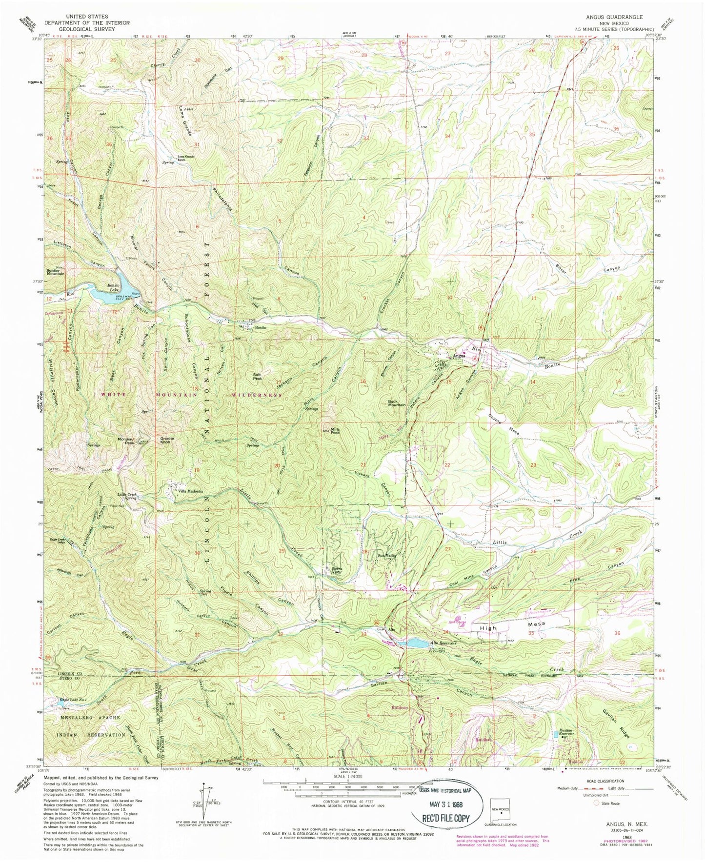
Classic USGS Angus New Mexico 7.5'x7.5' Topo Map
Couldn't load pickup availability
Historical USGS topographic quad map of Angus in the state of New Mexico. Typical map scale is 1:24,000, but may vary for certain years, if available. Print size: 24" x 27"
This quadrangle is in the following counties: Lincoln, Otero.
The map contains contour lines, roads, rivers, towns, and lakes. Printed on high-quality waterproof paper with UV fade-resistant inks, and shipped rolled.
Contains the following named places: Alto, Alto Reservoir, Anan Canyon, Angus Canyon, Bear Canyon, Bonito Lake, Buck Mountain, Carlton Canyon, Cedar Creek Trail, Coal Mine Canyon, Coyote Mesa, Crest Trail, Crocket Canyon, Dry Mills Trail, Eagle Creek Lodge, Eagle Lake, Ferguson Canyon, Flume Canyon, Fox Spring Canyon, Fred Canyon, Gavilan Ridge, George Canyon, Gilmore Canyon, Granite Knob, Grapevine Canyon, High Mesa, Hubbard Canyon, Jackson Canyon, Johnson Canyon, Krause Canyon, Kraut Canyon, Little Creek Spring, Littleton Canyon, Loma Grande, Loma Grande Ranch, Mills Canyon, Mills Peak, Mineral Farms Canyon, Monjeau Peak, Nolton Canyon, North Eagle Trail, Peters Canyon, Philadelphia Canyon, Phillips Canyon, Rodamaker Canyon, Ruidoso Reservoir, Salt Peak, Schoolhouse Canyon, Sierra Vista, Skinner Canyon, South Fork Eagle Creek, Spring Canyon, Sun Valley, Telephone Canyon, Vickers Canyon, Villa Madonna, Wet Mills Trail, Oak Grove Campground, Skyline Campground, Lamay Ranch, Yours Truly Claim, Mayberry Mine, McCrory Prospect, Mineral Farm Prospect, Monjeau Number 1 Claim, Hope Prospect, Rock Number One, Silver Plume Mine, Soldier, Water Dog Prospect, Christmas, Creek Lead Claim, Divine Guidance Number Two, Oso Claim, The Church of Latter Day Saints, Church of the Nazarene, Bonito, Alto Lake Dam, Bonito Dam, Monjeau Campground, Monjeau Lookout, Bonito Post Office (historical), Alto Post Office, KWES-FM (Ruidoso), Trick Tank, Angus, Fox Spring, Skyline Campground, Bonito Volunteer Fire Department Sun Valley Station, Bonito Volunteer Fire Department - Copper Canyon Station, Bonito Volunteer Fire Department - Angus Canyon Station, North Fork Eagle Creek