MyTopo
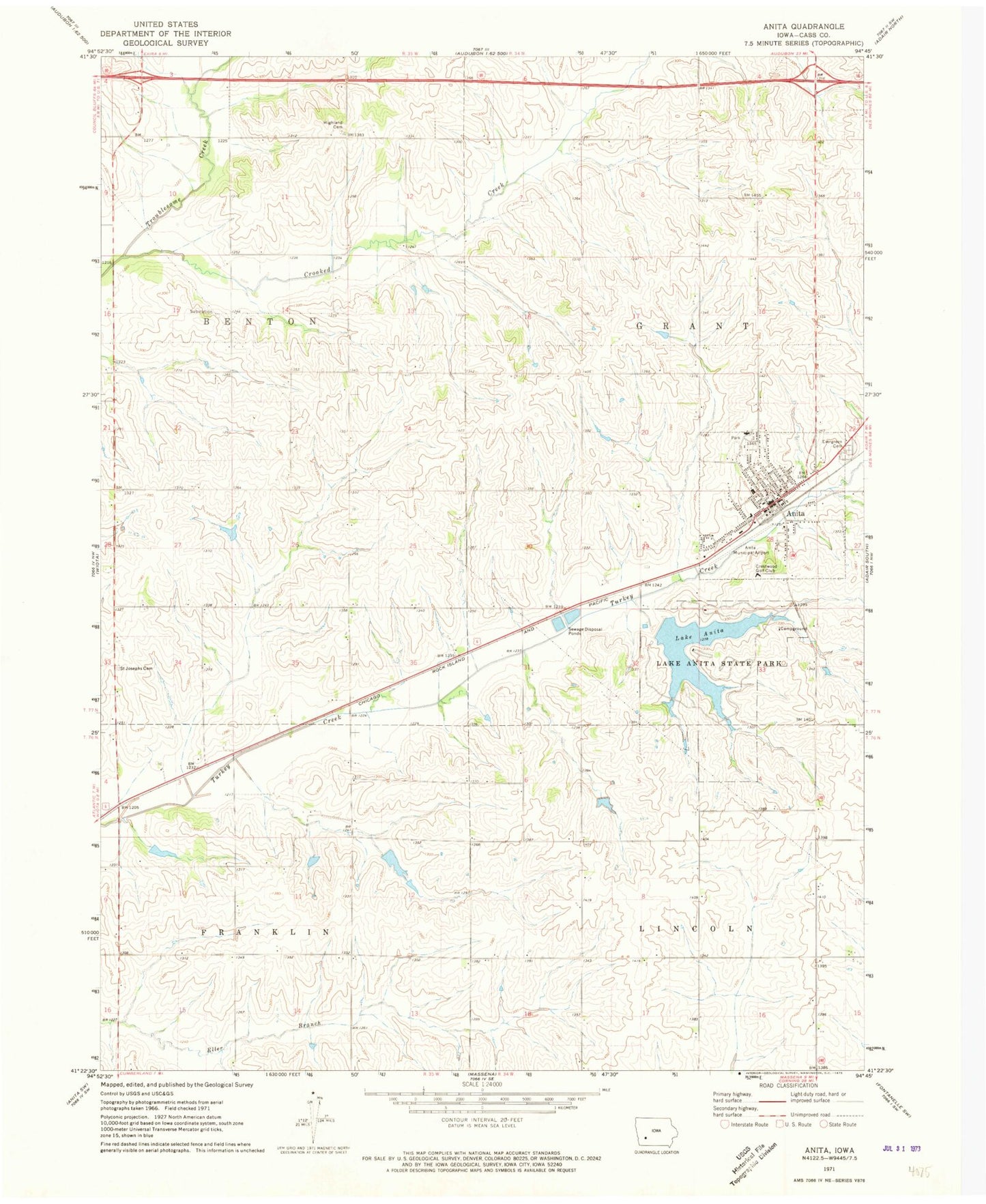
Classic USGS Anita Iowa 7.5'x7.5' Topo Map
Couldn't load pickup availability
Historical USGS topographic quad map of Anita in the state of Iowa. Map scale may vary for some years, but is generally around 1:24,000. Print size is approximately 24" x 27"
This quadrangle is in the following counties: Cass.
The map contains contour lines, roads, rivers, towns, and lakes. Printed on high-quality waterproof paper with UV fade-resistant inks, and shipped rolled.
Contains the following named places: Anita, Anita City Hall, Anita Medical Center, Anita Municipal Airport-Kevin Burke Memorial Field, Anita Police Department, Anita Post Office, Anita Public Library, Anita United Methodist Church, Anita Volunteer Fire Department, Bandshell Park, Central Church of Christ, City of Anita, Colonial Manor, Congregational Church, Crestwood Golf Club, Crooked Creek, Cumberland Anita Massena High School, Cumberland Anita Massena North Elementary School, Evergreen Cemetery, Highland Cemetery, Holy Cross Lutheran Church, Keystone Park, Lake Anita, Lake Anita State Park, Lutheran Church, Saint Josephs Cemetery, Saint Marys Catholic Church, Township of Benton, Township of Grant, Troublesome Creek Wildlife Area, Victory Park, ZIP Code: 50274