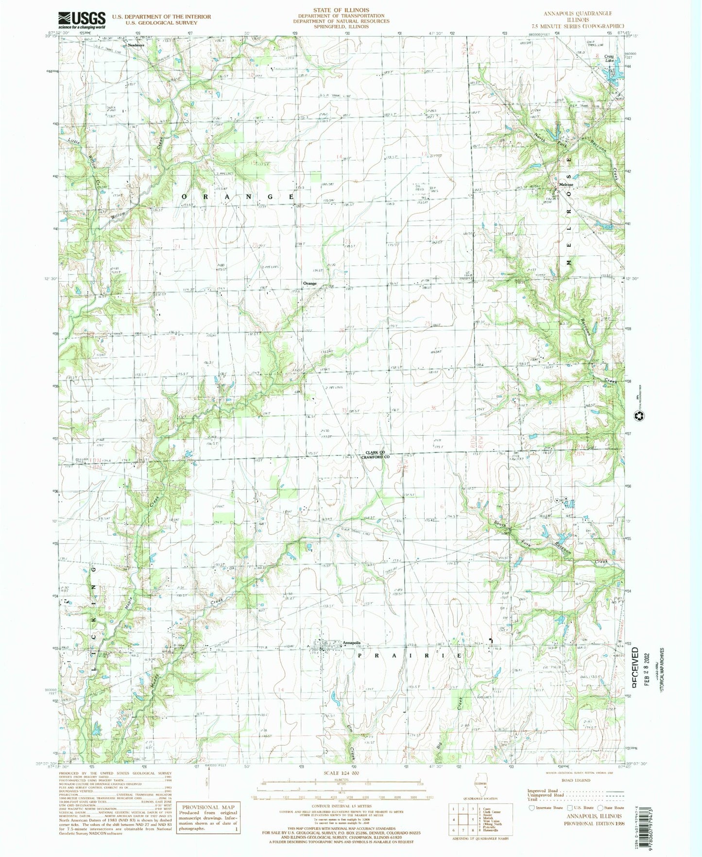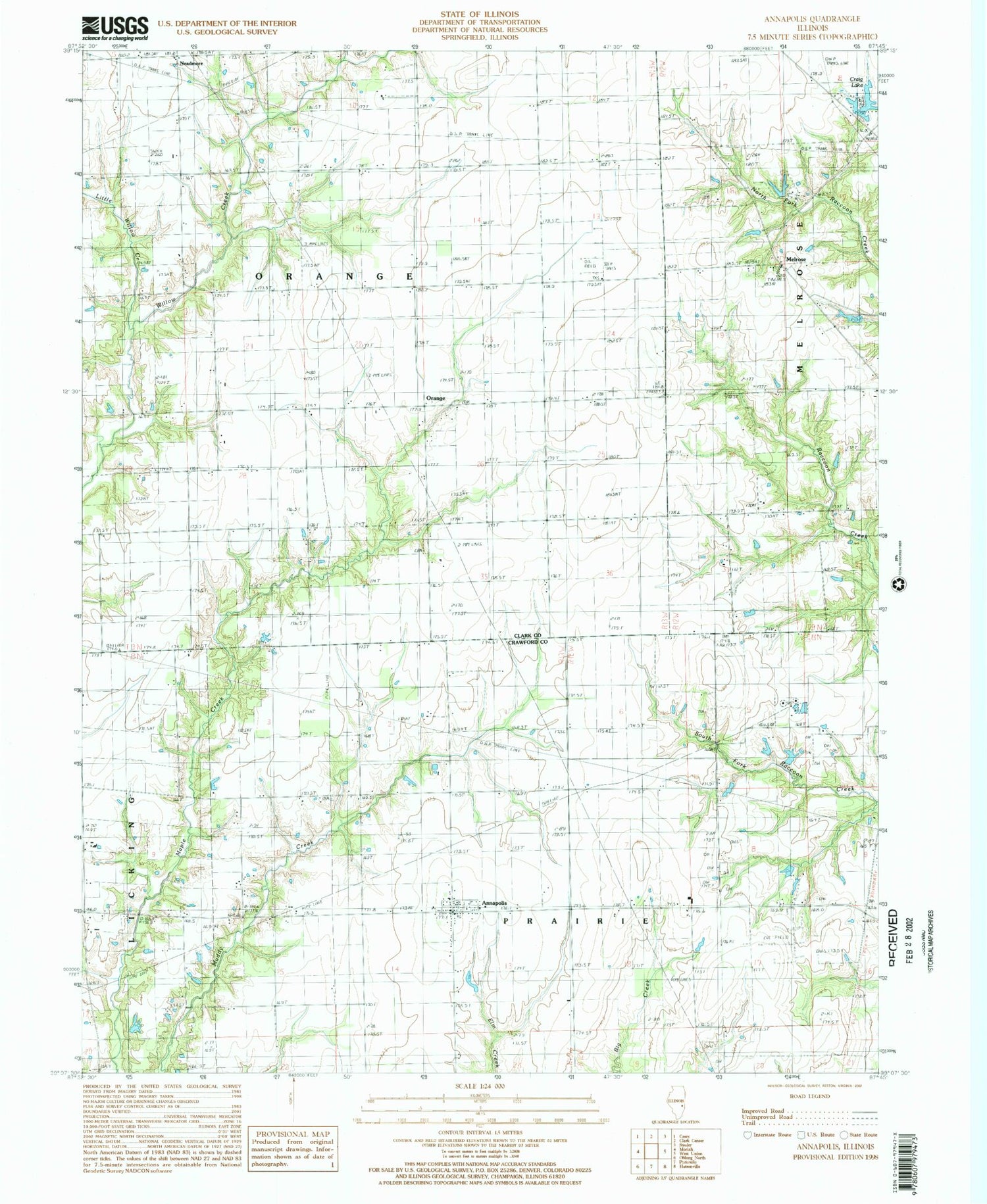
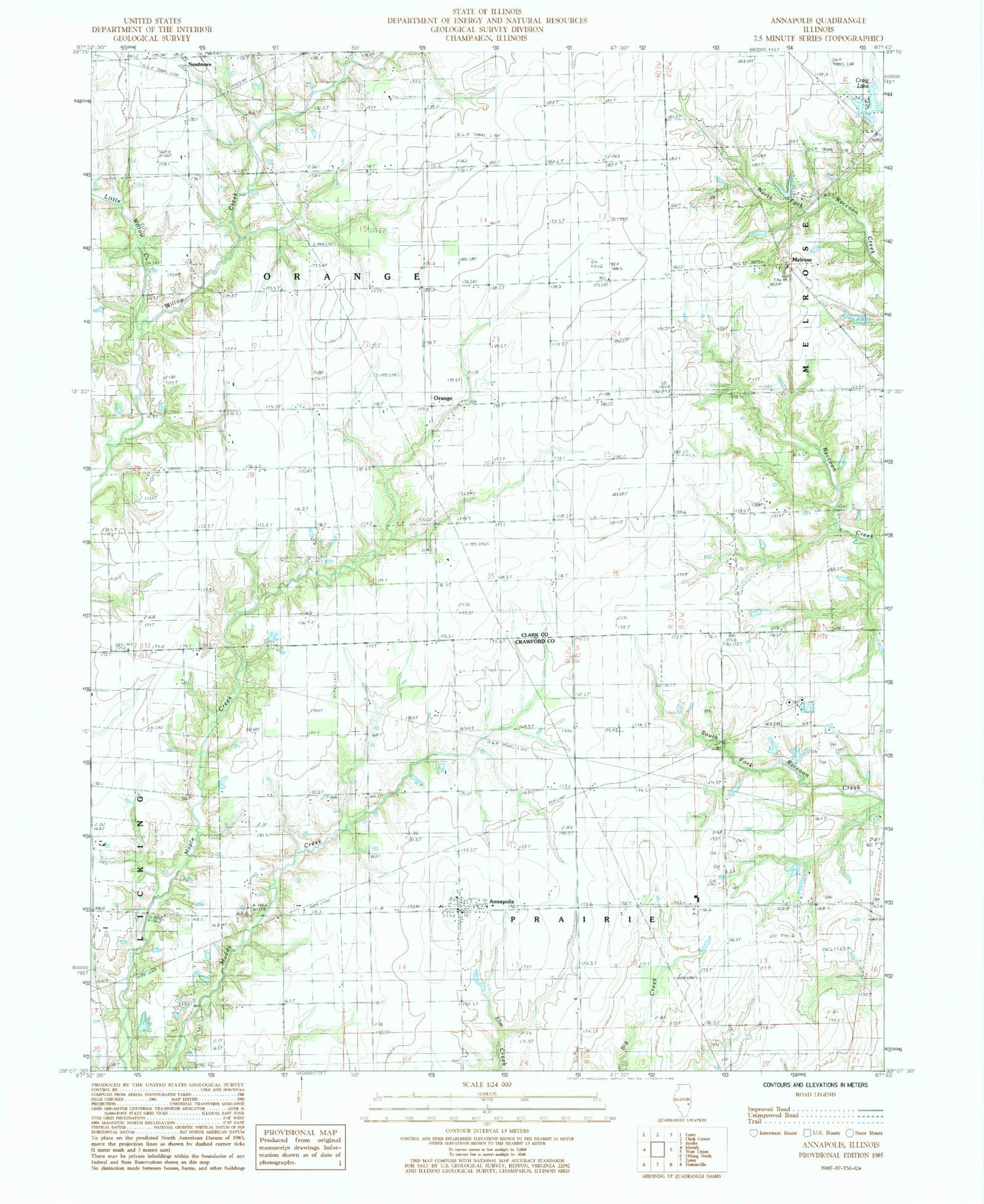
MyTopo
Classic USGS Annapolis Illinois 7.5'x7.5' Topo Map
Couldn't load pickup availability
Historical USGS topographic quad map of Annapolis in the state of Illinois. Map scale may vary for some years, but is generally around 1:24,000. Print size is approximately 24" x 27"
This quadrangle is in the following counties: Clark, Crawford.
The map contains contour lines, roads, rivers, towns, and lakes. Printed on high-quality waterproof paper with UV fade-resistant inks, and shipped rolled.
Contains the following named places: Annapolis, Annapolis Census Designated Place, Annapolis Christian Church, Annapolis Post Office, Cox Cemetery, Craig Lake, Craig Lake Dam, Dix Cemetery, East McDaniel School, Little Willow Creek, Medsker Cemetery, Melrose, Neadmore, Olive Branch Cemetery, Olive Branch Church, Orange, Orange School, Pleasant Grove Church, Prairie - Licking Fire Protection District, Sand Rock Farm, Stanfield Cemetery, Township of Orange, Township of Prairie, Wernze Farms, Wesley Chapel, Wesley Chapel Cemetery, ZIP Code: 62413