MyTopo
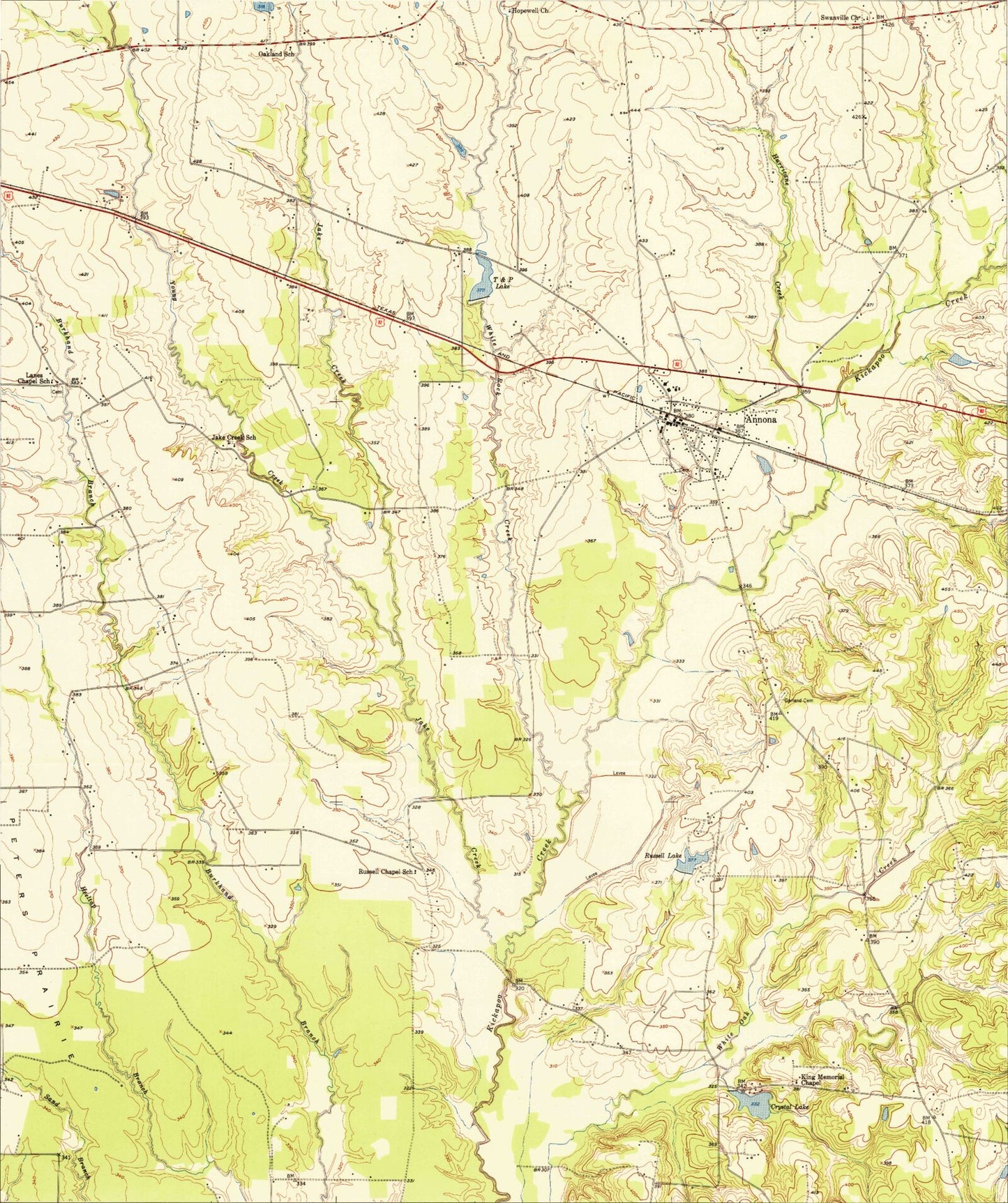
Classic USGS Annona Texas 7.5'x7.5' Topo Map
Couldn't load pickup availability
Historical USGS topographic quad map of Annona in the state of Texas. Map scale may vary for some years, but is generally around 1:24,000. Print size is approximately 24" x 27"
This quadrangle is in the following counties: Red River.
The map contains contour lines, roads, rivers, towns, and lakes. Printed on high-quality waterproof paper with UV fade-resistant inks, and shipped rolled.
Contains the following named places: Annona, Annona City Hall, Annona Post Office, Bentsen Lake, Bentsen Lake Dam, Crystal Lake, Crystal Lake Dam, Garland Cemetery, Harvey Lake, Harvey Lake Dam, Hopewell Church, Hurricane Creek, Jake Creek, Jake Creek School, King Memorial Chapel, Lanes Chapel Cemetery, Lanes Chapel School, Magic Valley Lake, Mena, Oakland School, Peters Prairie, Russell Chapel School, Russell Lake, Russell Lake 2, Russell Lake 2 Dam, Russells Ranch Airport, Swanville Church, T and P Lake, Town of Annona, White Rock Creek