MyTopo
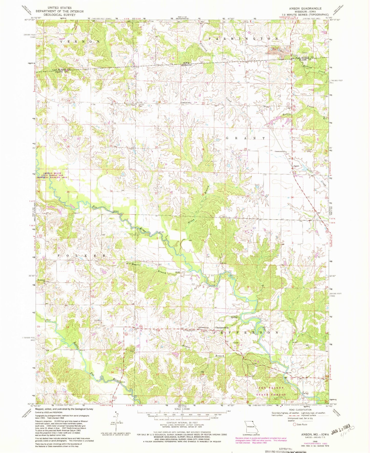
Classic USGS Anson Missouri 7.5'x7.5' Topo Map
Couldn't load pickup availability
Historical USGS topographic quad map of Anson in the states of Missouri, Iowa. Typical map scale is 1:24,000, but may vary for certain years, if available. Print size: 24" x 27"
This quadrangle is in the following counties: Clark, Van Buren.
The map contains contour lines, roads, rivers, towns, and lakes. Printed on high-quality waterproof paper with UV fade-resistant inks, and shipped rolled.
Contains the following named places: Bethlehem Church, Burnt Shirt Branch, Chambersburg Church, Christy Cemetery, Community Church, Duncan School, Kaylor Branch, Nixon Branch, Saint Thomas Cemetery, Troxel Cemetery, Union Chapel, Upp School (historical), Hogan School (historical), Jordan School (historical), Fairview School (historical), Collins School (historical), Fehlhaber Bridge, Spencer Cemetery, Mantle Branch, Acasto, Anson, Chambersburg, Acasto Post Office, Herring Lake Dam, Township of Grant, Township of Jefferson, Anderson Cemetery, Burrier Cemetery