MyTopo
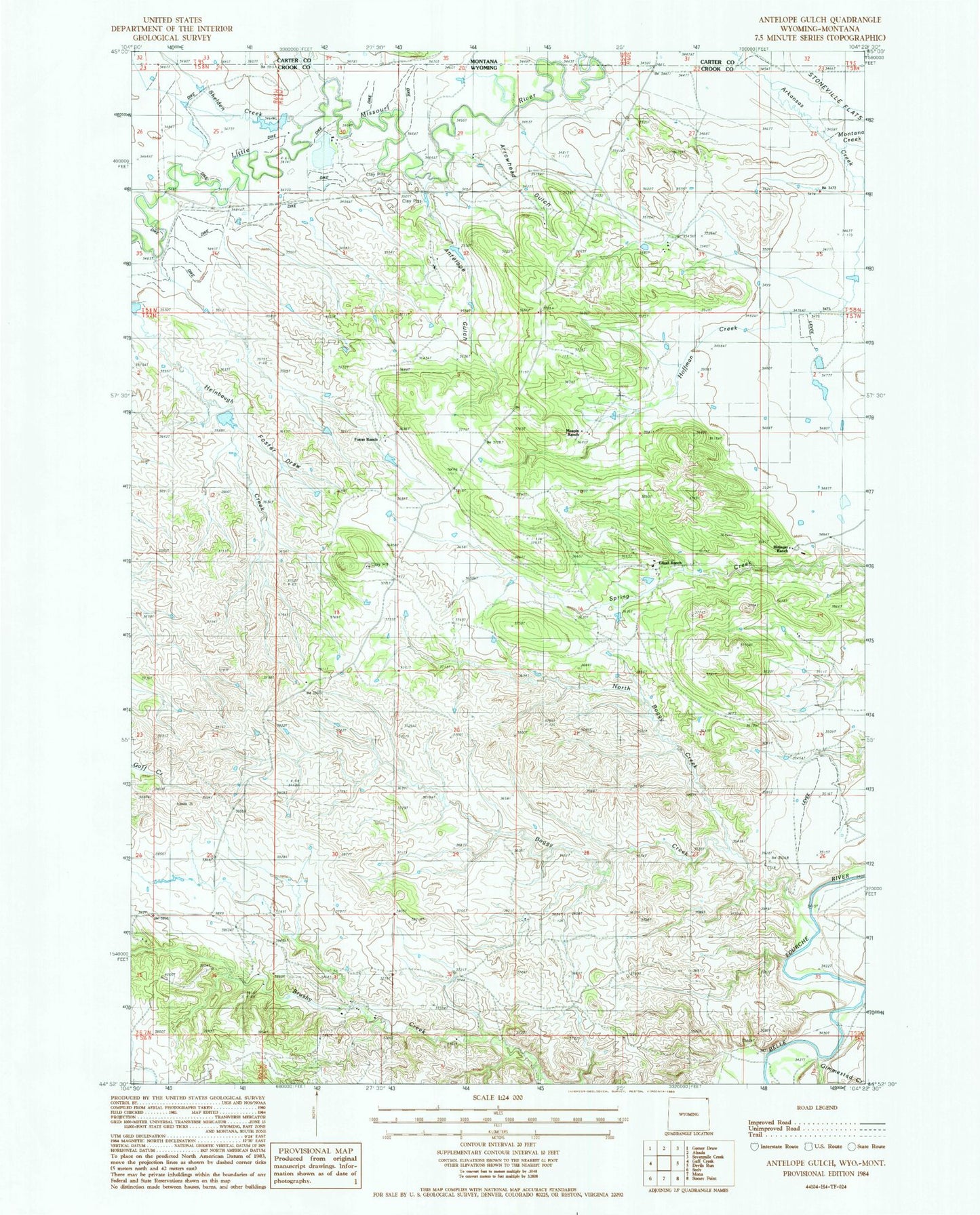
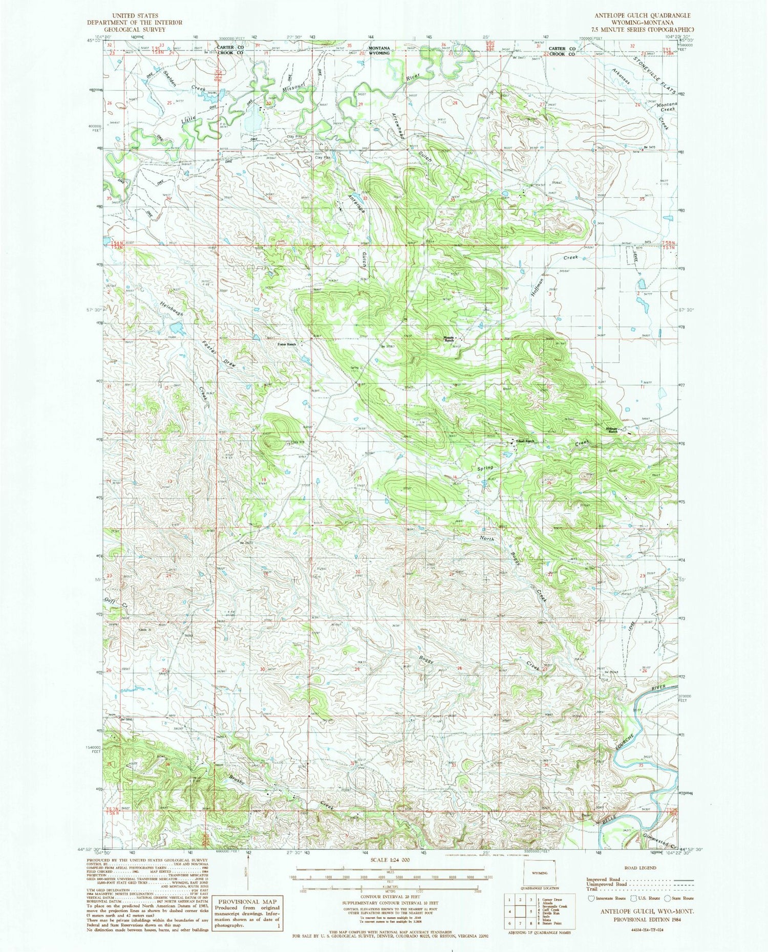
Classic USGS Antelope Gulch Wyoming 7.5'x7.5' Topo Map
Couldn't load pickup availability
Historical USGS topographic quad map of Antelope Gulch in the state of Wyoming. Map scale may vary for some years, but is generally around 1:24,000. Print size is approximately 24" x 27"
This quadrangle is in the following counties: Carter, Crook.
The map contains contour lines, roads, rivers, towns, and lakes. Printed on high-quality waterproof paper with UV fade-resistant inks, and shipped rolled.
Contains the following named places: Antelope Gulch, Antelope Gulch School, Arrowhead Gulch, Banks Creek Dam, Banks Creek Reservoir, Boggy Creek, C Cockran Mine, Cochrun Ranch, Edsall Ranch, Foster Draw, Foster Ranch, Gimmestad Creek, Harney Ranch, Heinbaugh Creek, Hoffman Creek, Maupin Ranch, Montana Creek, North Boggy Creek, Ridinger Junior Ranch, Ridinger Ranch, Shelden Creek, T J Maupin Number 1 Dam, T J Maupin Number 1 Reservoir