MyTopo
Classic USGS Antelope Hills NE Oklahoma 7.5'x7.5' Topo Map
Regular price
$16.95
Regular price
Sale price
$16.95
Unit price
per
Couldn't load pickup availability
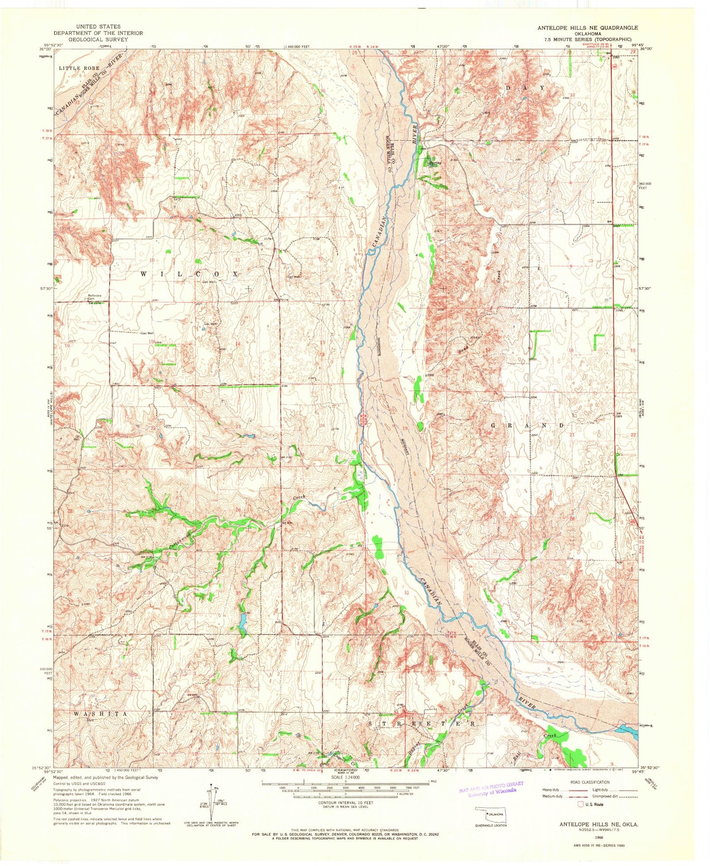
Historical USGS topographic quad map of Antelope Hills NE in the state of Oklahoma. Map scale may vary for some years, but is generally around 1:24,000. Print size is approximately 24" x 27"
This quadrangle is in the following counties: Ellis, Roger Mills.
The map contains contour lines, roads, rivers, towns, and lakes. Printed on high-quality waterproof paper with UV fade-resistant inks, and shipped rolled.
Contains the following named places: Bachman Dam, Bachman Reservoir, Belleview Cemetery, Bull Creek, Cottonwood Creek, Dugout Creek, Frank McKram Dam, Frank McKram Reservoir, Hanawalt Dam, Hanawalt Reservoir, Johnson Dam, Johnson Reservoir, Sand Creek, Township of Wilcox