MyTopo
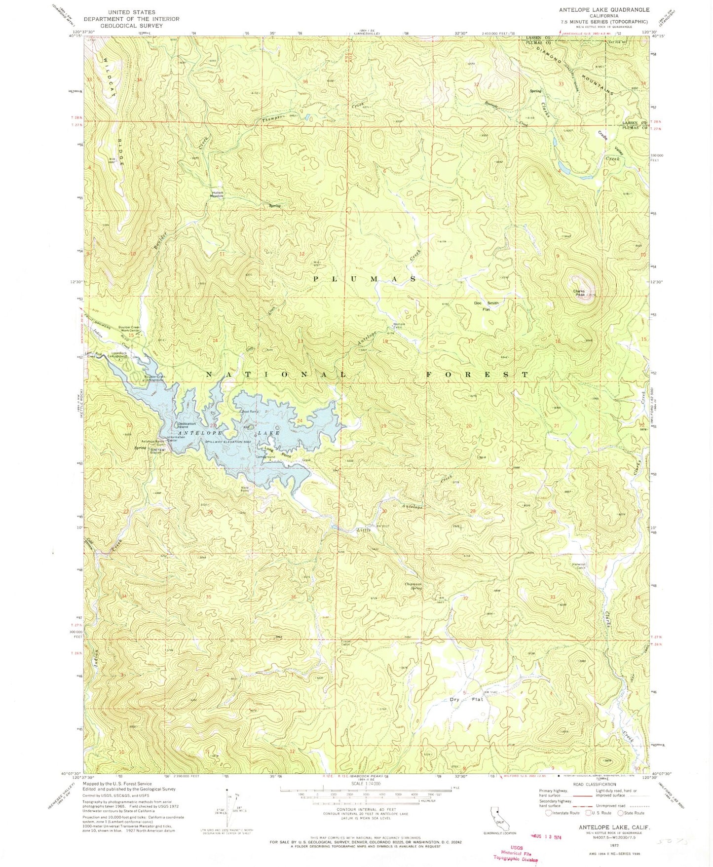
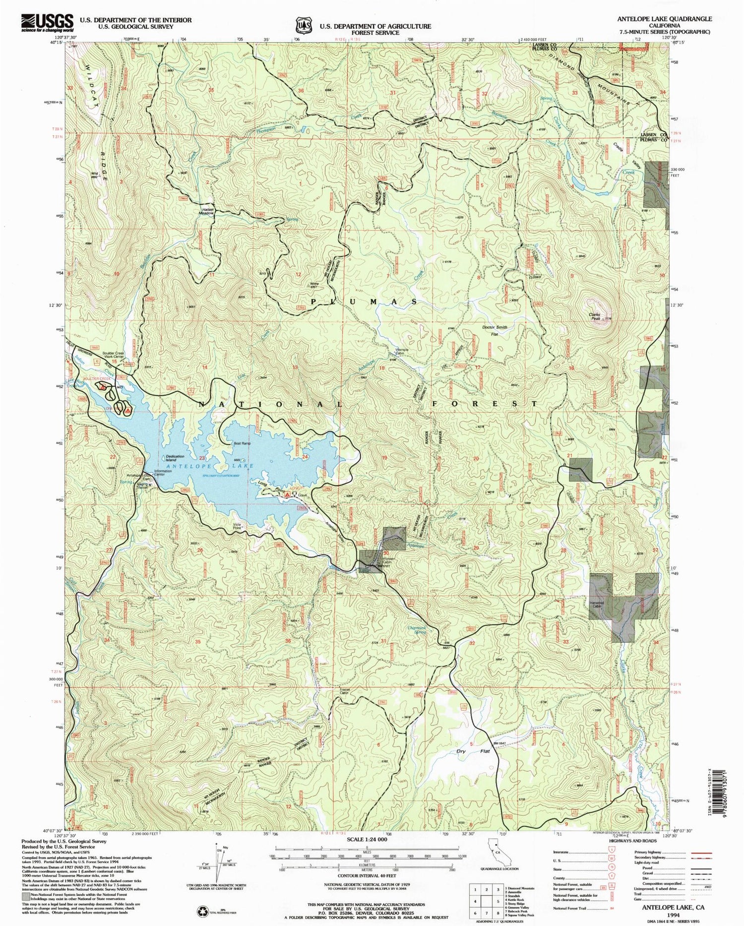
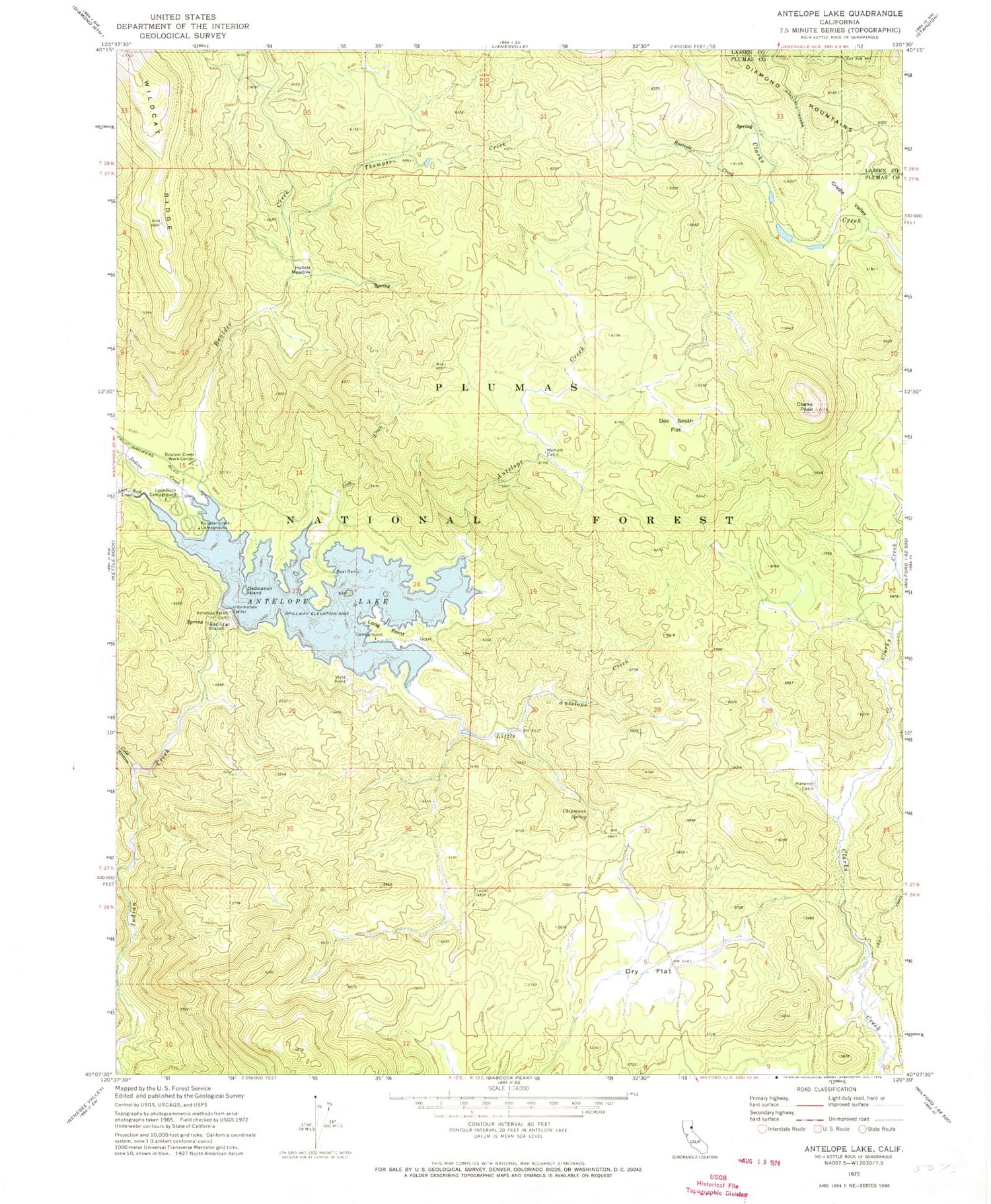
Classic USGS Antelope Lake California 7.5'x7.5' Topo Map
Couldn't load pickup availability
Historical USGS topographic quad map of Antelope Lake in the state of California. Typical map scale is 1:24,000, but may vary for certain years, if available. Print size: 24" x 27"
This quadrangle is in the following counties: Lassen, Plumas.
The map contains contour lines, roads, rivers, towns, and lakes. Printed on high-quality waterproof paper with UV fade-resistant inks, and shipped rolled.
Contains the following named places: Antelope Creek, Antelope Lake, Antelope Valley Dam, Bootsole Creek, Boulder Creek, Boulder Creek Campground, Boulder Creek Work Center, Chipmunk Spring, Clarks Peak, Cold Stream, Cradle Valley, Dedication Island, Doctor Smith Flat, Dry Flat, Frazier Cabin, Hallett Meadow, Harwood Cabin, Little Antelope Creek, Lone Rock Campground, Lone Rock Creek, Long Point, Lost Creek, Thompson Creek, Wemple Cabin, Long Point Campground, Antelope Valley, Lost Cove Picnic Area, Pioneer Cabin, Antelope 1-050 Dam