MyTopo
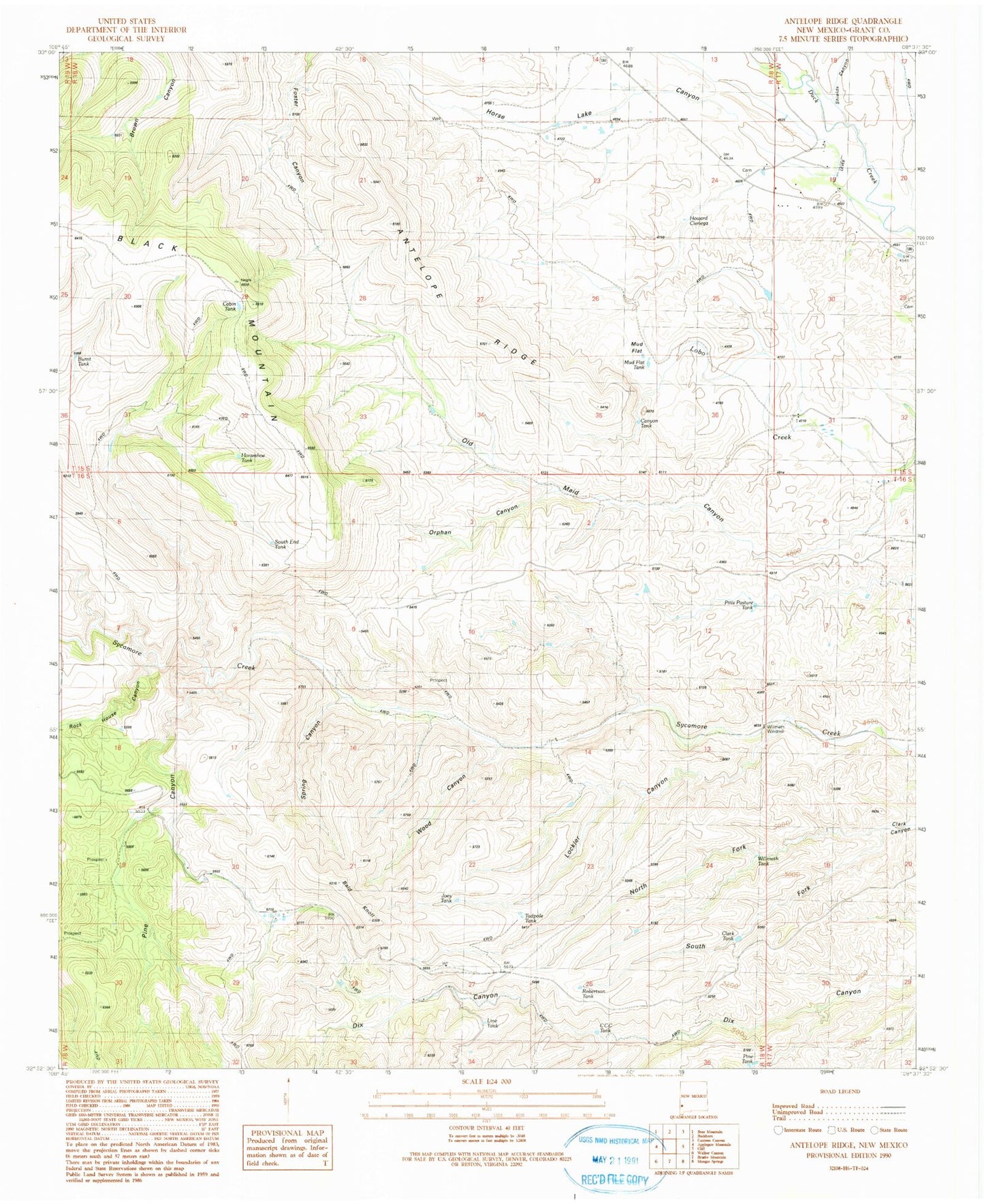
Classic USGS Antelope Ridge New Mexico 7.5'x7.5' Topo Map
Couldn't load pickup availability
Historical USGS topographic quad map of Antelope Ridge in the state of New Mexico. Map scale may vary for some years, but is generally around 1:24,000. Print size is approximately 24" x 27"
This quadrangle is in the following counties: Grant.
The map contains contour lines, roads, rivers, towns, and lakes. Printed on high-quality waterproof paper with UV fade-resistant inks, and shipped rolled.
Contains the following named places: Antelope Ridge, Bald Knoll, Bennett, Big Dix Windmill, Black Mountain, Bradberry Ranch, Burnt Tank, Cabin Tank, Canyon Tank, CCC Tank, Clark Tank, Clark Windmill, Cow Camp, Horse Lake Canyon, Horseshoe Tank, Howard Cienega, Hunter Windmill, Joes Tank, Leachman Draw, Line Tank, Little Dix Windmill, Lockler Canyon, Mud Flat, Mud Flat Tank, Norris Ranch, North Fork Clark Canyon, Old Maid Canyon, Orphan Canyon, Pine Canyon, Pine Tank, Pitts Pasture Tank, Robertson Tank, Rock House Canyon, Shields Canyon, South End Tank, South Fork Clark Canyon, Spring Canyon, Stout Cemetery, Tadpole Tank, Wallace Ranch, Wallace Ranch Perlite Deposit, Willmeth Tank, Willmeth Windmill, Wood Canyon, ZIP Code: 88028