MyTopo
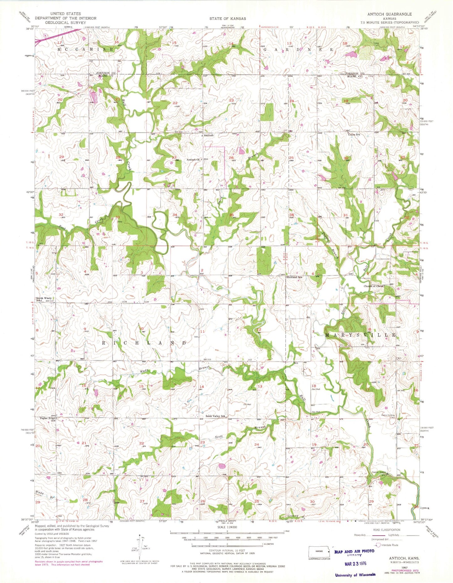
Classic USGS Antioch Kansas 7.5'x7.5' Topo Map
Couldn't load pickup availability
Historical USGS topographic quad map of Antioch in the state of Kansas. Typical map scale is 1:24,000, but may vary for certain years, if available. Print size: 24" x 27"
This quadrangle is in the following counties: Johnson, Miami.
The map contains contour lines, roads, rivers, towns, and lakes. Printed on high-quality waterproof paper with UV fade-resistant inks, and shipped rolled.
Contains the following named places: Little Bull Creek, Smith Branch, Union School (historical), Antioch Baptist Church, Antioch, Church of Christ, Tuggle Branch, Richland School (historical), North Windy School (historical), Home Holding Cemetery, Scott Valley School (historical), Ten Mile Creek, Wade Branch, Poplar Ridge School (historical), Rock Creek, Township of Richland, Scott Branch Bull Creek, Hayden Farm Airport, Wade (historical), Hillsdale Lake, Kansas State Park Rangers Office Hillsdale, Johnson County Rural Water District 7 Water Tower, Antioch Baptist Church, Antioch Cemetery, Marysville Cemetery - Old, Scott Valley Cemetery, Hillsdale State Park Crappie Cove Camping Area, Hillsdale State Park Pintail Point Camping Area, Hillsdale State Park Quail Run Camping Area, Hillsdale State Park Rabbit Ridge Camping Area, Hillsdale State Park Scott Creek Camping Area, Hillsdale State Park Saddle Ridge Campground