MyTopo
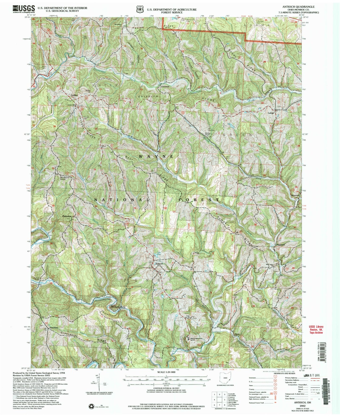
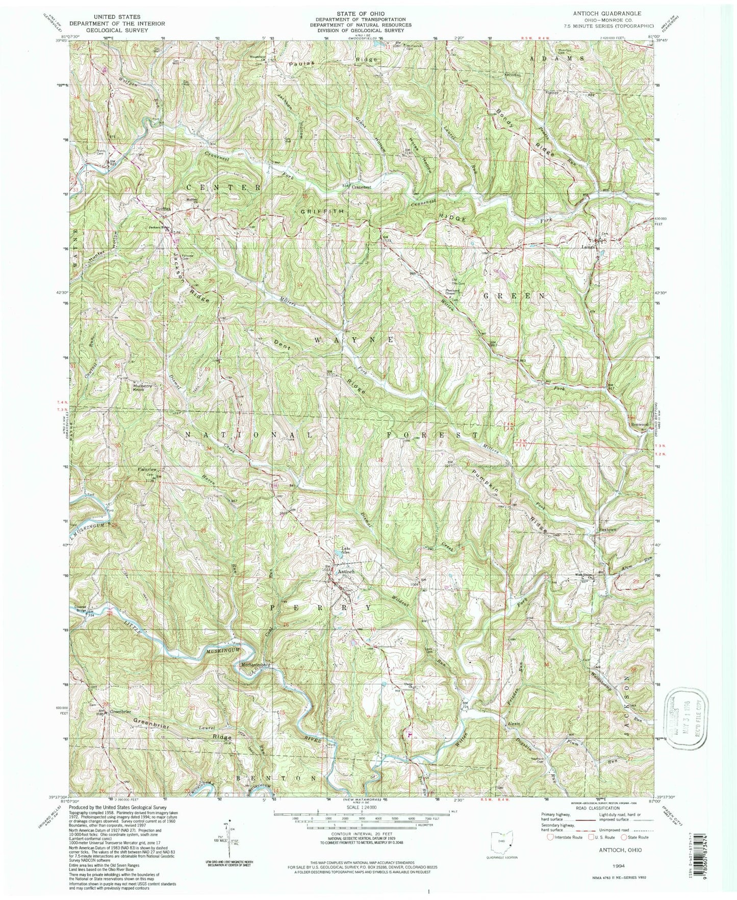
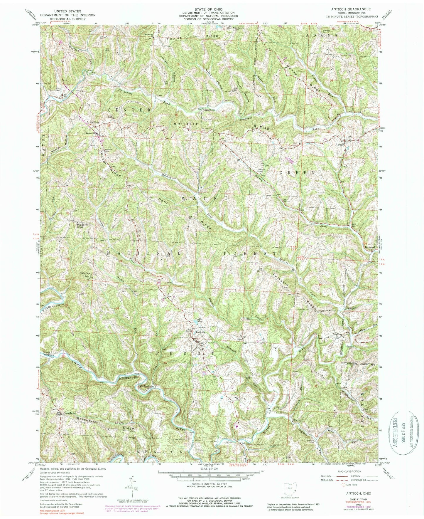
Classic USGS Antioch Ohio 7.5'x7.5' Topo Map
Couldn't load pickup availability
Historical USGS topographic quad map of Antioch in the state of Ohio. Typical map scale is 1:24,000, but may vary for certain years, if available. Print size: 24" x 27"
This quadrangle is in the following counties: Monroe.
The map contains contour lines, roads, rivers, towns, and lakes. Printed on high-quality waterproof paper with UV fade-resistant inks, and shipped rolled.
Contains the following named places: Bondy Ridge, Foraker Bridge, Millers Fork, Monroe County, Alexis, Alum Run, Antioch, Benwood, Coal Run, Cowtail Run, Cranenest, Dent Ridge, Dismal Creek, Dogskin Run, Fairview Cemetery, Fletchers Chapel, Foxtown, Frieden Run, Lake Glen, Grant Hollow, Greenbrier, Griffith, Griffith Ridge, Haren Run, Haythorn Cemetery, Horse Hollow, Jackson Ridge Church, Jackson Hollow, Jackson Ridge, Laings, Laurel Run, Laurel Run, Lentz Cemetery, Mechanicsburg, Moffets Church, Monahan Cemetery, Mulberry Knob, Norris Cemetery, Old Otts Cemetery, Paulas Ridge, Plainview, Plum Run, Pratts Run, Pumpkin Ridge, Trail Run, Unity Baptist Church, Walnutcamp Run, West Union Church, Wildcat Run, Wolfpen Run, Woods Run, Woodsfield Church, Mount Carrick Cemetery, Township of Green, Township of Perry, New Antioch Cemetery, Fletcher Cemetery, Greenbrier Cemetery, Laings Presbyterian Cemetery, Moffett Methodist Cemetery, Plainview Cemetery, Unity Baptist Cemetery, West Union Cemetery, Alexis Post Office (historical), Antioch Post Office, Benwood Post Office (historical), Griffith Post Office (historical), Lainges Post Office, Plainview Post Office (historical), Village of Antioch, Antioch Community Fire Department, Monroe County Emergency Medical Services Squad 1 Antioch, Bondy Ridge, Foraker Bridge, Millers Fork, Monroe County, Alexis, Alum Run, Antioch, Benwood, Coal Run, Cowtail Run, Cranenest, Dent Ridge, Dismal Creek, Dogskin Run, Fairview Cemetery, Fletchers Chapel, Foxtown, Frieden Run, Lake Glen, Grant Hollow, Greenbrier, Griffith, Griffith Ridge, Haren Run, Haythorn Cemetery, Horse Hollow, Jackson Ridge Church, Jackson Hollow, Jackson Ridge, Laings, Laurel Run, Laurel Run, Lentz Cemetery, Mechanicsburg, Moffets Church, Monahan Cemetery, Mulberry Knob, Norris Cemetery, Old Otts Cemetery, Paulas Ridge, Plainview, Plum Run, Pratts Run, Pumpkin Ridge, Trail Run, Unity Baptist Church, Walnutcamp Run, West Union Church, Wildcat Run, Wolfpen Run, Woods Run, Woodsfield Church, Mount Carrick Cemetery, Township of Green, Township of Perry, New Antioch Cemetery, Fletcher Cemetery, Greenbrier Cemetery, Laings Presbyterian Cemetery, Moffett Methodist Cemetery, Plainview Cemetery, Unity Baptist Cemetery, West Union Cemetery, Alexis Post Office (historical), Antioch Post Office, Benwood Post Office (historical), Griffith Post Office (historical), Lainges Post Office, Plainview Post Office (historical), Village of Antioch, Antioch Community Fire Department, Monroe County Emergency Medical Services Squad 1 Antioch