MyTopo
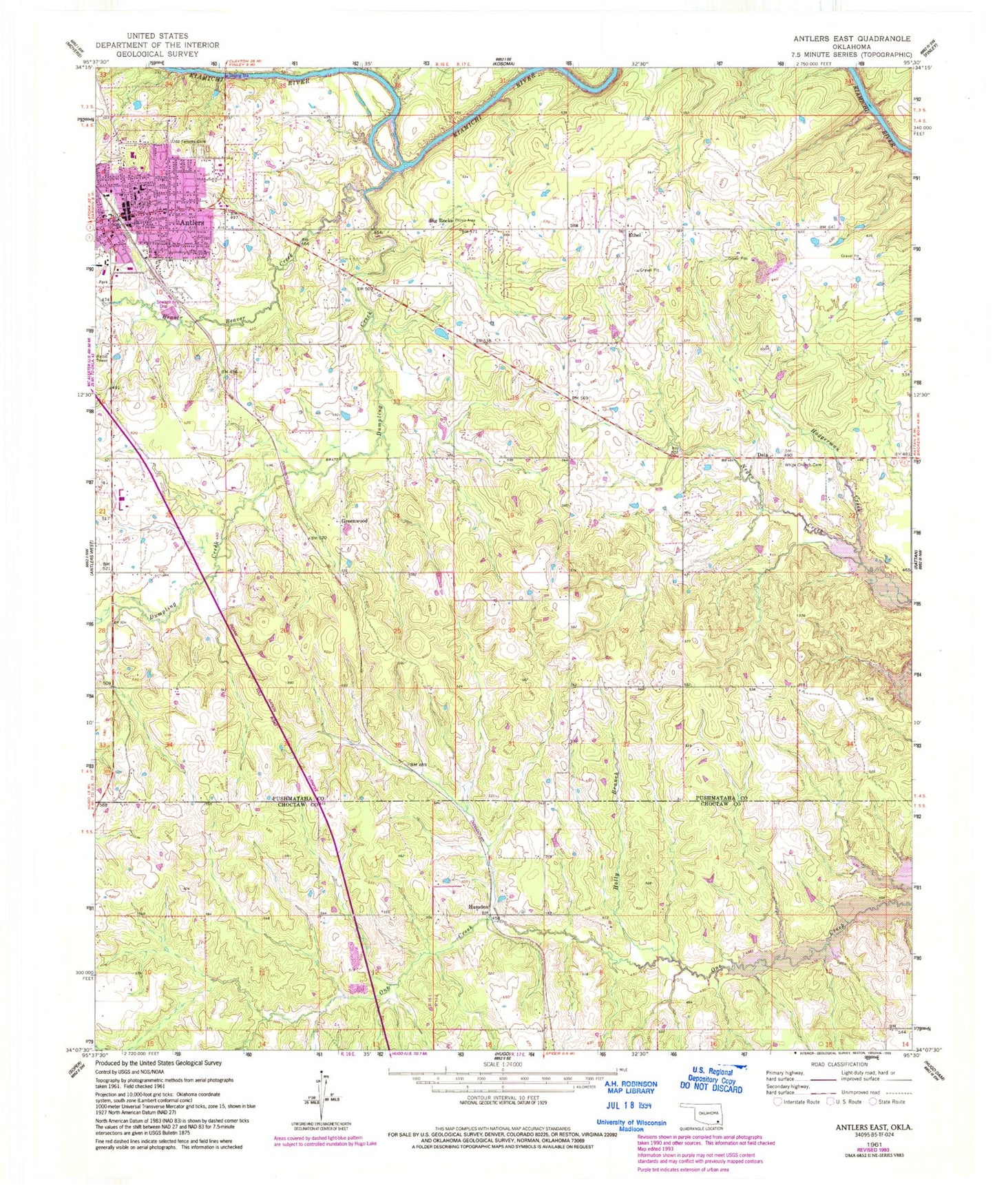
Classic USGS Antlers East Oklahoma 7.5'x7.5' Topo Map
Couldn't load pickup availability
Historical USGS topographic quad map of Antlers East in the state of Oklahoma. Map scale may vary for some years, but is generally around 1:24,000. Print size is approximately 24" x 27"
This quadrangle is in the following counties: Choctaw, Pushmataha.
The map contains contour lines, roads, rivers, towns, and lakes. Printed on high-quality waterproof paper with UV fade-resistant inks, and shipped rolled.
Contains the following named places: Antlers, Antlers Fire Department and Emergency Medical Services, Antlers High School, Antlers Police Department, Antlers Post Office, Assembly of God Church, Beaver Creek, Big Rocks, Brantly Elementary School, Church of Christ, Church of the Nazarene, City of Antlers, Dela, Dela Cemetery, Dumpling Creek, East Town Village, Ethel, Ethel Cemetery, First Baptist Church, First Christian Church, First Presbyterian Church, Greenwood, Haggerman Creek, Hamden, Holly Branch, Kingdom Hall-Jehovahs Witness, Little Cedar Creek, Obuch Middle School, Odd Fellows Cemetery, Oknoname 127006 Dam, Oknoname 127006 Reservoir, Pushmataha County Jail, Pushmataha County Sheriff's Office, Pushmataha Hospital, Saint Agnes Catholic Church, Souls Harbor Church, ZIP Code: 74523