MyTopo
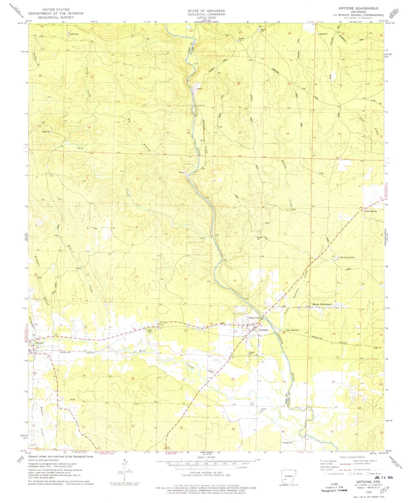
Classic USGS Antoine Arkansas 7.5'x7.5' Topo Map
Couldn't load pickup availability
Historical USGS topographic quad map of Antoine in the state of Arkansas. Typical map scale is 1:24,000, but may vary for certain years, if available. Print size: 24" x 27"
This quadrangle is in the following counties: Clark, Pike.
The map contains contour lines, roads, rivers, towns, and lakes. Printed on high-quality waterproof paper with UV fade-resistant inks, and shipped rolled.
Contains the following named places: Big Branch, Brushy Creek, Chinquapin Branch, Coon Creek, Harrison Church, Kirkham Branch, Lamb Cemetery, Little Antoine Creek, Meeks Settlement, Mill Creek, Suck Creek, Wolf Creek, Pike Junction, Antoine Cemetery, Delight High School, Happy Hill Church (historical), Rosewald School (historical), Township of Wolf Creek, Antoine, Clear Spring, Clear Spring Camp, Antoine Volunteer Fire Department, Town of Antoine, Antoine Post Office