MyTopo
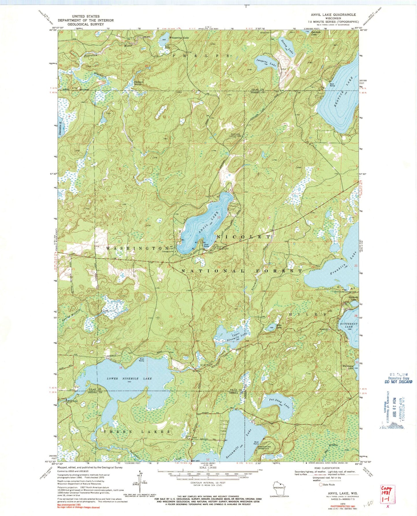
Classic USGS Anvil Lake Wisconsin 7.5'x7.5' Topo Map
Couldn't load pickup availability
Historical USGS topographic quad map of Anvil Lake in the state of Wisconsin. Typical map scale is 1:24,000, but may vary for certain years, if available. Print size: 24" x 27"
This quadrangle is in the following counties: Forest, Oneida, Vilas.
The map contains contour lines, roads, rivers, towns, and lakes. Printed on high-quality waterproof paper with UV fade-resistant inks, and shipped rolled.
Contains the following named places: Anvil Lake, Anvil Lake Campground, Blackjack Creek, Blackjack Springs, Dewey Lake, Echo Lake, Franklin Lake, Franklin Lake Campground, Gertrude Lake, Imogene Lake, Lower Ninemile Lake, Pat Shay Lake, Sevenmile Lake, Sevenmile Lake Campground, Upper Ninemile Lake, Whispering Lake, Eastern Continental Divide Point of Interest, Anvil Lake Trail System, Military Road Point of Interest, Blackjack Springs Wilderness, Anvil Lake Lookout Tower, Lower Nine Mile Dam, Lower Nine Mile Lake 25, Sanborn School (historical), Pine-Oak Grove State Natural Area, Hiles Fire Department - Station 2