
MyTopo
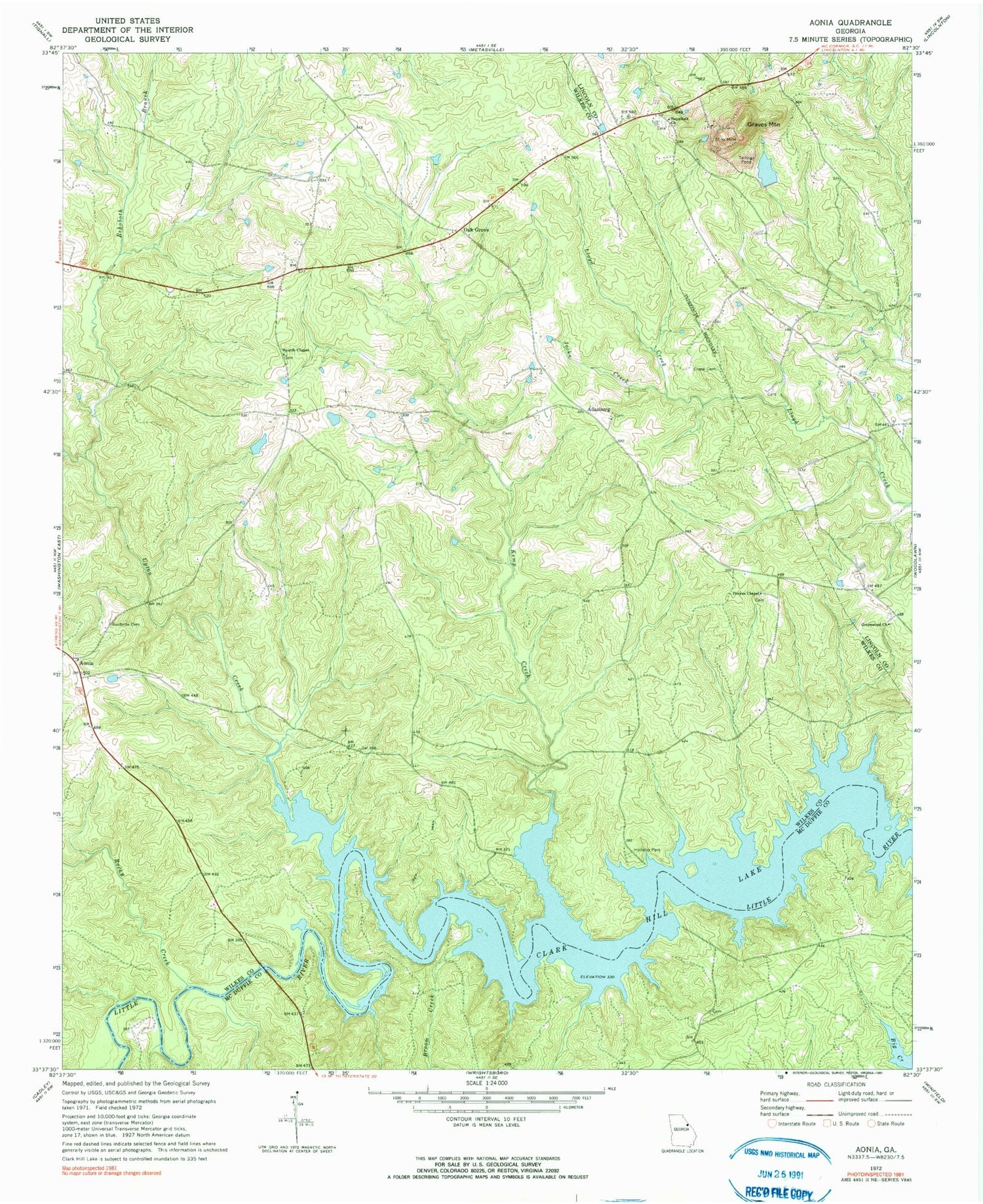
Classic USGS Aonia Georgia 7.5'x7.5' Topo Map
Couldn't load pickup availability
Historical USGS topographic quad map of Aonia in the state of Georgia. Map scale may vary for some years, but is generally around 1:24,000. Print size is approximately 24" x 27"
This quadrangle is in the following counties: Lincoln, McDuffie, Wilkes.
The map contains contour lines, roads, rivers, towns, and lakes. Printed on high-quality waterproof paper with UV fade-resistant inks, and shipped rolled.
Contains the following named places: Adasburg, Aonia, Broom Creek, Burdette Cemetery, Busseys Bend, Crook Cemetery, Ebenezer Cemetery, Ebenezer Church, Fish Dam Bend, Fish Dam Ford, Graves Mountain, Greenwood Cemetery, Greenwood Church, Griffin-Johnson Cemetery, Griffins Bend, Hale Lake, Hale Lake Dam, Heards Chapel, Hepzibah Cemetery, Hepzibah Church, Holliday Park, Jocko Creek, Kemp Creek, Oak Grove, Pierces Chapel, Pierces Chapel Cemetery, Rehoboth Branch, Rocky Creek, Smith Bridge, Smiths Mill, Tom Watson Bridge, Upton Creek


