MyTopo
Classic USGS Apache Maid Mountain Arizona 7.5'x7.5' Topo Map
Couldn't load pickup availability
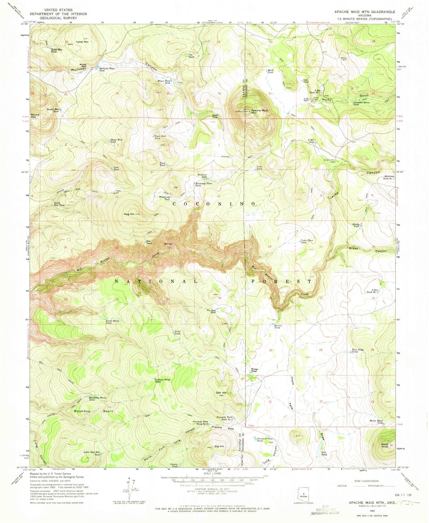
Historical USGS topographic quad map of Apache Maid Mountain in the state of Arizona. Typical map scale is 1:24,000, but may vary for certain years, if available. Print size: 24" x 27"
This quadrangle is in the following counties: Coconino, Yavapai.
The map contains contour lines, roads, rivers, towns, and lakes. Printed on high-quality waterproof paper with UV fade-resistant inks, and shipped rolled.
Contains the following named places: Apache Maid Cabin, Apache Maid Mountain, Apache Maid Trail, Big Hill, Brady Canyon, Brady Tank, Bruce Place Tank, Burnt Basin Tank, Campbell Draw Tank, Cove Tank, Cuter Place Tank, Fivemile Pass, Fivemile Pass Tank, Fivemile Pass Tank Number One, Fivemile Pass Tank Number Two, Four Wall Tank, Fritz Tank, Harris Tank, Hog Hill, Horse Knoll, Horse Knoll Tank, Jacks Canyon, Little Hog Hill Tank, Lookout Point Tank, Maid Tank, Mullican Place Tank, Mullican Ranch, Mullican Tank, Mullican Tank Number One, New Tank, North Rim Tank, Oak Hill, Pine Ridge Tank, Road Tank, Rocky Gulch, Round Mountain Tank, Roundup Basin, Roundup Basin Tank, Sues Tank, T-Bar Ranch, T-Bar Tank, T-bar Tank Number One, T-bar Tank Number Two, Table Mountain, Table Mountain Tank, Three Wall Tank, Tin Roof Tank, Tinny Tank, Trail Tank, Utopia Tank, V D Tank, Waldroup Place Tank, Waldroup Tank, Apache Maid Ranger Station, Cuter Tank, Sues Tank, Table Mountain Tank, Weir Number Eleven, Knob Tank, Rim Tank, Wier Number Five, Wier Number Six, Wet Beaver Wilderness, Slope Tank, Division Tank, Anniversary Tank, Big Hill Tank