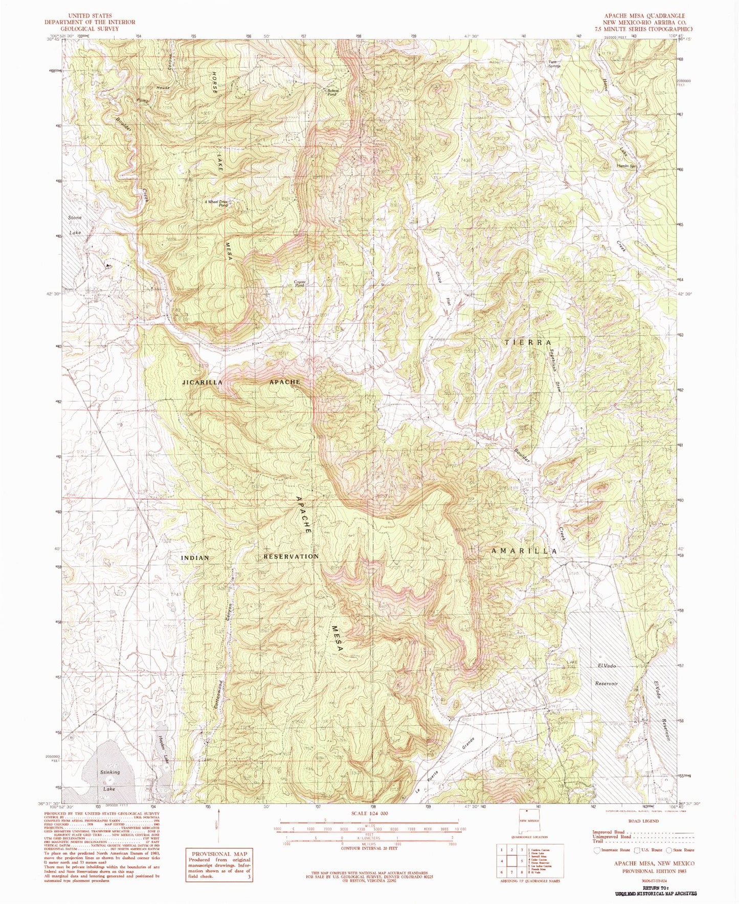
MyTopo
Classic USGS Apache Mesa New Mexico 7.5'x7.5' Topo Map
Regular price
$16.95
Regular price
Sale price
$16.95
Unit price
per
Couldn't load pickup availability
Historical USGS topographic quad map of Apache Mesa in the state of New Mexico. Map scale may vary for some years, but is generally around 1:24,000. Print size is approximately 24" x 27"
This quadrangle is in the following counties: Rio Arriba.
The map contains contour lines, roads, rivers, towns, and lakes. Printed on high-quality waterproof paper with UV fade-resistant inks, and shipped rolled.
Contains the following named places: Boulder Creek, Hayden Lake, Hayden Lake Dam, La Puerta Grande, Pound Ranch, Pump House Canyon, Stone Lake Dam, Stone Lake Dike Number Four, Stone Lake Dike Number One, Stone Lake Dike Number Three, Stone Lake Dike Number Two