MyTopo
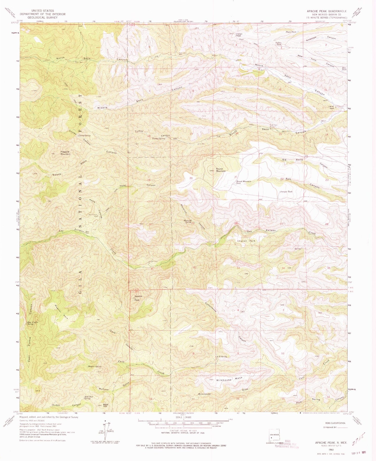
Classic USGS Apache Peak New Mexico 7.5'x7.5' Topo Map
Couldn't load pickup availability
Historical USGS topographic quad map of Apache Peak in the state of New Mexico. Map scale may vary for some years, but is generally around 1:24,000. Print size is approximately 24" x 27"
This quadrangle is in the following counties: Sierra.
The map contains contour lines, roads, rivers, towns, and lakes. Printed on high-quality waterproof paper with UV fade-resistant inks, and shipped rolled.
Contains the following named places: Apache Camp, Apache Peak, Bald Hill, Bald Hill Spring, Beam Spring, Cave Canyon, Chacon Corral, Chacon Park, Conley Canyon, Conley Spring, Cottonwood Canyon, Davis Well, Dumm Place, East Curtis Spring, Escondida Spring, Flagpole Mountain, Hells Canyon, Hells Canyon Well, Hilton Corral, Hyler Canyon, Indian Peak, Indian Tank, Ingersoll Mine, Juniper Tank, L M Bar Ranch, Magner Park, Magnum Spring, Maverick Canyon, Maverick Spring, McCann Gulch, Middle Seco Canyon, Middle Seco Creek, Milkhouse Draw, Milkhouse Mesa, New Tank, North Seco Creek, North Seco Well, Pague Tank, Pague Well, Round Mountain, Round Mountain Tank, Six B Spring, South Seco Creek, South Seco Windmill, Turkey Canyon, Turkey Spring, Turkey Well, Walnut Corral