MyTopo
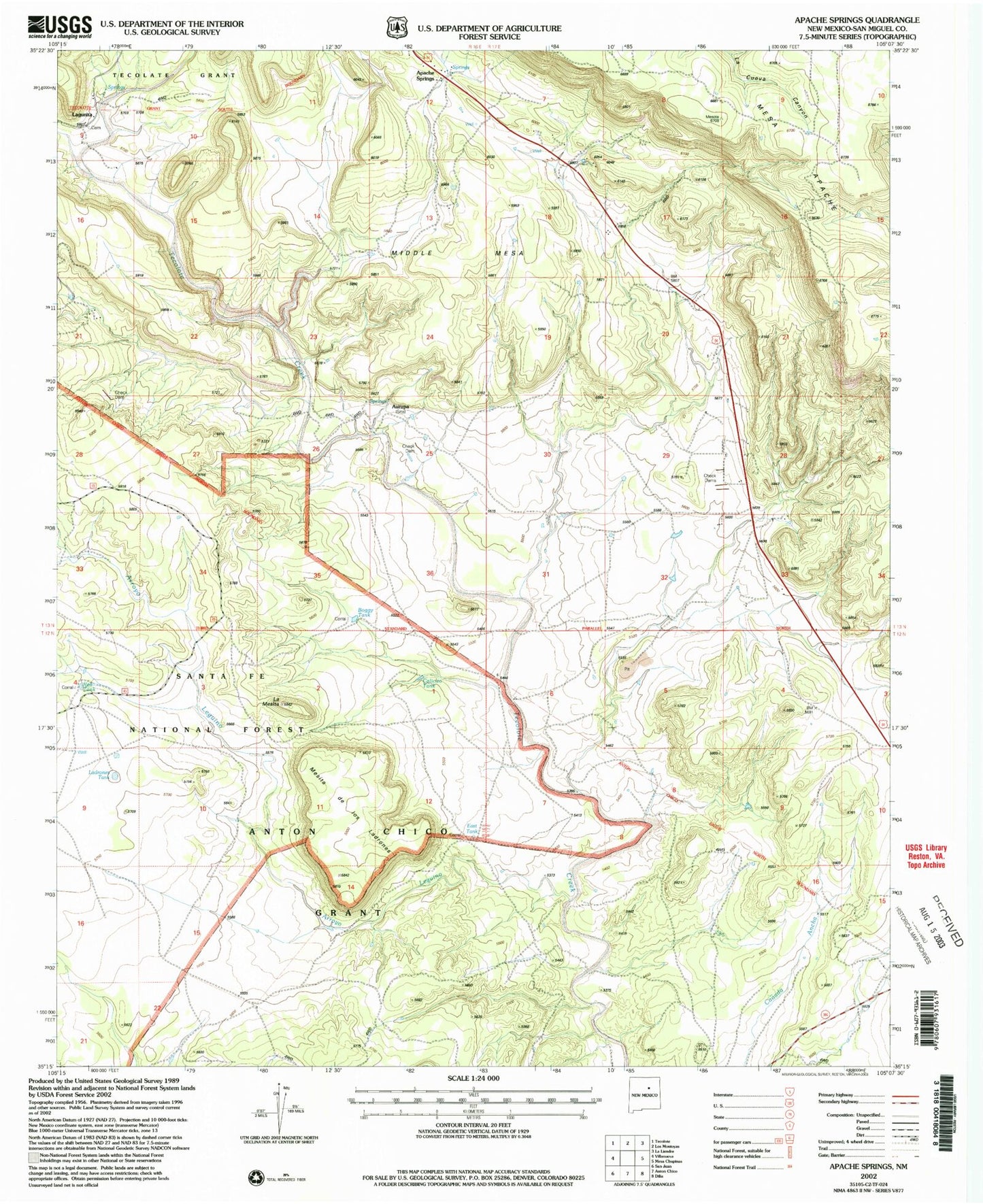
Classic USGS Apache Springs New Mexico 7.5'x7.5' Topo Map
Regular price
$16.95
Regular price
Sale price
$16.95
Unit price
per
Couldn't load pickup availability
Historical USGS topographic quad map of Apache Springs in the state of New Mexico. Map scale may vary for some years, but is generally around 1:24,000. Print size is approximately 24" x 27"
This quadrangle is in the following counties: San Miguel.
The map contains contour lines, roads, rivers, towns, and lakes. Printed on high-quality waterproof paper with UV fade-resistant inks, and shipped rolled.
Contains the following named places: Adlin, Apache Springs, Arroyo Leguino, Aurupa, Boggy Tank, Calicito Tank, East Tank, La Mesita, Ladrones Tank, Lagunita, Lagunita Post Office, Mesita de los Ladrones, Middle Mesa, Red Tank, Tecolote Windmill, Tres Hermanos Canon, Tres Hermanos Creek, Virginia