MyTopo
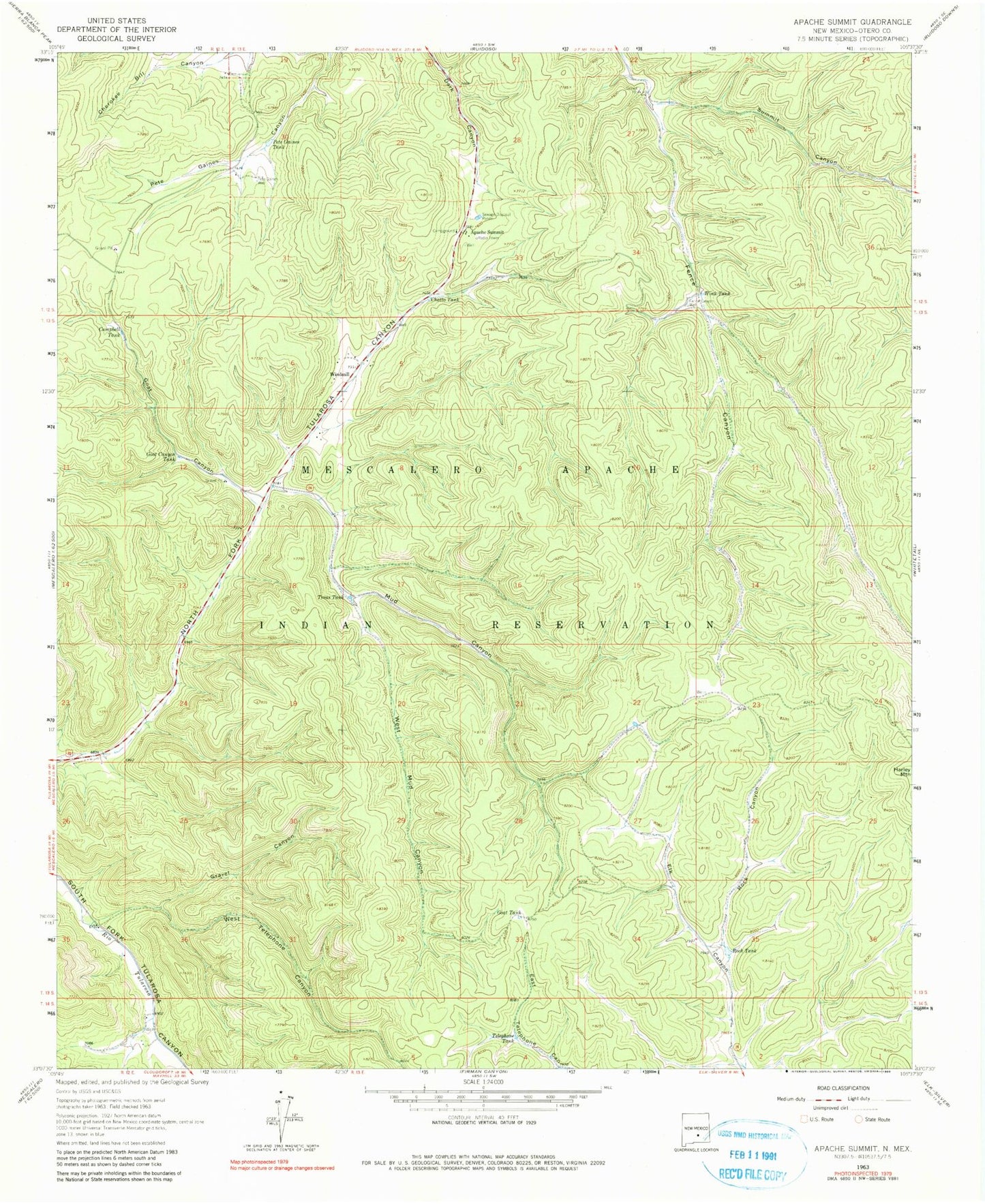
Classic USGS Apache Summit New Mexico 7.5'x7.5' Topo Map
Couldn't load pickup availability
Historical USGS topographic quad map of Apache Summit in the state of New Mexico. Map scale may vary for some years, but is generally around 1:24,000. Print size is approximately 24" x 27"
This quadrangle is in the following counties: Otero.
The map contains contour lines, roads, rivers, towns, and lakes. Printed on high-quality waterproof paper with UV fade-resistant inks, and shipped rolled.
Contains the following named places: Apache Summit, Bureau of Indian Affairs Forestry Branch, Campbell Tank, Chatto Tank, Fence Canyon Well, Goat Canyon, Goat Canyon Tank, Goat Windmill, Gravel Canyon, Harley Mountain, Mescalero Apache Fire Rescue Station, Mescalero Apache Pit, Mud Canyon, Pete Gaines Tank, Pete Gaines Well, Rock Canyon, Rock Tank, Summit Canyon, Telephone Tank, Treas Tank, West Mud Canyon, West Telephone Canyon, Windmill, Wink Tank