MyTopo
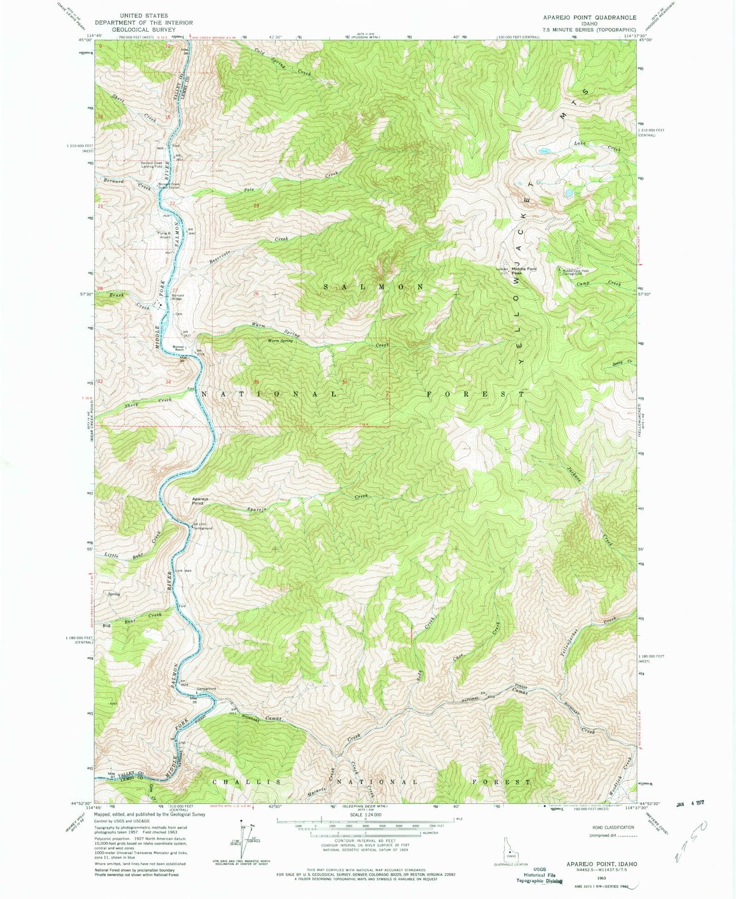
Classic USGS Aparejo Point Idaho 7.5'x7.5' Topo Map
Couldn't load pickup availability
Historical USGS topographic quad map of Aparejo Point in the state of Idaho. Typical map scale is 1:24,000, but may vary for certain years, if available. Print size: 24" x 27"
This quadrangle is in the following counties: Lemhi, Valley.
The map contains contour lines, roads, rivers, towns, and lakes. Printed on high-quality waterproof paper with UV fade-resistant inks, and shipped rolled.
Contains the following named places: Aparejo Creek, Aparejo Point, Bernard Bridge, Bernard Creek, Bernard Creek Guard Station, Brush Creek, Camas Creek, Cave Creek, Cinch Creek, Cold Spring Creek, Cove Creek, Jackass Creek, Little Bear Creek, Macarte Creek, Middle Fork Peak, Middle Fork Peak Campground, Mormon Ranch, Pole Creek, Reservoir Creek, Sheep Creek, Short Creek, Warm Spring, Woodtick Creek, Yellowjacket Creek, Haystack Rapids, Camas Creek Bridge, Big Bear Creek, Soda Creek, Warm Spring Creek, Bernard USFS Airport, Flying B Ranch Landing Strip, Tappan Falls