
MyTopo
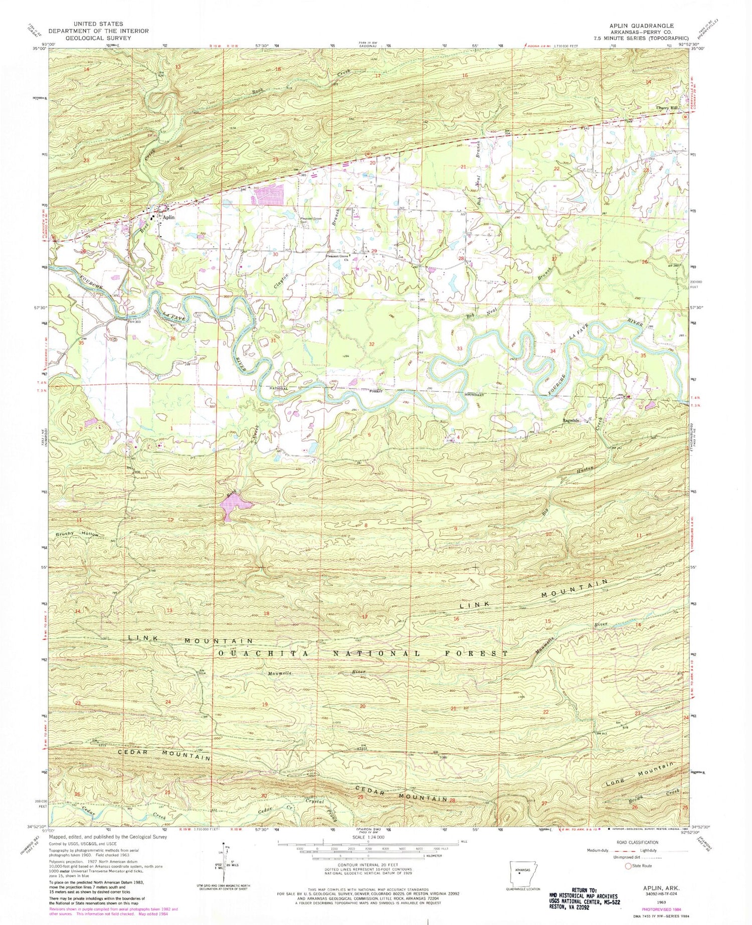
Classic USGS Aplin Arkansas 7.5'x7.5' Topo Map
Couldn't load pickup availability
Historical USGS topographic quad map of Aplin in the state of Arkansas. Map scale may vary for some years, but is generally around 1:24,000. Print size is approximately 24" x 27"
This quadrangle is in the following counties: Perry.
The map contains contour lines, roads, rivers, towns, and lakes. Printed on high-quality waterproof paper with UV fade-resistant inks, and shipped rolled.
Contains the following named places: Aplin, Aplin Census Designated Place, Big Fish Pond, Big Fish Pond Dam, Big Huston Creek, Bob Neal Branch, Busby Shoals, Cedar Mountain, Clayton Branch, Crystal Prong, Ground School, Iron Horse Farm, Lee Shoals, Link Mountain, Link School, Long Mountain, New Georgia School, Perry County, Pleasant Grove Baptist Church, Pleasant Grove Cemetery, Pleasant Grove School, Ragsdale, Rock Creek, Rock Creek Lake, Township of Aplin, Township of Cherry Hill, Township of Forest, Township of Pleasant Grove, Township of Rose, Webbs Church, West Aplin, Windle Sodding Farm, ZIP Code: 72126


