MyTopo
Classic USGS Aplington Iowa 7.5'x7.5' Topo Map
Couldn't load pickup availability
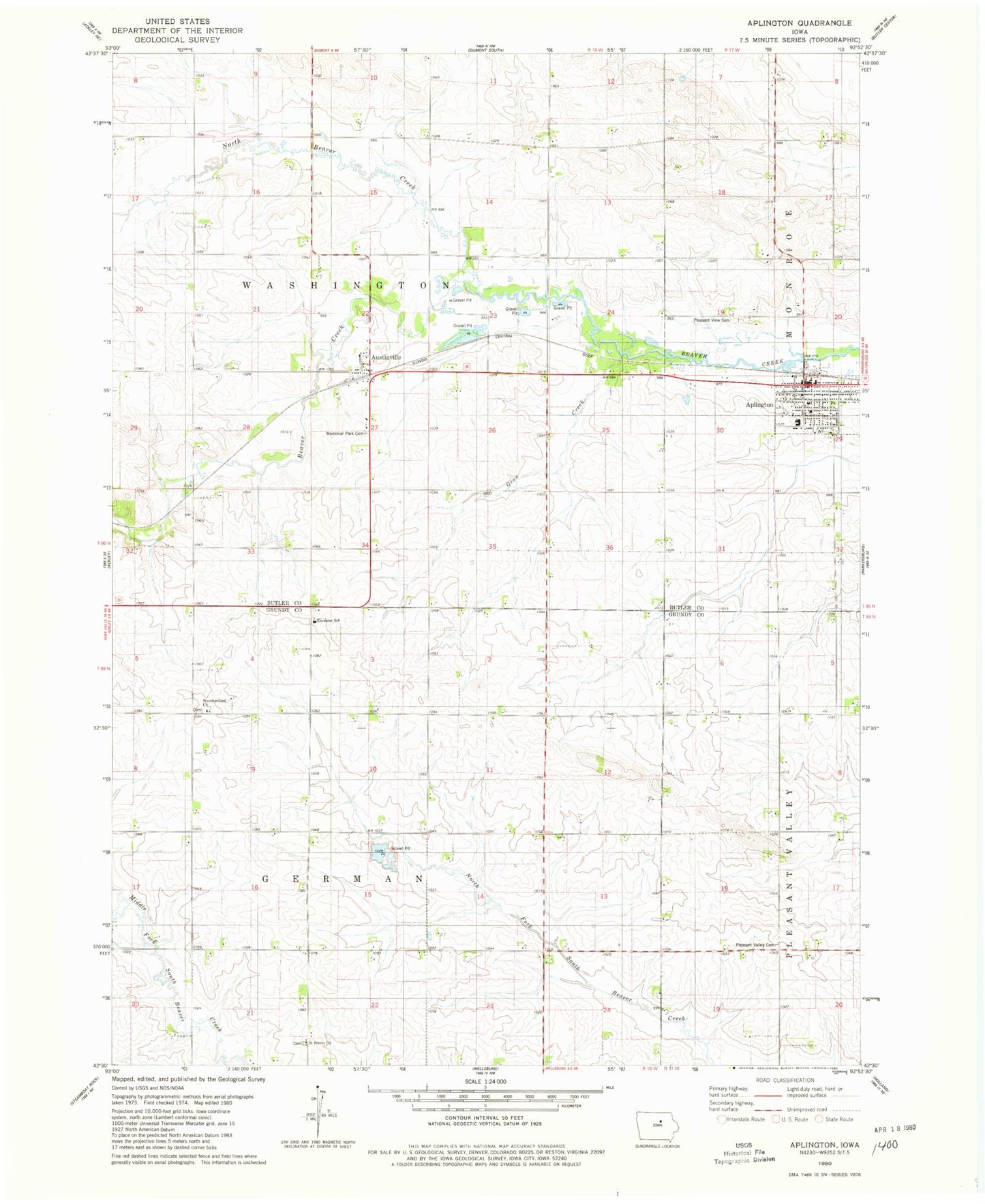
Historical USGS topographic quad map of Aplington in the state of Iowa. Map scale may vary for some years, but is generally around 1:24,000. Print size is approximately 24" x 27"
This quadrangle is in the following counties: Butler, Grundy.
The map contains contour lines, roads, rivers, towns, and lakes. Printed on high-quality waterproof paper with UV fade-resistant inks, and shipped rolled.
Contains the following named places: Ackley Christian Reformed Church, Aplington, Aplington - Parkersburg Middle School, Aplington Ambulance Service, Aplington Chiropractic Clinic, Aplington City Hall, Aplington Elementary School, Aplington Feed and Grain Company Elevator, Aplington Fire Department, Aplington Post Office, Aplington Public Library, Aplington Recreation Complex, Austinville, Austinville Elevator, Austinville Post Office, Baptist Church, City of Aplington, Excelsior School, First Presbyterian Church, First Reformed Church, Gran Creek, Memorial Park Cemetery, North Beaver Creek, Pleasant Valley Cemetery, Pleasant View Cemetery, Saint Peters Cemetery, Saint Peter's Church, Township of German, Township of Washington, West Freisland Presbyterian Church, Westfriesland Church, ZIP Code: 50604