MyTopo
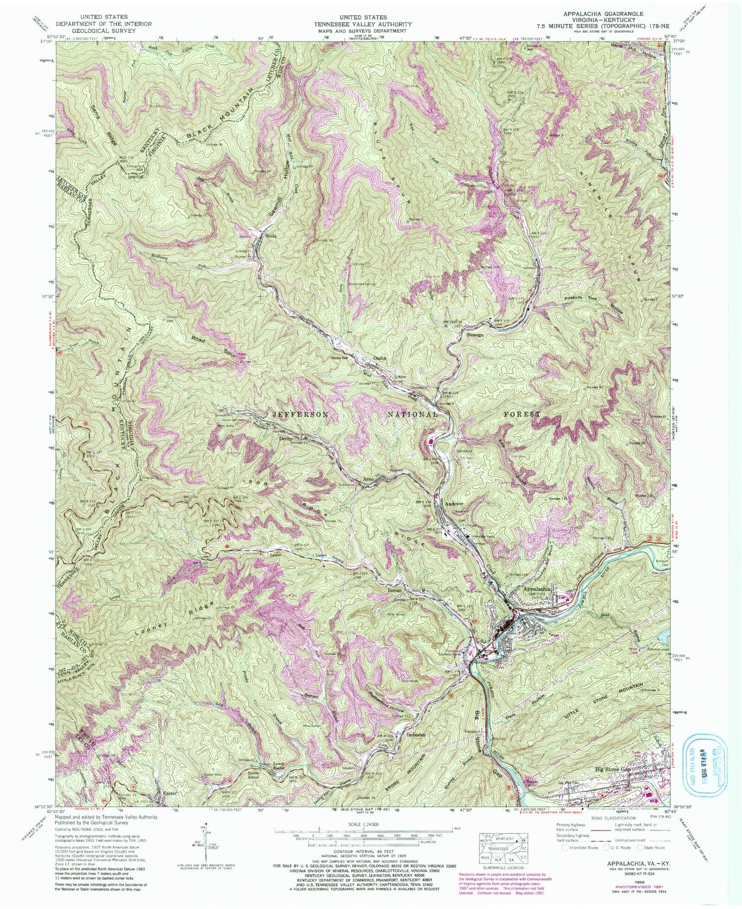
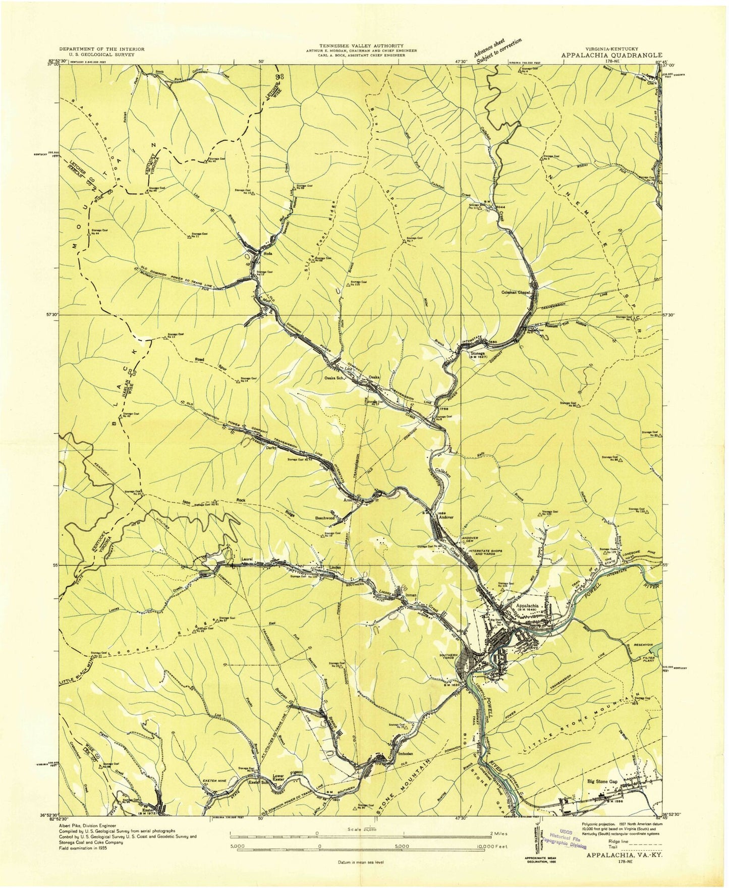
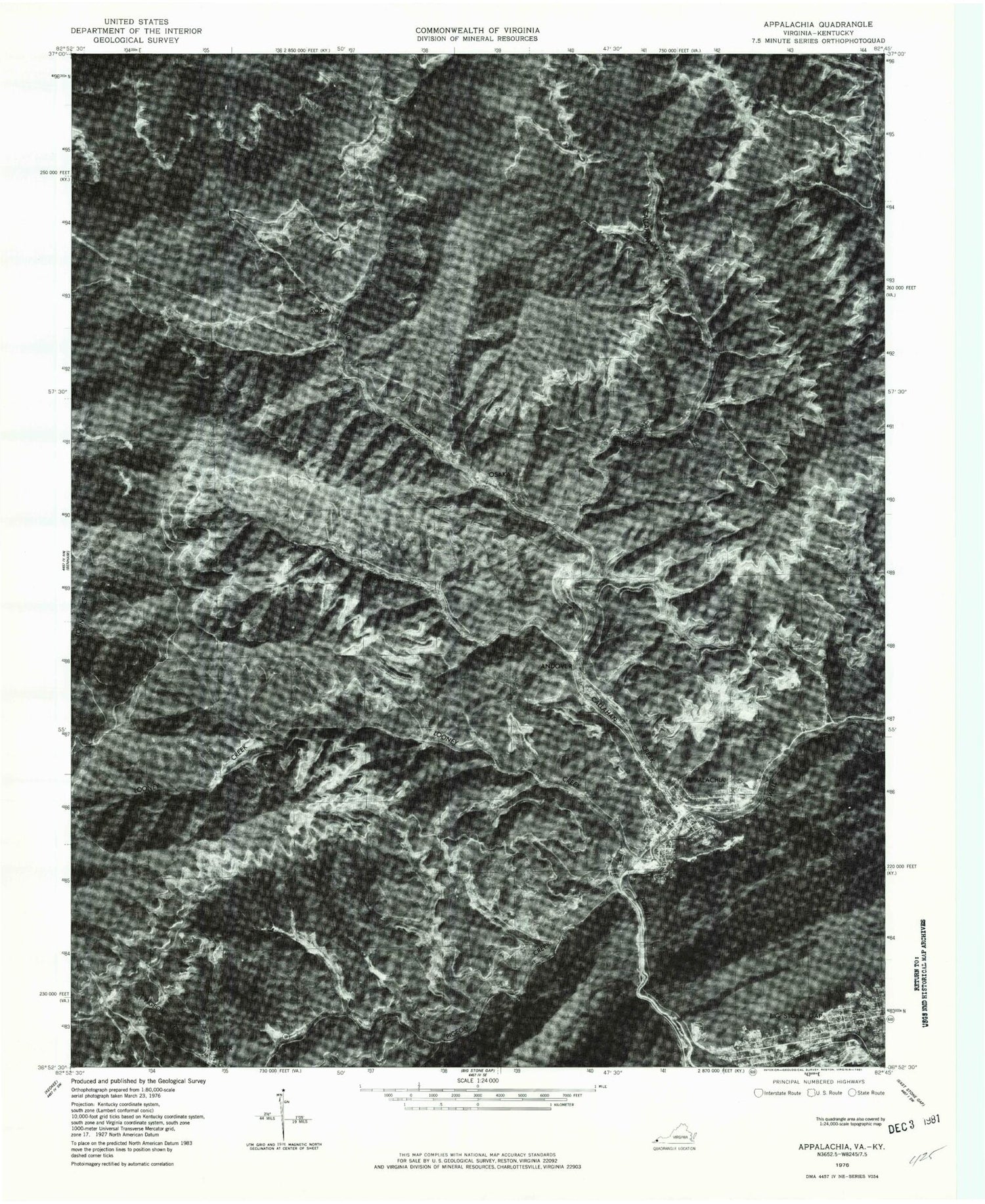
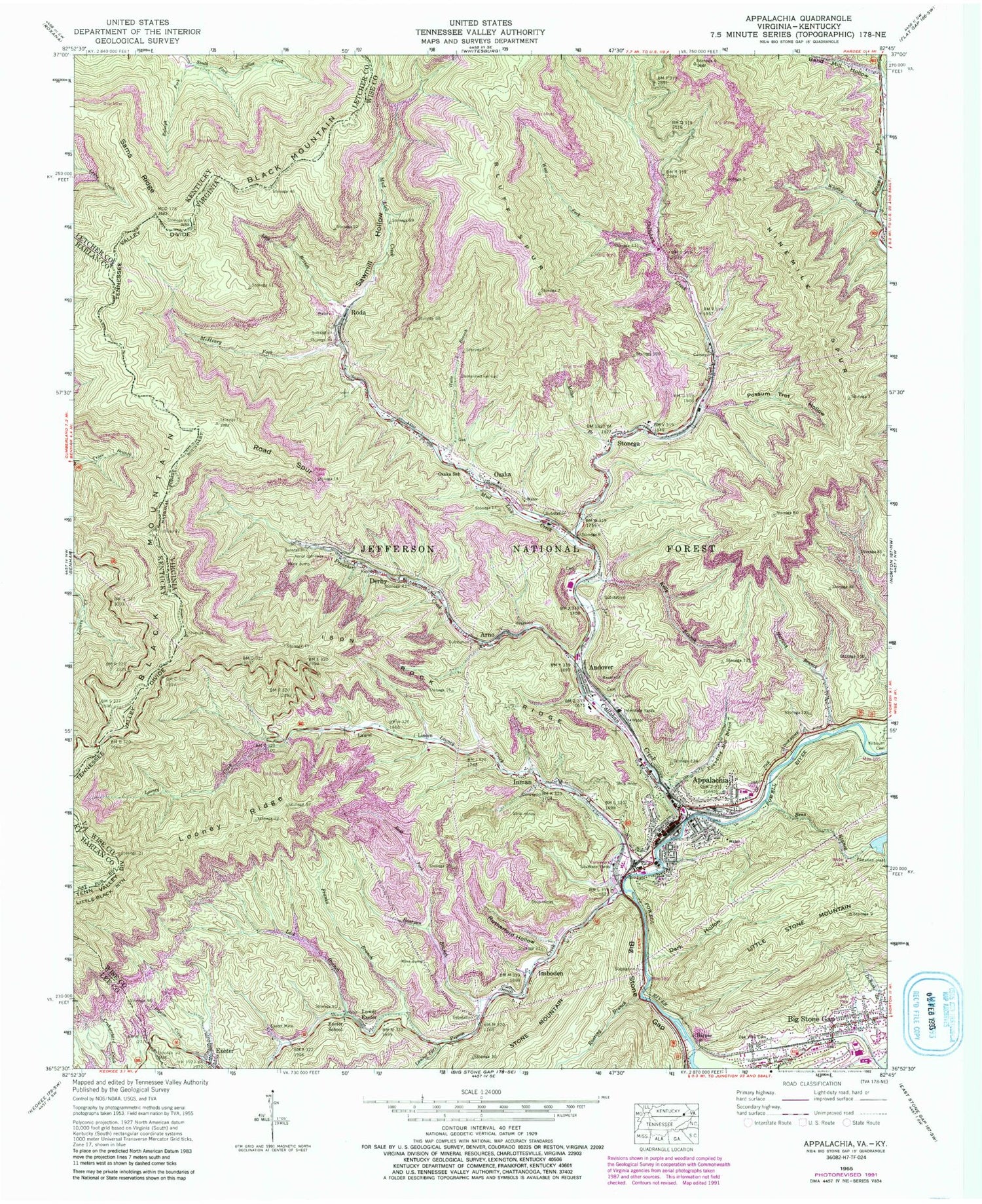
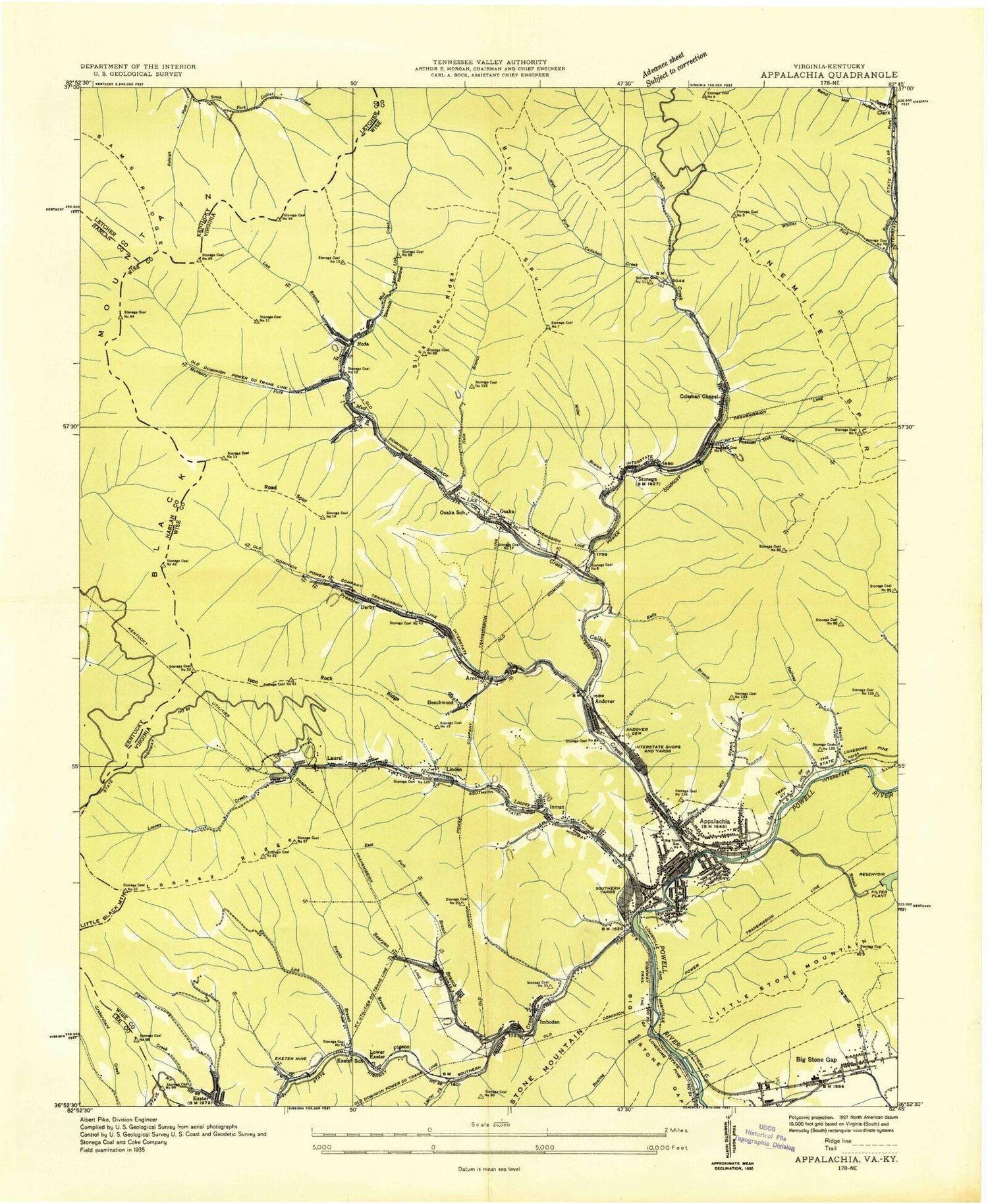
Classic USGS Appalachia Virginia 7.5'x7.5' Topo Map
Couldn't load pickup availability
Historical USGS topographic quad map of Appalachia in the states of Virginia, Kentucky. Map scale may vary for some years, but is generally around 1:24,000. Print size is approximately 24" x 27"
This quadrangle is in the following counties: Harlan, Lee, Letcher, Wise.
The map contains contour lines, roads, rivers, towns, and lakes. Printed on high-quality waterproof paper with UV fade-resistant inks, and shipped rolled.
Contains the following named places: Andover, Andover Cemetery, Appalachia, Appalachia High School, Appalachia Police Department, Appalachia Post Office, Appalachia Rescue Squad, Appalachia Volunteer Fire Department, Arno, Band Mill Hollow, Bearpen Branch, Beechwood, Bens Branch, Bens Branch Dam, Big Stone Gap, Bluff Spur, Callahan Creek, Castlewood Quarry, Clark, Coleman Chapel, Dark Hollow, Derby, East Fork Bearpen Branch, Exeter, Exeter Mine, Exeter School, First Baptist Church, First Presbyterian Church, Franks Branch, Halfway Branch, Halls Branch, Harper, Imboden, Inman, Interstate Yards, Ison Rock Ridge, Kelly Branch, Kilbourn Cemetery, Laurel, Laurel Fork, Lick Branch, Linden, Looney Creek, Looney Ridge, Lower Exeter, McHenry Fork, Miller Branch, Mud Lick Creek, Ninemile Spur, Oak View Cemetery, Osaka, Osaka Census Designated Place, Osaka School, Pigeon Creek, Possum Trot Hollow, Pounding Mill Creek, Preacher Creek, Raleigh Fork, Road Spur, Roaring Branch, Roda, Rutherford Hollow, Sams Ridge, Sawmill Hollow, Southern Yards, Stonega, Stonega Census Designated Place, Town of Appalachia, Wellmont Lonesome Pine Hospital, West Fork Collahan Creek, Whitley Fork, ZIP Code: 24216