MyTopo
Classic USGS Appendicitis Hill Idaho 7.5'x7.5' Topo Map
Regular price
$16.95
Regular price
Sale price
$16.95
Unit price
per
Couldn't load pickup availability
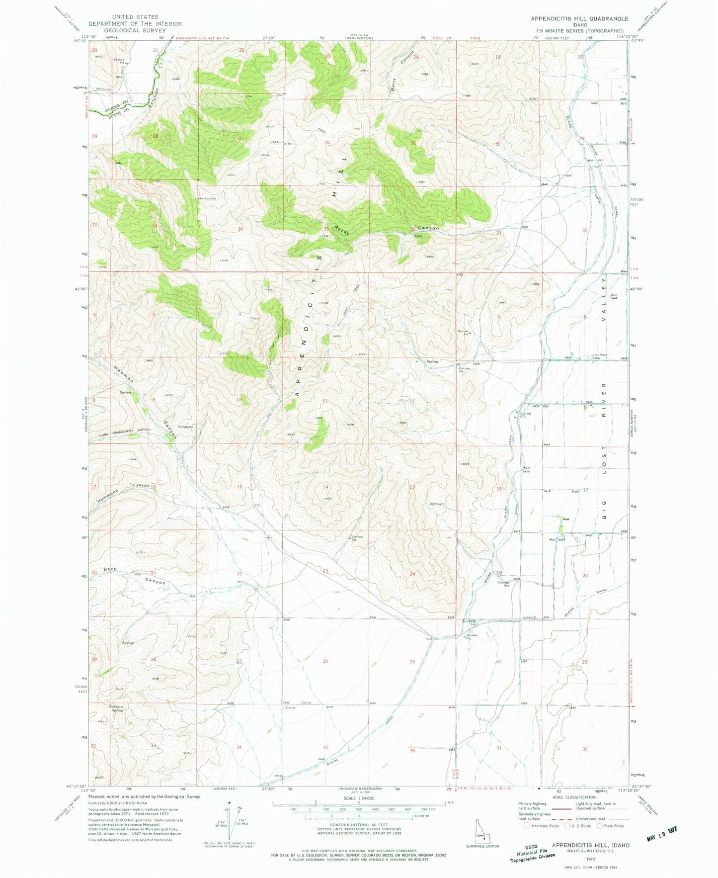
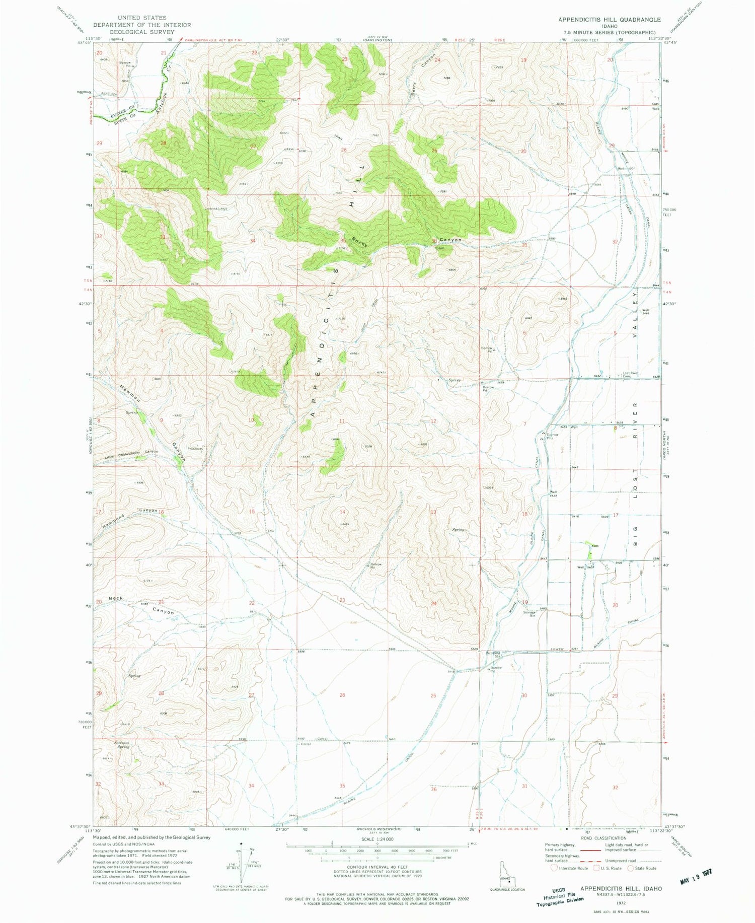
Historical USGS topographic quad map of Appendicitis Hill in the state of Idaho. Map scale may vary for some years, but is generally around 1:24,000. Print size is approximately 24" x 27"
This quadrangle is in the following counties: Butte, Custer.
The map contains contour lines, roads, rivers, towns, and lakes. Printed on high-quality waterproof paper with UV fade-resistant inks, and shipped rolled.
Contains the following named places: Antelope Creek Access Area, Appendicitis Hill, Beck Canyon, Blaine Canal, Hammond Canyon, Little Chokecherry Canyon, Lost River Cemetery, Lower Blaine Canal, Moore Canal, Newman Canyon, Rocky Canyon, Sorenson Spring