MyTopo
Classic USGS Applegate Mountain New Mexico 7.5'x7.5' Topo Map
Couldn't load pickup availability
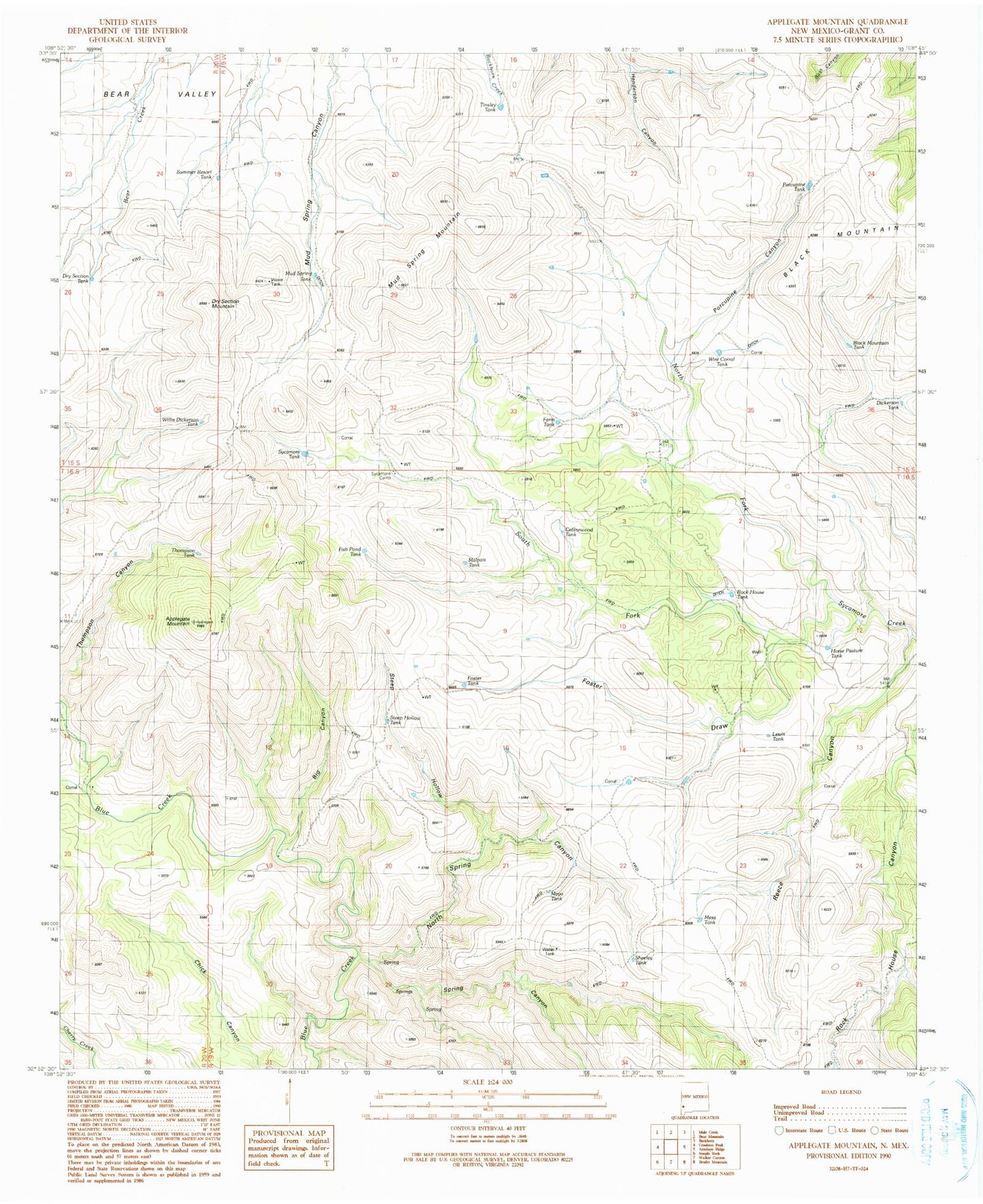
Historical USGS topographic quad map of Applegate Mountain in the state of New Mexico. Map scale may vary for some years, but is generally around 1:24,000. Print size is approximately 24" x 27"
This quadrangle is in the following counties: Grant.
The map contains contour lines, roads, rivers, towns, and lakes. Printed on high-quality waterproof paper with UV fade-resistant inks, and shipped rolled.
Contains the following named places: Applegate Mountain, Big Canyon, Black Mountain Tank, Cottonwood Tank, Dickerson Tank, Dry Section Mountain, Dry Section Tank, Farm Tank, Fish Pond Tank, Foster Draw, Foster Tank, Horse Pasture Tank, Lewis Tank, Malpais Tank, Mayo Tank, Mesa Tank, Mud Spring Mountain, Mud Spring Tank, Mud Spring Windmill, North Fork Sycamore Creek, North Spring Canyon, Porcupine Canyon, Porcupine Tank, Reece Canyon, Rock House Tank, Sheeley Tank, South Fork Sycamore Creek, Spring Canyon, Steep Hollow, Steep Hollow Spring Canyon, Steep Hollow Tank, Summer Resort Tank, Sycamore Camp, Sycamore Tank, Thompson Tank, Tinsley Tank, Willis Dickerson Tank, Wire Corral Tank