MyTopo
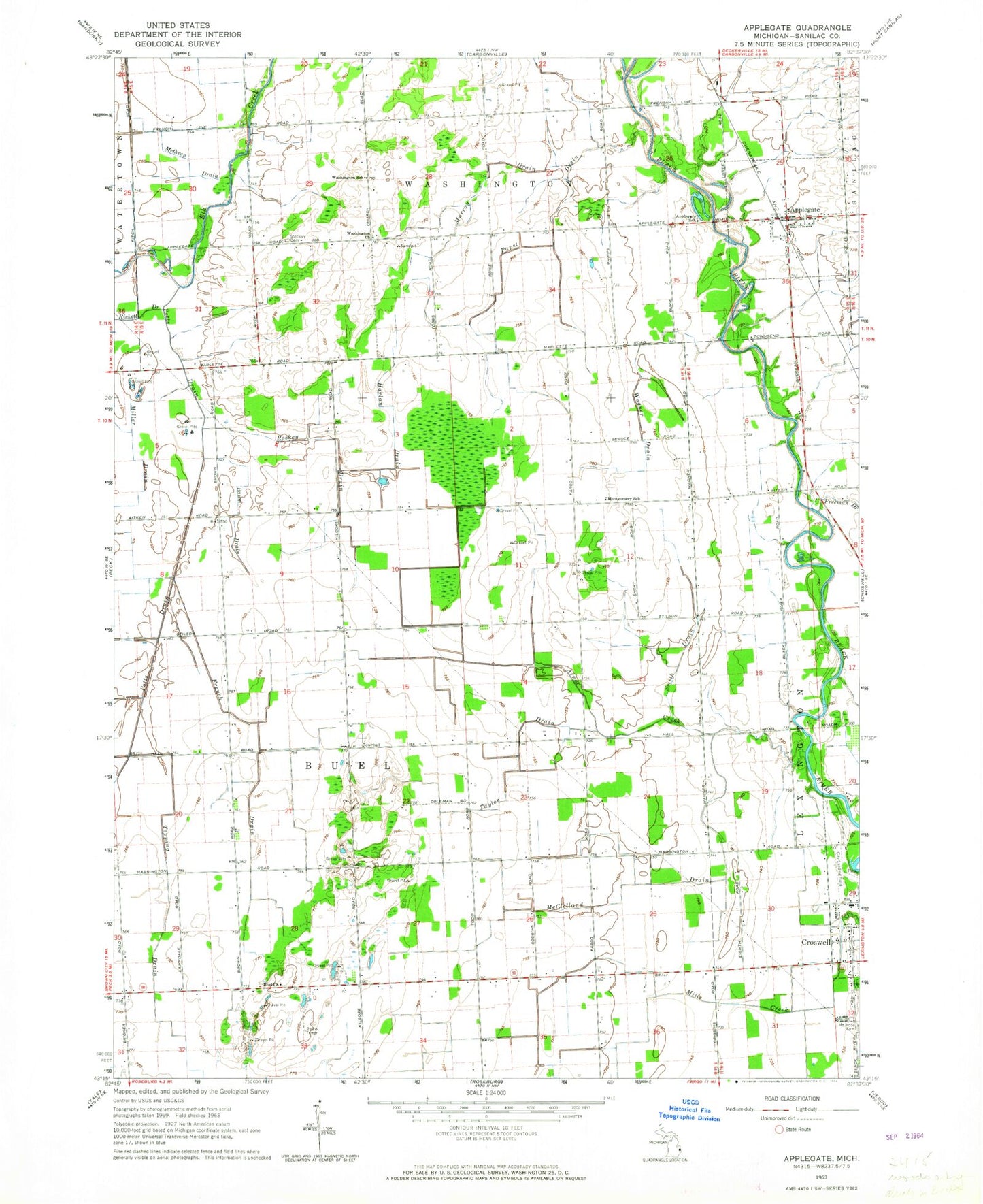
Classic USGS Applegate Michigan 7.5'x7.5' Topo Map
Couldn't load pickup availability
Historical USGS topographic quad map of Applegate in the state of Michigan. Map scale may vary for some years, but is generally around 1:24,000. Print size is approximately 24" x 27"
This quadrangle is in the following counties: Sanilac.
The map contains contour lines, roads, rivers, towns, and lakes. Printed on high-quality waterproof paper with UV fade-resistant inks, and shipped rolled.
Contains the following named places: Applegate, Applegate Fire Department, Applegate Post Office, Applegate School, Applegate Station, Applegate United Methodist Church, Applegate Wesleyan Church, Arnot Creek, Baum Drain, Buel Church, Buel Methodist Episcopal Church Historical Marker, Buell Hill Estates Mobile Home Park, Buell Post Office, Country Hill Pines Mobile Home Park, Croswell Community Church, Croswell Wesleyan Church, Freeman Drain, French Drain, Harlan Drain, Hicks Post Office, McClelland Drain, Methven Drain, Miller Drain, Montgomery School, Murray Drain, Papst Drain, Peck Air Park, Potts Drain, Roskey Drain, Saint Patrick Mount Hope Cemetery, Saint Patrick Parish, Smith Drain, Steckley Cemetery, Taylor Drain, Topping Drain, Township of Buel, Village of Applegate, Wagner Drain, Washington Church, Washington School, ZIP Codes: 48401, 48422