
MyTopo
Classic USGS Appleton Illinois 7.5'x7.5' Topo Map
Couldn't load pickup availability
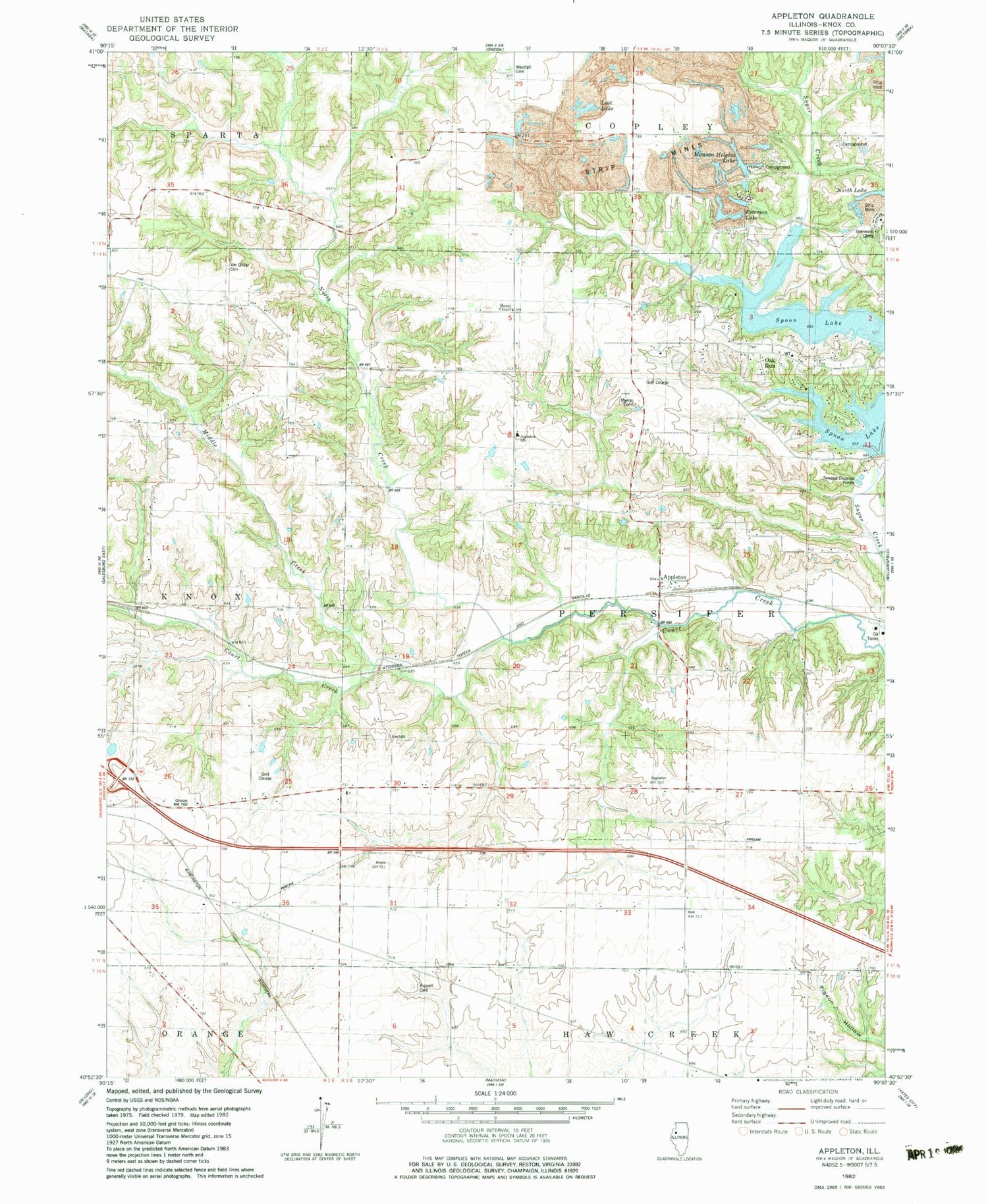
Historical USGS topographic quad map of Appleton in the state of Illinois. Map scale may vary for some years, but is generally around 1:24,000. Print size is approximately 24" x 27"
This quadrangle is in the following counties: Knox.
The map contains contour lines, roads, rivers, towns, and lakes. Printed on high-quality waterproof paper with UV fade-resistant inks, and shipped rolled.
Contains the following named places: Appleton, Appleton Fire Station, Appleton School, Bruington Lake, Bruington Lake Dam, Cottonwood School, Dempsey School, Egypt School, Flynn School, Fort Henry School, Glisson School, Knox County, Knoxville Mine, Lotts School, Manson Heights Lake, Maple Grove School, Maxey Chapel, Middle Creek, Myers Cemetery, North Creek, North Lake, Oak Run, Oak Run Census Designated Place, Peterson Lake, Red Oak School, Russell Cemetery, Sherman School, Sherwood Camp, Sunnyside School, Thermal Mine, Township of Persifer, Van Gilder Cemetery, West Falls School, Westfall Cemetery, White Oak School, ZIP Code: 61448


