MyTopo
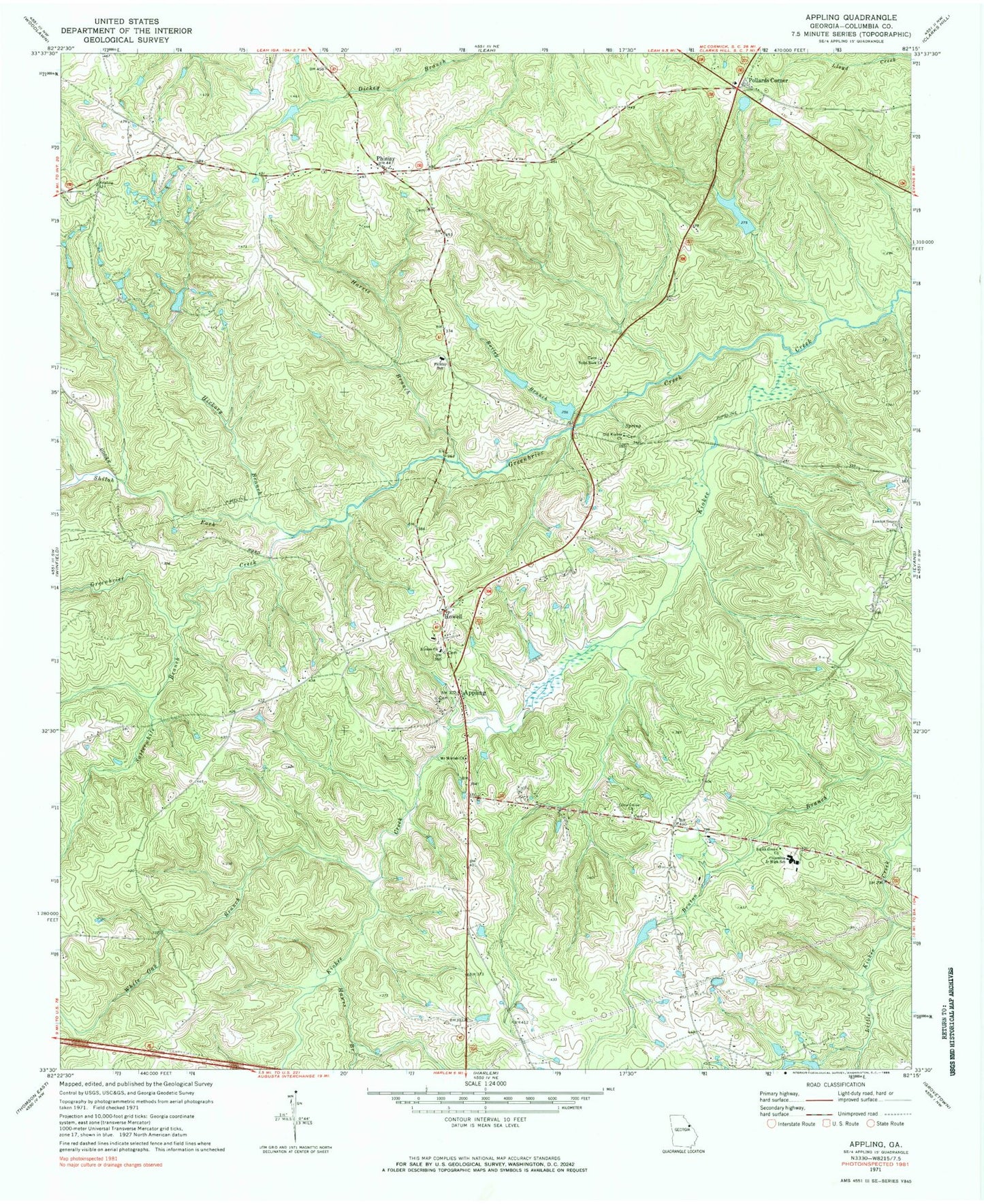
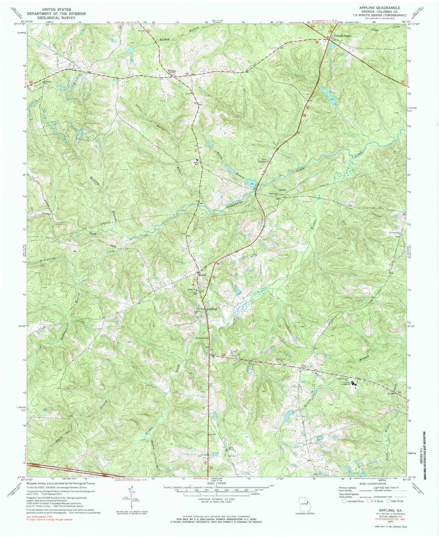
Classic USGS Appling Georgia 7.5'x7.5' Topo Map
Couldn't load pickup availability
Historical USGS topographic quad map of Appling in the state of Georgia. Map scale may vary for some years, but is generally around 1:24,000. Print size is approximately 24" x 27"
This quadrangle is in the following counties: Columbia.
The map contains contour lines, roads, rivers, towns, and lakes. Printed on high-quality waterproof paper with UV fade-resistant inks, and shipped rolled.
Contains the following named places: Appling, Appling Census Designated Place, Appling Church, Appling Division, Appling Grove Church, Appling Post Office, Bailey Branch, Bennett Dam, Bennett Lake, Carpenter Airport, Casaga Lake, Casaga Lake Dam, Cluese, Columbia County, Columbia County Courthouse, Columbia County Fire Rescue Station 10, Columbia County Jail, Columbia County Sheriff's Office, Columbia Fire Rescue Station 12, Columbia Middle School, Crawford Lake, Crawford Lake Dam, Delph, Greenbrier Creek, Harris Branch, Hawes Branch, Hickory Branch, Hickory Lake, Hickory Lake Dam, Howell, Kelly Branch, Kiokee Church, Kiokee School, Lamkin Grove Church, Lamkin Grove School, Lampkin Grove Baptist Cemetery, Lower Pollards Lake, Lower Pollards Lake Dam, Maddox, Marshall Monument, Martinez - Columbia Fire Rescue Station 15, Mount Moriah Church, North Columbia Elementary School, Old Kiokee Church, Olive Grove Church, Phinizy, Pollards Corner, Pollards Corner Lake, Pollards Corner Lake Dam, Pollards Lake, Pollards Lake Dam, Satterwhite Branch, Shiloh Fork, Smith Church, Smith Grove Church, Smith School, Solid Rock Baptist Church Cemetery, Solid Rock Church, Susie Bostic Cemetery, Walnut Grove Baptist Cemetery, Walnut Grove School, White Oak Branch, WMTZ-FM (Martinez), ZIP Code: 30802