MyTopo
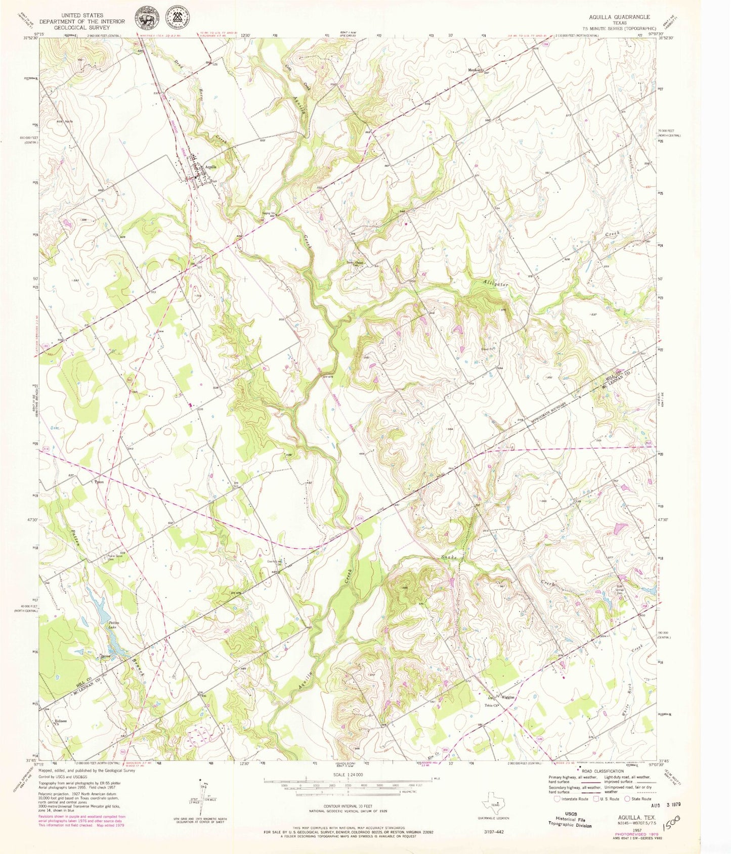
Classic USGS Aquilla Texas 7.5'x7.5' Topo Map
Couldn't load pickup availability
Historical USGS topographic quad map of Aquilla in the state of Texas. Map scale may vary for some years, but is generally around 1:24,000. Print size is approximately 24" x 27"
This quadrangle is in the following counties: Hill, McLennan.
The map contains contour lines, roads, rivers, towns, and lakes. Printed on high-quality waterproof paper with UV fade-resistant inks, and shipped rolled.
Contains the following named places: Alligator Creek, Aquilla, Aquilla Post Office, Aquilla Volunteer Fire Department, Bold Springs Cemetery, City of Aquilla, Cobb Creek, Coffelt Lake Number 1 Dam, Coffelt Lake Number 2, Coffelt Lake Number 2 Dam, County Line Gin, Dead Horse Creek, Holiness Church, KJNE-FM (Hillsboro), Menlow, Patten Lake, Prairie Grove Cemetery, Scotts Chapel Cemetery, Snake Creek, Square K Airport, Tokio, Tokio Church, Tyson, Vrbas Lake, Vrbas Lake Dam, West Division, Wiggins, ZIP Code: 76622