

MyTopo
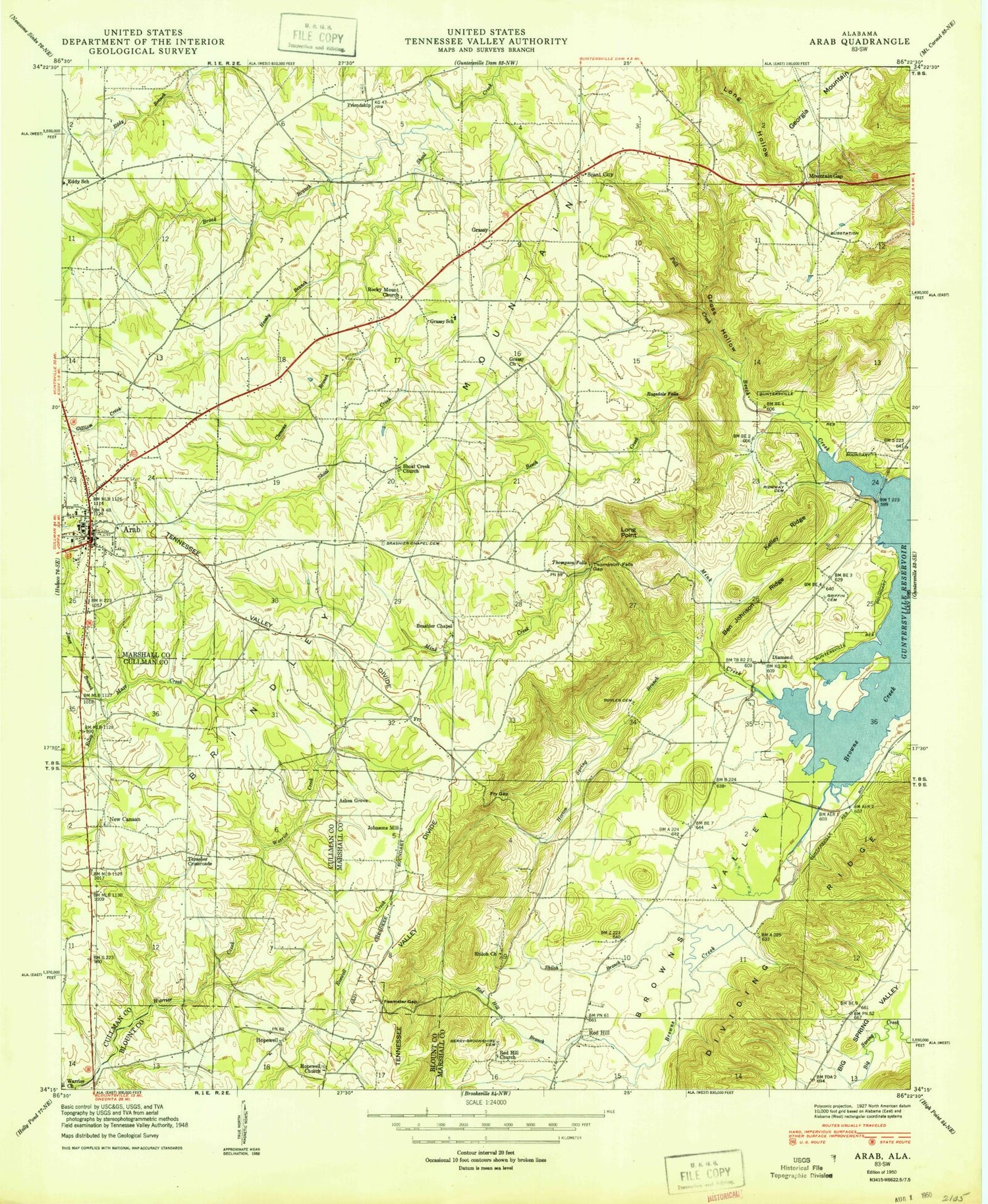
Classic USGS Arab Alabama 7.5'x7.5' Topo Map
Couldn't load pickup availability
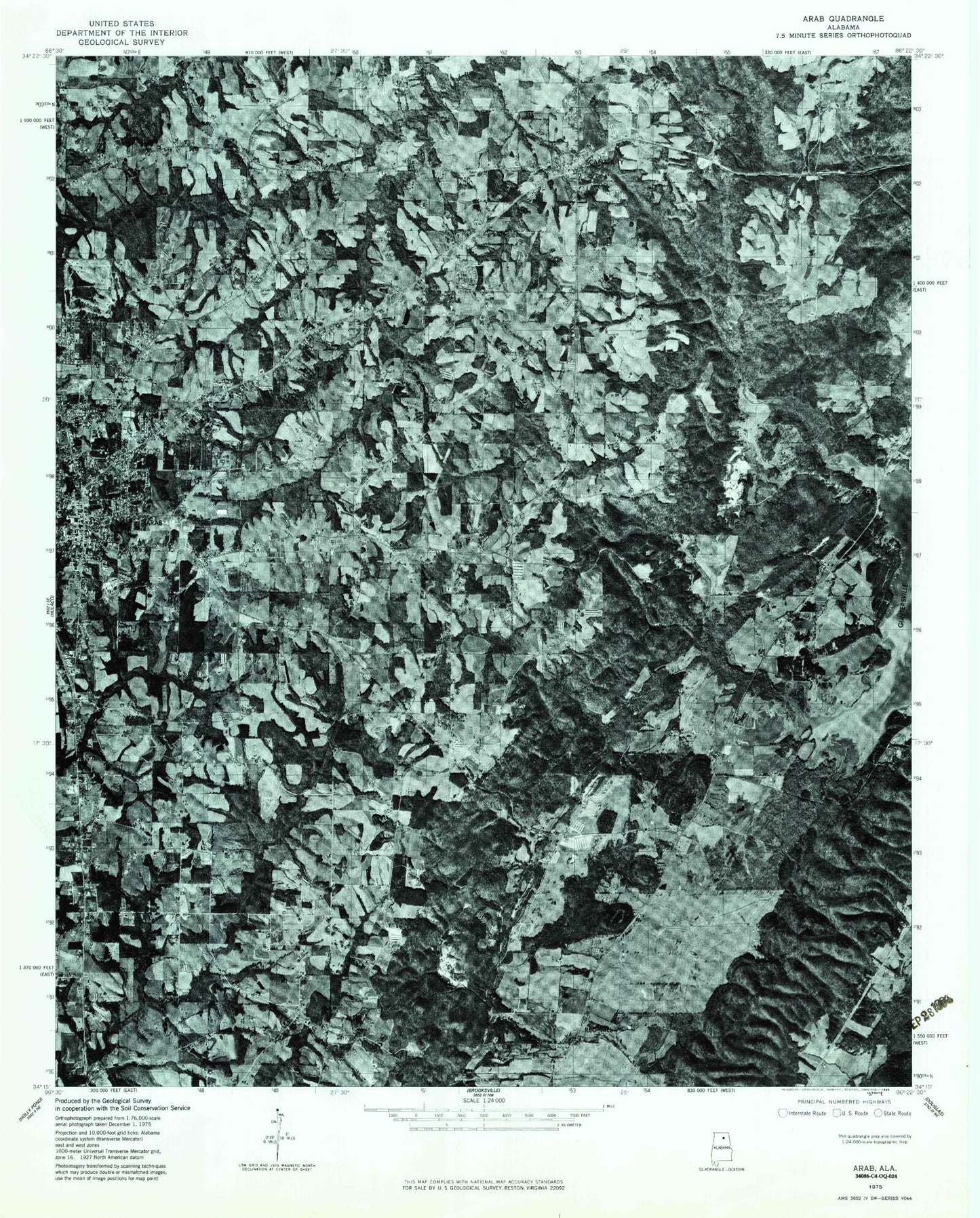
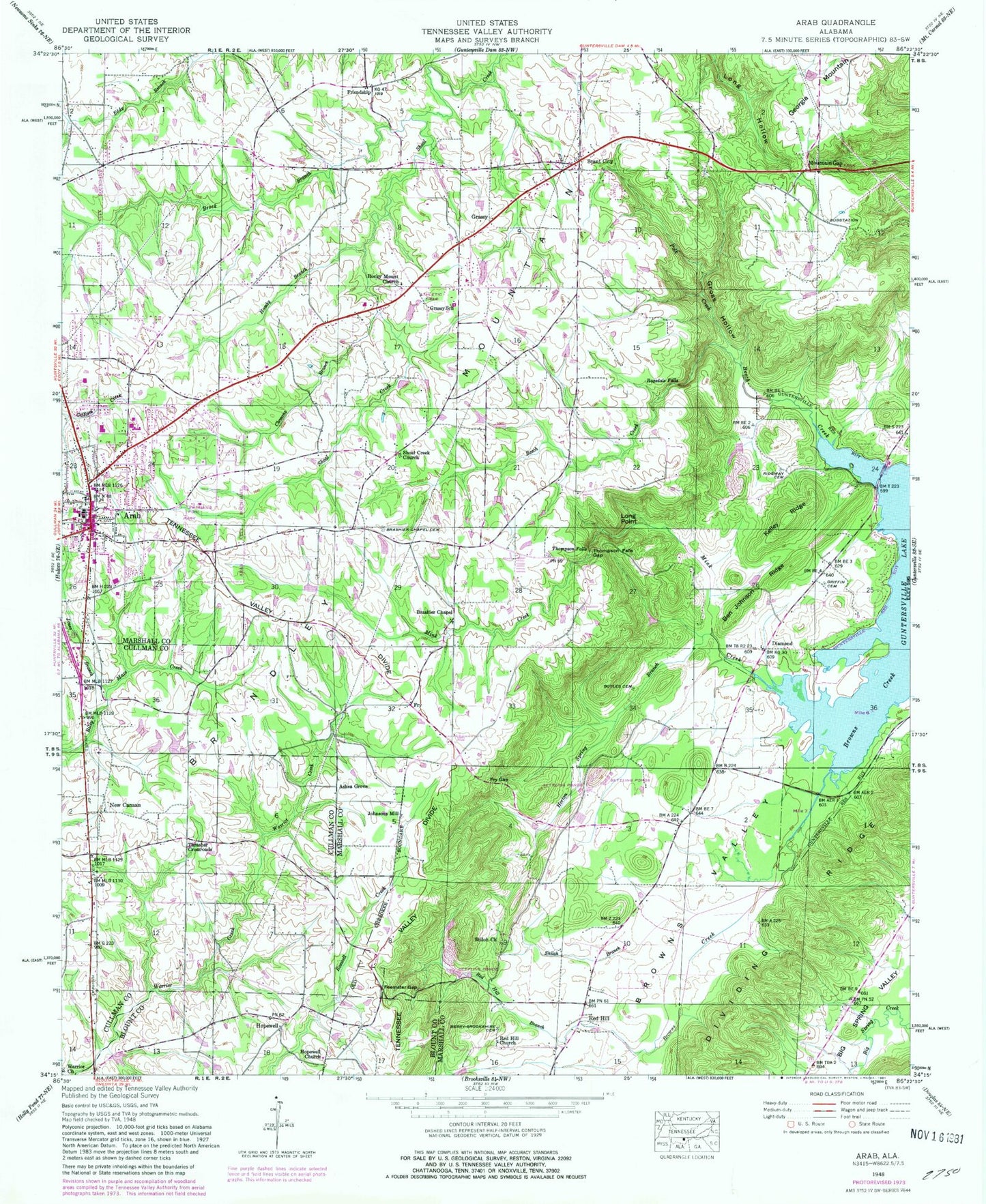
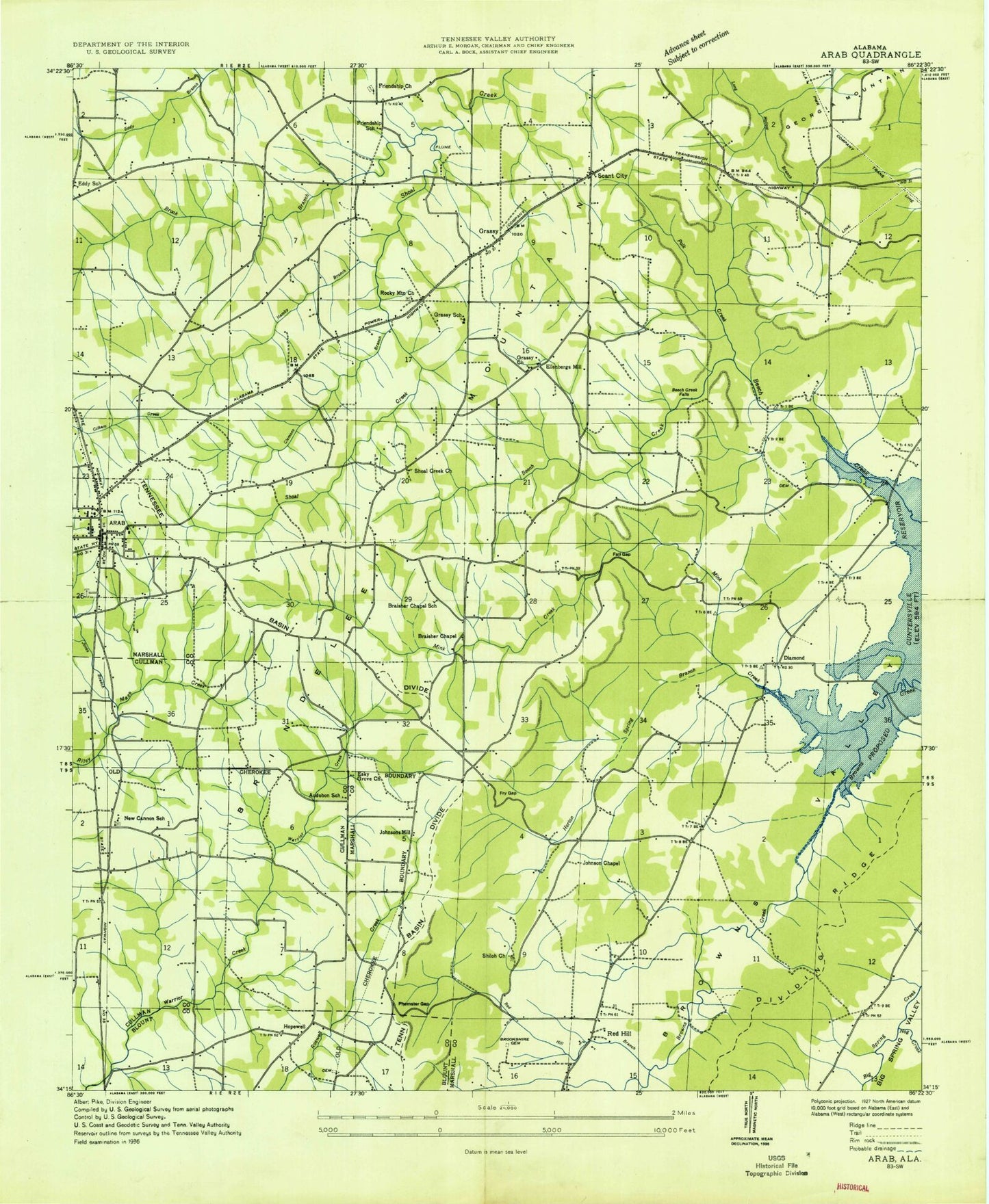
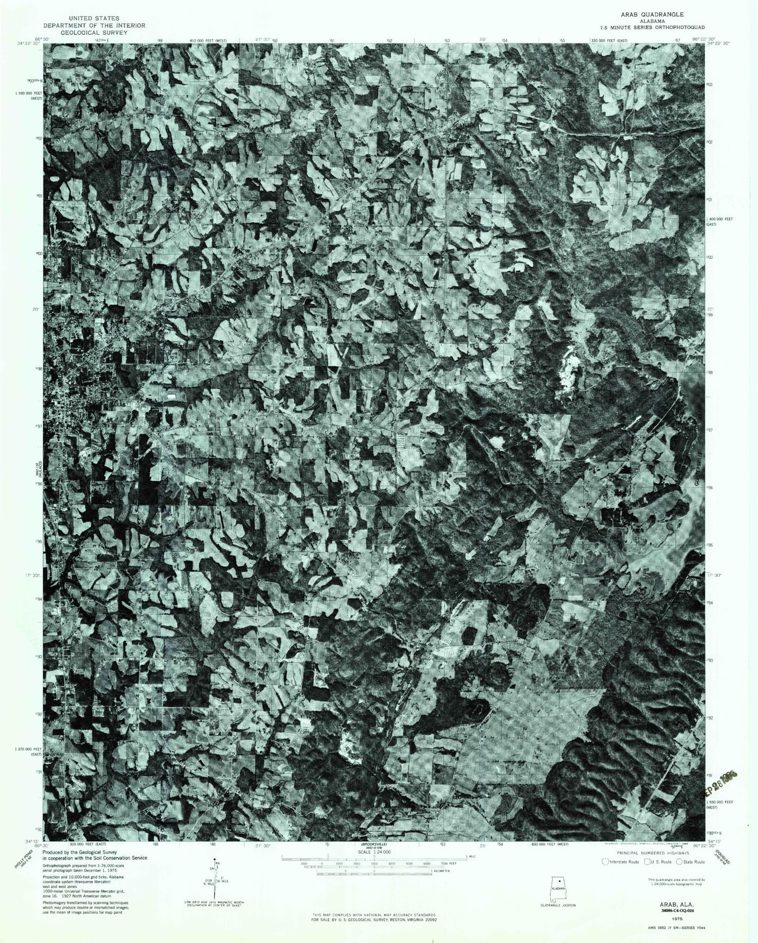
Historical USGS topographic quad map of Arab in the state of Alabama. Map scale may vary for some years, but is generally around 1:24,000. Print size is approximately 24" x 27"
This quadrangle is in the following counties: Blount, Cullman, Marshall.
The map contains contour lines, roads, rivers, towns, and lakes. Printed on high-quality waterproof paper with UV fade-resistant inks, and shipped rolled.
Contains the following named places: Arab, Arab Division, Arab Elementary School, Arab High School, Arab Hospital, Arab Memorial Cemetery, Arab Police Department, Arab Post Office, Arab Primary School, Askea Grove, Audubon School, Beech Creek, Beech Creek Church, Ben Johnson Ridge, Berry-Brookshire Cemetery, Boyles Cemetery, Braisher Chapel School, Brashier Chapel, Brashier Chapel Cemetery, Brock Branch, Brookwood Cemetery, Browns Creek, City of Arab, Clemons Branch, Diamond, Diamond Church, Dividing Ridge, Dream Ranch, Eddy Branch, Eddy School, Ellenbergs Mill, Esky Grove Church, Feemster Gap, Four - C Volunteer Fire Department, Friendship, Friendship School, Fry Gap, Grassy, Grassy Church, Grassy Junior High School, Griffin Cemetery, Gross Hollow, Hamby Branch, Hopewell, Hopewell Missionary Baptist Church, Horton Spring Branch, Johnson Chapel, Johnsons Mill, Jones Branch, Kelley Ridge, Long Point, Marshall Medical Center North, Mink Creek, Mountain Gap, New Canaan, New Canaan Baptist Church, New Canaan Baptist Church Cemetery, New Canaan School, New Friendship Cemetery, New Friendship Church, Pine Acres, Polk Creek, Ragsdale Falls, Red Hill, Red Hill Branch, Red Hill Cemetery, Red Hill Church, Red Hill Methodist Church, Ridgway Cemetery, Rock Hill School, Rocky Mount Primitive Baptist Church, Scant City, Sherwood Forest, Shiloh Branch, Shiloh Cemetery, Shiloh Church, Shoal Creek Cemetery, Shoal Creek Church, Thompson Falls, Thompson Falls Gap, Thrasher Crossroads, Warrior Creek Baptist Church, Warrior Creek Missionary Baptist Church Cemetery, WCRQ-FM (Arab), WRAB-AM (Arab)