
MyTopo
Classic USGS Arabi Georgia 7.5'x7.5' Topo Map
Couldn't load pickup availability
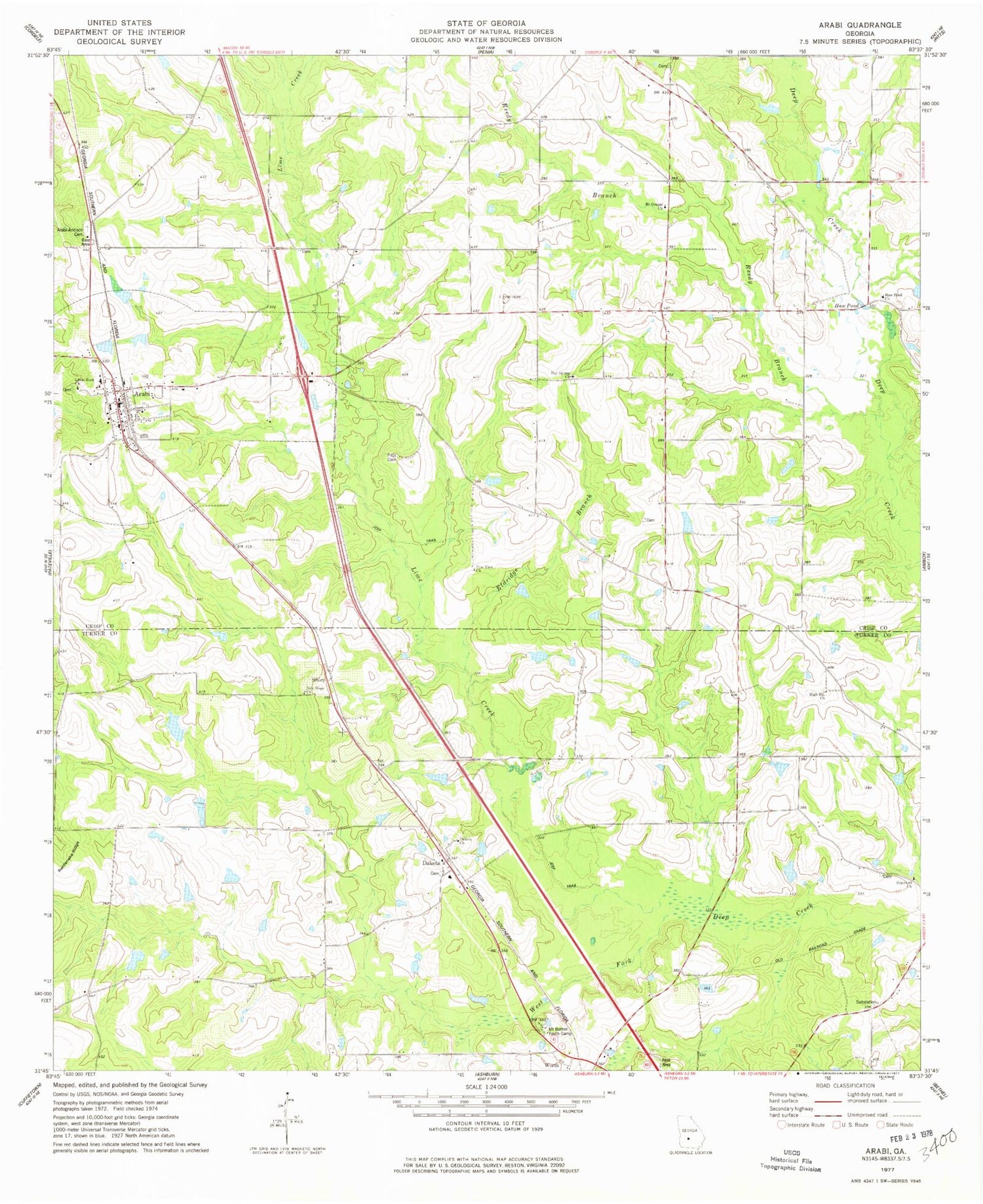
Historical USGS topographic quad map of Arabi in the state of Georgia. Map scale may vary for some years, but is generally around 1:24,000. Print size is approximately 24" x 27"
This quadrangle is in the following counties: Crisp, Turner.
The map contains contour lines, roads, rivers, towns, and lakes. Printed on high-quality waterproof paper with UV fade-resistant inks, and shipped rolled.
Contains the following named places: Arabi, Arabi - Antioch Cemetery, Arabi Division, Arabi Post Office, Bay Spring Church, Bay Spring School, Bedgood, Crisp County Fire Department Station 3, Dakota, Dakota Cemetery, Dakota Church, Dakota Consolidated School, Eldridge Branch, Haw Pond, Haw Pond Church, Haw Pond School, High Hill Church, Hopewell Cemetery, Hopewell Church, Jackson Cemetery, Lime Creek, Little Rock Church, Mount Bethel Youth Camp, Mount Orham Church, New Hope Church, Pine View Church, Pitts Cemetery, Rainey School, Rattlesnake Ridge, Reedy Branch, Sibley, Sink of the Creek, Smith Cemetery, Town of Arabi, Turner County Fire and Rescue Dakota Station, Worth, Youngblood Lake, Youngblood Lake Dam, ZIP Code: 31712


