MyTopo
Classic USGS Aragon New Mexico 7.5'x7.5' Topo Map
Couldn't load pickup availability
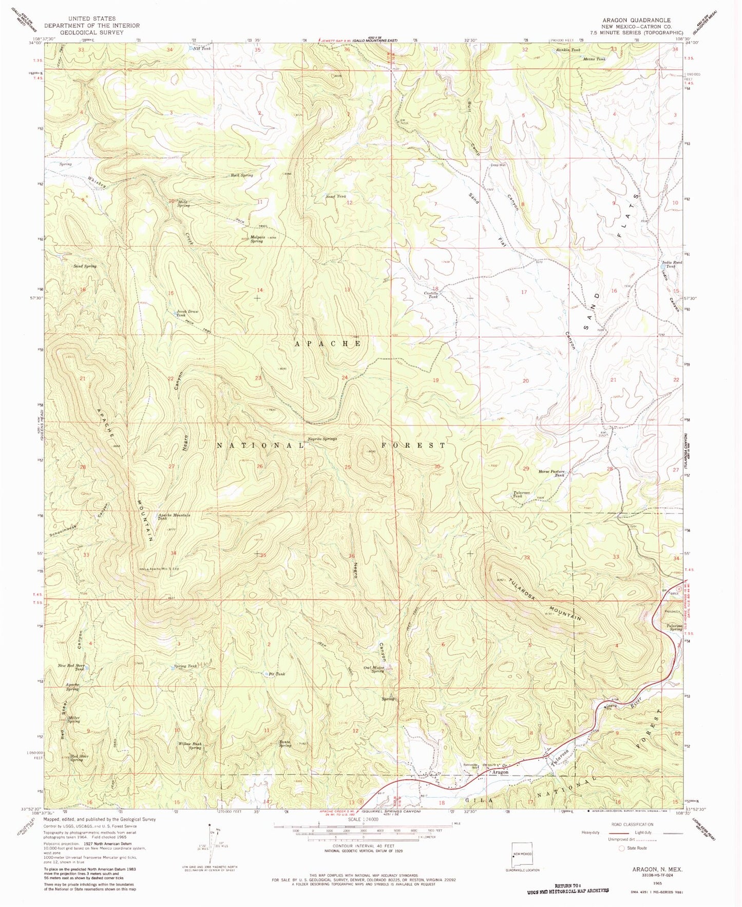
Historical USGS topographic quad map of Aragon in the state of New Mexico. Typical map scale is 1:24,000, but may vary for certain years, if available. Print size: 24" x 27"
This quadrangle is in the following counties: Catron.
The map contains contour lines, roads, rivers, towns, and lakes. Printed on high-quality waterproof paper with UV fade-resistant inks, and shipped rolled.
Contains the following named places: Apache Mountain, Apache Mountain Tank, Apache Spring, Banta Spring, Bull Camp Canyon, Castillo Tank, Deep Well, Horse Pasture Tank, Indio Road Tank, Jacob Draw Tank, Malpais Spring, Mata Spring, Means Tank, Miller Spring, NH Tank, Negrito Springs, Negro Canyon, New Red Steer Tank, Owl Water Spring, Pit Tank, Rankin Tank, Red Steer Spring, Rock Spring, Sand Spring, Sand Tank, Santonino School, Spring Tank, Tularosa Mountain, Tularosa Spring, Tularosa Tank, Willow Bush Spring, Negrito Tank, Orono Spring, Sand Flat Airstrip (historical), E Robertson Tank, Kline Tank, Tularosa Mountains, Aragon, Fort Tularosa (historical), Aragon Census Designated Place, Cruzville - Apache Creek / Aragon Fire Department