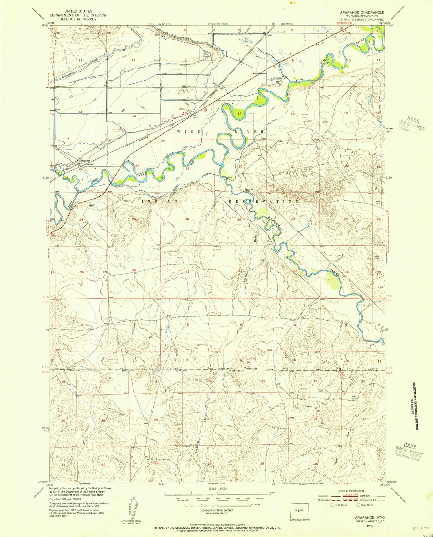
MyTopo
Classic USGS Arapahoe Wyoming 7.5'x7.5' Topo Map
Couldn't load pickup availability
Historical USGS topographic quad map of Arapahoe in the state of Wyoming. Map scale may vary for some years, but is generally around 1:24,000. Print size is approximately 24" x 27"
This quadrangle is in the following counties: Fremont.
The map contains contour lines, roads, rivers, towns, and lakes. Printed on high-quality waterproof paper with UV fade-resistant inks, and shipped rolled.
Contains the following named places: Arapaho Elementary School, Arapahoe, Arapahoe Catholic Cemetery, Arapahoe Cemetery, Arapahoe Census Designated Place, Arapahoe Middle School, Beaver Creek, Double Ditch, Fort Washakie Post Cemetery, Gustin Number 2 Reservoir, Lefthand Ditch, Mission Ditch, Popo Agie River, Preacher Draw, Saint Stephens, Saint Stephens Post Office, Sub-Agency Ditch