MyTopo
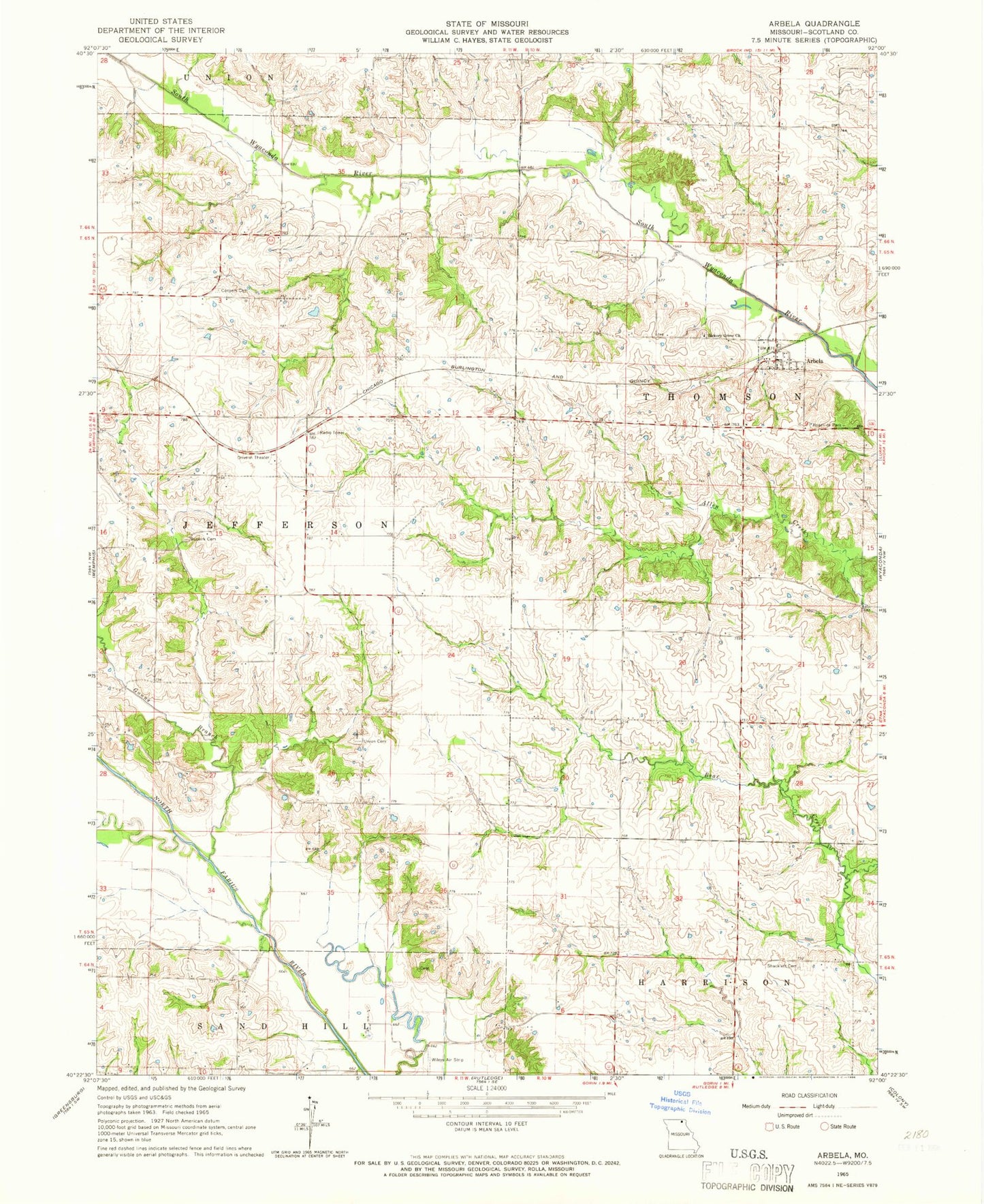
Classic USGS Arbela Missouri 7.5'x7.5' Topo Map
Couldn't load pickup availability
Historical USGS topographic quad map of Arbela in the state of Missouri. Map scale may vary for some years, but is generally around 1:24,000. Print size is approximately 24" x 27"
This quadrangle is in the following counties: Scotland.
The map contains contour lines, roads, rivers, towns, and lakes. Printed on high-quality waterproof paper with UV fade-resistant inks, and shipped rolled.
Contains the following named places: A-2 Lake, Arbela, Bear Creek Watershed Dam A-2, Buskirk Cemetery, Cedar Grove School, Conyers Cemetery, Conyers Church, Conyers School, Gunns Branch, Hazel Hill School, Hickory Grove Cemetery, Hickory Grove Church, Howard Airport, Morning View School, North Mount Pleasant School, Oak Ridge School, Plum College School, Round Grove School, Salem School, Shacklett Cemetery, Town of Arbela, Township of Thomson, Union Cemetery, Union Church, Union School, Wileys Air Strip