MyTopo
Classic USGS Arbuckle Hill Oklahoma 7.5'x7.5' Topo Map
Couldn't load pickup availability
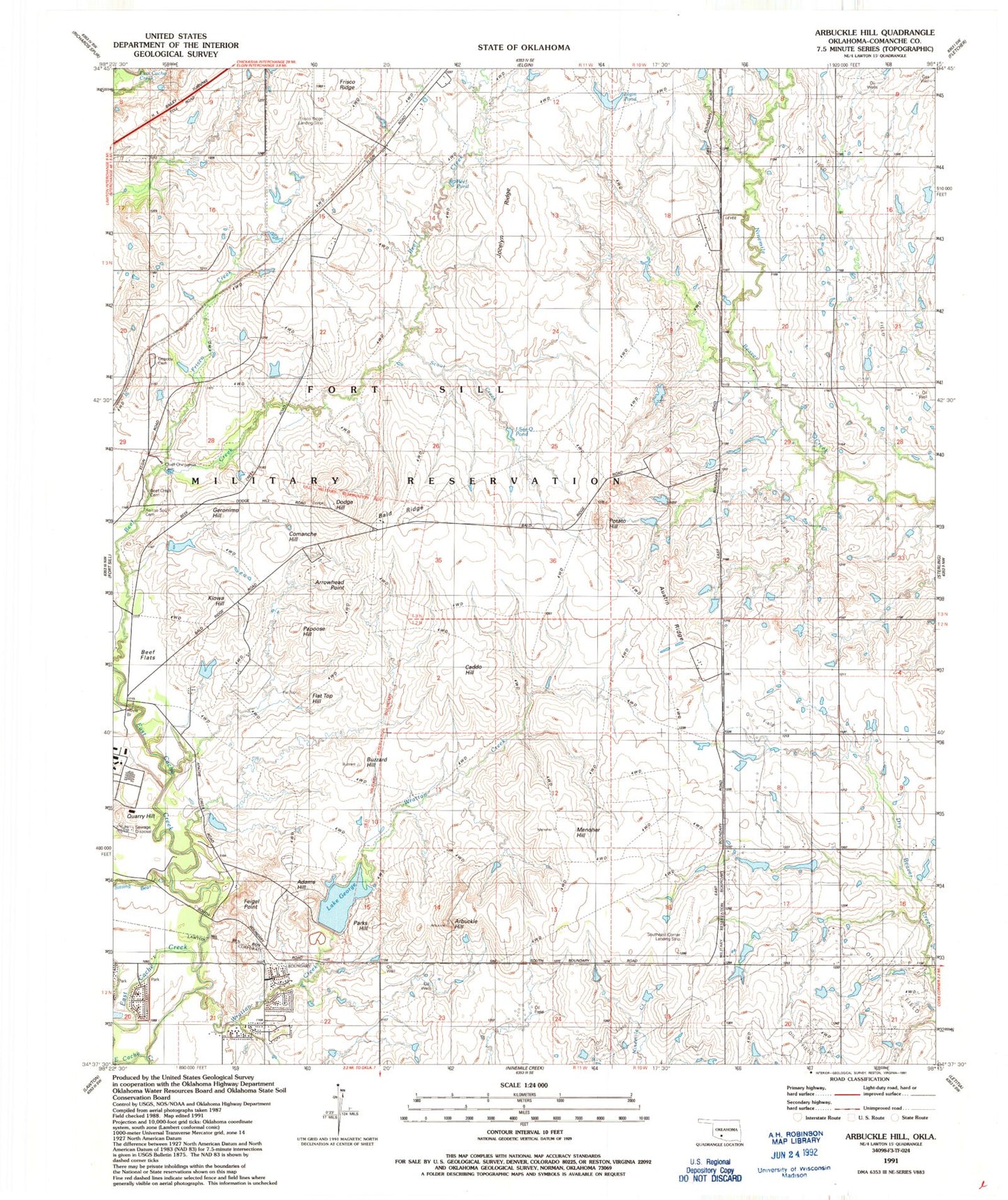
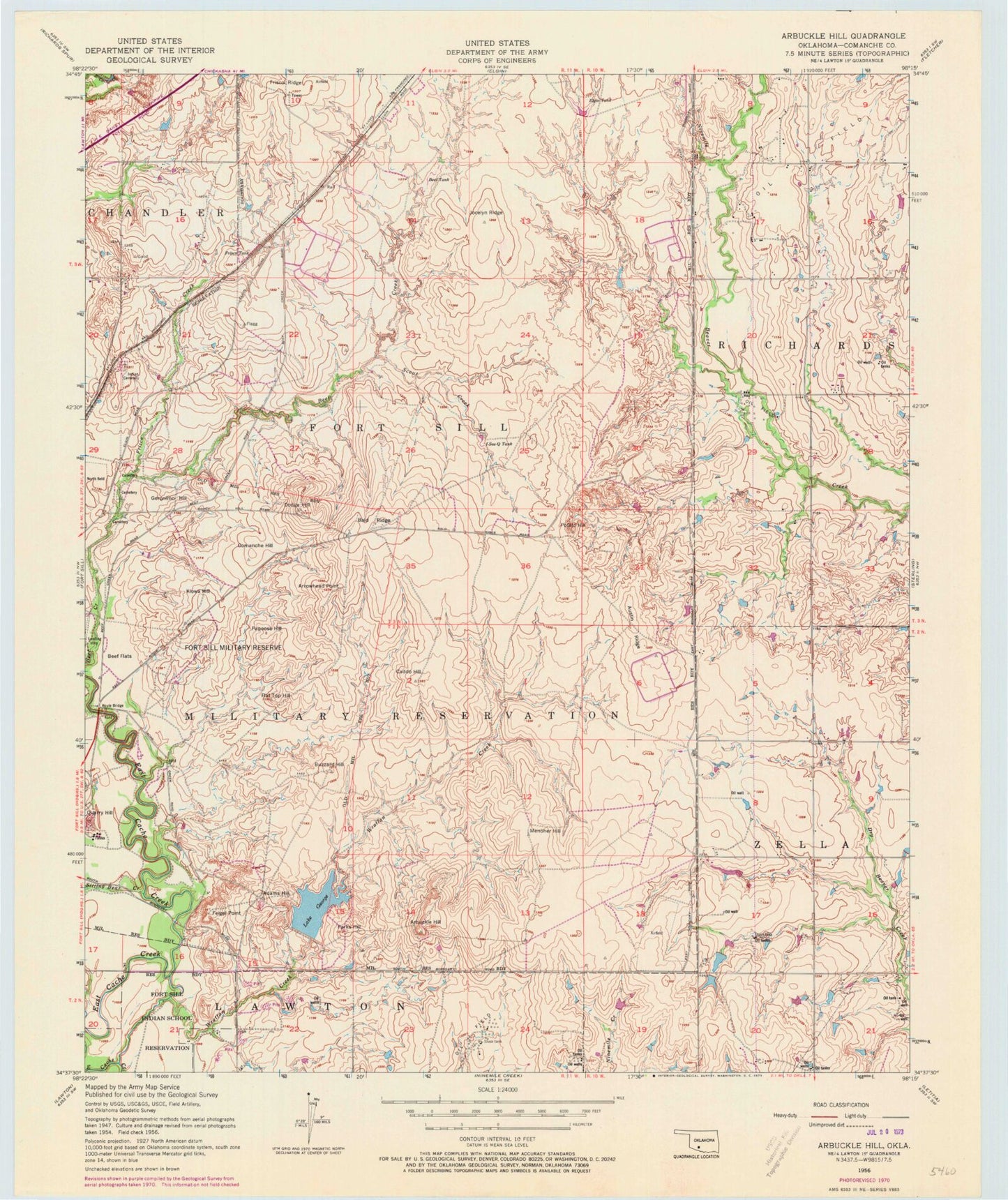
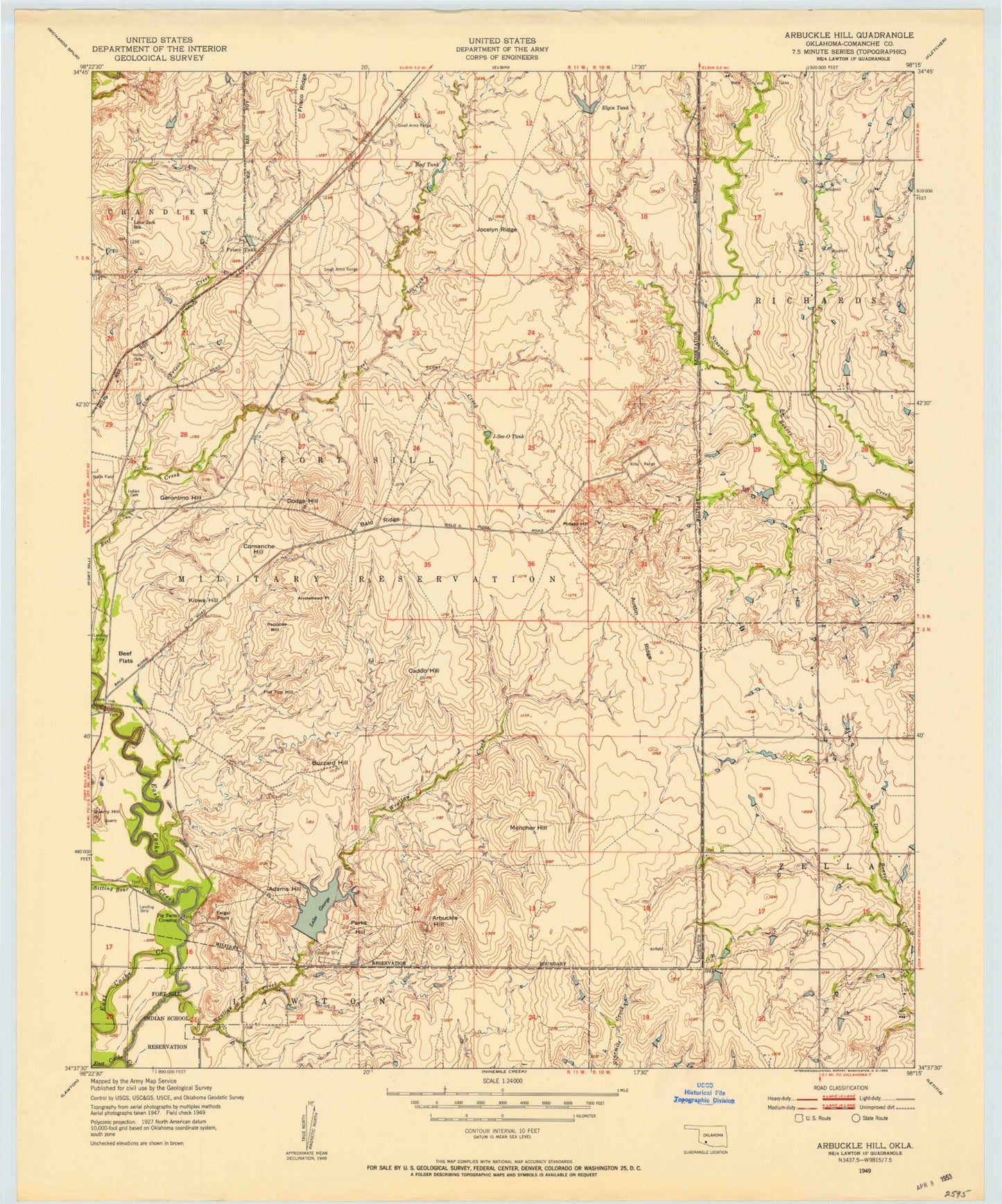
Historical USGS topographic quad map of Arbuckle Hill in the state of Oklahoma. Map scale may vary for some years, but is generally around 1:24,000. Print size is approximately 24" x 27"
This quadrangle is in the following counties: Comanche.
The map contains contour lines, roads, rivers, towns, and lakes. Printed on high-quality waterproof paper with UV fade-resistant inks, and shipped rolled.
Contains the following named places: Adams Hill, Arbuckle Hill, Arrowhead Point, Austin Ridge, Bailtso Apache South Cemetery, Bald Ridge, Beef Creek Apache Cemetery, Beef Flats, Beef Pond, Buzzard Hill, Caddo Hill, Chief Chihuahua Apache Cemetery, Comanche Hill, Dodge Hill, Elgin Pond, Feigel Point, Flat Top Hill, Frisco Creek, Frisco Ridge Airfield, Frisco Tank, Geronimo Hill, Hoyle Bridge, I-See-O Tank, Jocelyn Ridge, Kiowa Hill, Lake George, Lake George Dam, Menoher Hill, Oknoname 031006 Dam, Oknoname 031006 Reservoir, Oknoname 031036 Dam, Oknoname 031036 Reservoir, Otipoby Comanche Cemetery, Papoose Hill, Parks Hill, Potato Hill, Quarry Hill, Scout Creek, Sitting Bear Creek, Southeast Corner Airfield, Wrattan Creek