MyTopo
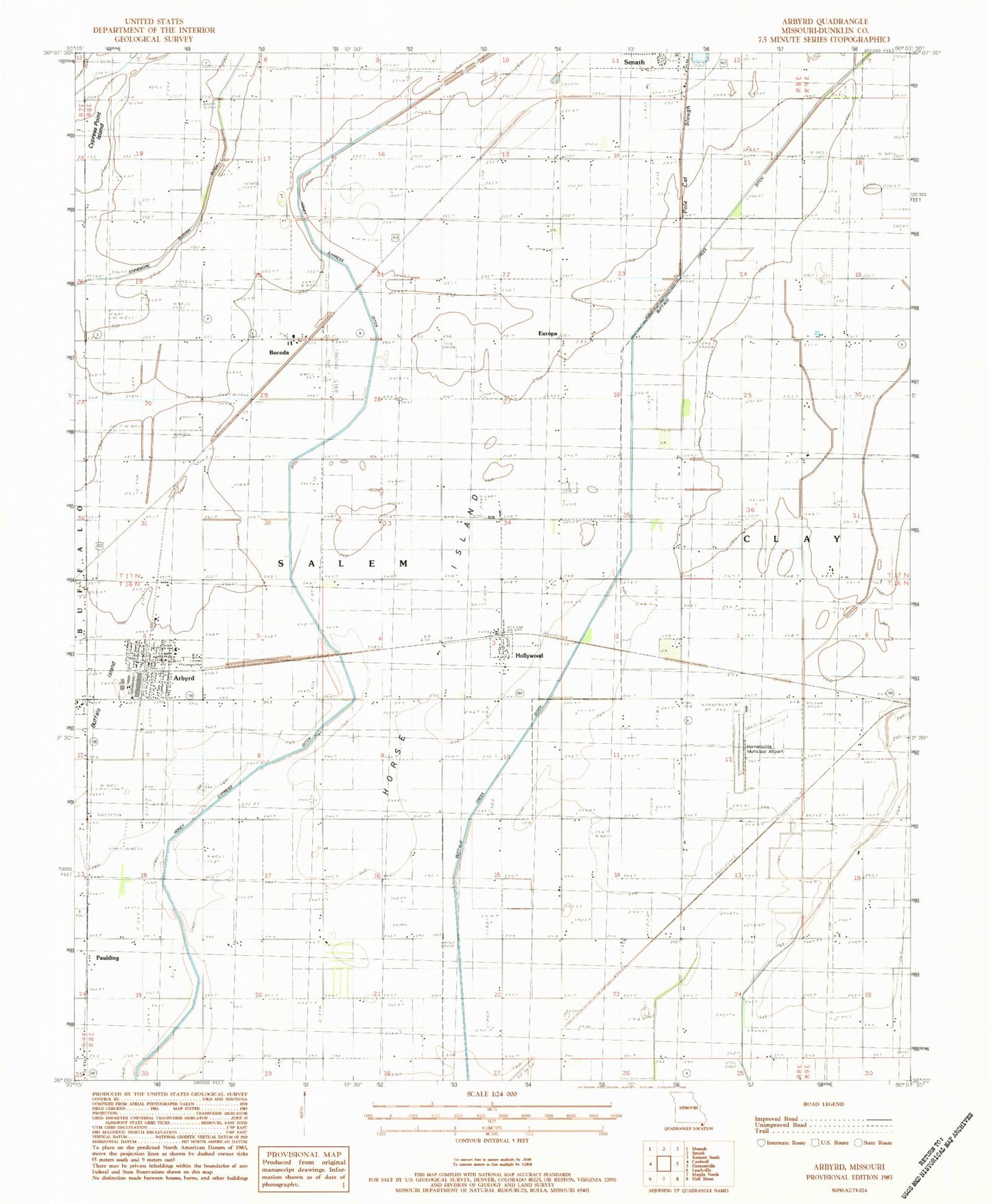
Classic USGS Arbyrd Missouri 7.5'x7.5' Topo Map
Couldn't load pickup availability
Historical USGS topographic quad map of Arbyrd in the state of Missouri. Map scale may vary for some years, but is generally around 1:24,000. Print size is approximately 24" x 27"
This quadrangle is in the following counties: Dunklin.
The map contains contour lines, roads, rivers, towns, and lakes. Printed on high-quality waterproof paper with UV fade-resistant inks, and shipped rolled.
Contains the following named places: Arbyrd, Arbyrd Police Department, Arbyrd Post Office, Arbyrd Volunteer Fire Department, Bone Camp Church, Bone School, Bucoda, Bucoda Church, Bucoda School, Buffalo Creek Ditch, Buffalo Island, Caneer, Caneer School, City of Arbyrd, Cold Water Cemetery, Coldwater Church, Coldwater School, Cole Ditch, Cude Cemetery, Cypress Point Island, Dunklin County, Europa, Europa School, Evorge, Hollywood, Hollywood Census Designated Place, Honey Cypress Ditch Number 34, Horner Cemetery, Hornersville Memorial Airport, Horse Island, Kearns, Lateral Number 2, Lulu Church, Lulu Perpetual Care Cemetery, Nesbit, New Hope Church, Old Coldwater Church, Paulding, Paulding School, Pole Cat Slough, Sand Pit, Shields Church, Shields School, Silverdale Cemetery, Silverdale Church, Silverdale School, Township of Salem, Vardell School, Wilkins Cemetery, ZIP Code: 63821