MyTopo
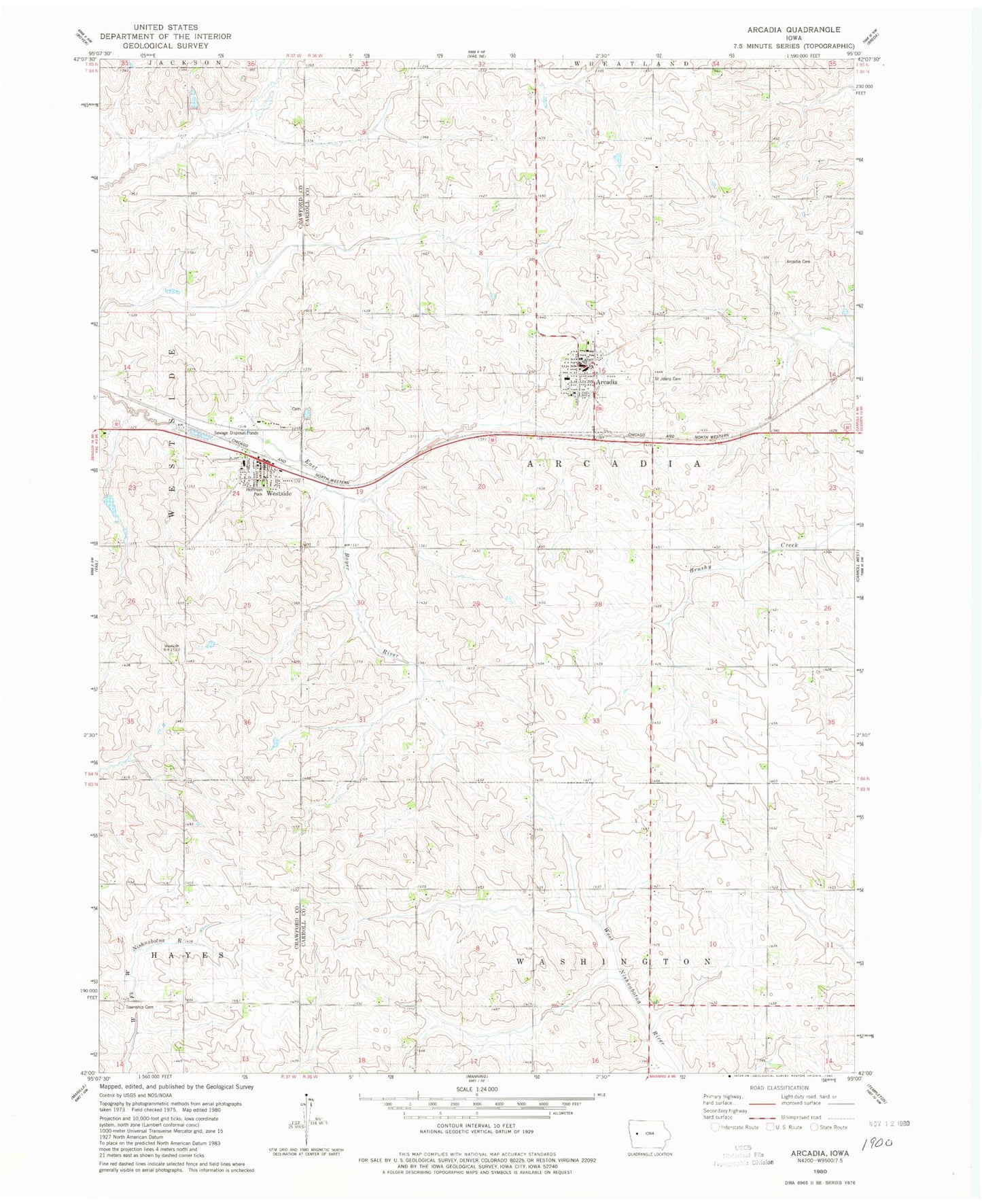
Classic USGS Arcadia Iowa 7.5'x7.5' Topo Map
Couldn't load pickup availability
Historical USGS topographic quad map of Arcadia in the state of Iowa. Map scale may vary for some years, but is generally around 1:24,000. Print size is approximately 24" x 27"
This quadrangle is in the following counties: Carroll, Crawford.
The map contains contour lines, roads, rivers, towns, and lakes. Printed on high-quality waterproof paper with UV fade-resistant inks, and shipped rolled.
Contains the following named places: Adena Post Office, Ar - We - Va Community School, Arcadia, Arcadia Ball Field, Arcadia Cemetery, Arcadia City Hall, Arcadia Elementary School, Arcadia Fire Department, Arcadia Police Department, Arcadia Post Office, City of Arcadia, City of Westside, Farmers Co-op Elevator, First Presbyterian Church, Hayes Township Cemetery, Hoffman Park, Saint Anthony Medical Clinic, Saint John's Catholic Church, Saint John's Catholic School, Saint Johns Cemetery, Township of Arcadia, United Church, Westside, Westside Cemetery, Westside City Hall, Westside Fire Department, Westside Post Office, Westside Public Library, Zion Lutheran Church, ZIP Codes: 51430, 51467