MyTopo
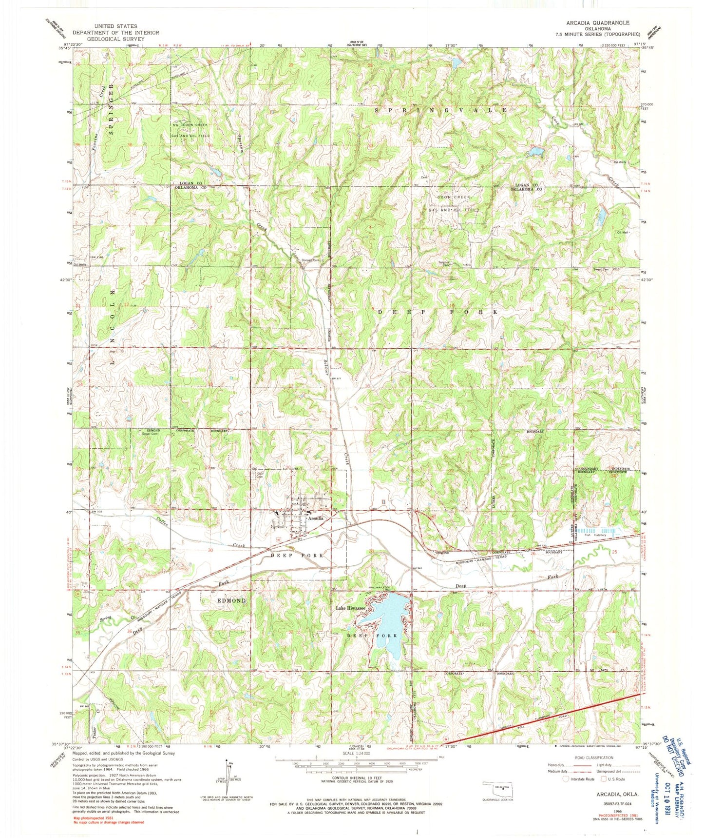
Classic USGS Arcadia Oklahoma 7.5'x7.5' Topo Map
Couldn't load pickup availability
Historical USGS topographic quad map of Arcadia in the state of Oklahoma. Map scale may vary for some years, but is generally around 1:24,000. Print size is approximately 24" x 27"
This quadrangle is in the following counties: Logan, Oklahoma.
The map contains contour lines, roads, rivers, towns, and lakes. Printed on high-quality waterproof paper with UV fade-resistant inks, and shipped rolled.
Contains the following named places: Arcadia, Arcadia Fire Department, Arcadia Independent Order of Odd Fellows Cemetery, Arcadia Police Department, Arcadia Post Office, Bear Fall Coon Creek Site 30 Dam, Bear Fall Coon Creek Site 30 Reservoir, Bear Fall Coon Creek Site 31 Dam, Bear Fall Coon Creek Site 31 Reservoir, Bear Fall Coon Creek Site 32 Dam, Bear Fall Coon Creek Site 32 Reservoir, Coffee Creek, Coon Creek Gas and Oil Field, Donnell Cemetery, Gower Cemetery, Gregg Airport, Hiwassee Lake Dam, Lake Arcadia, Lake Hiwassee, Northwest Coon Creek Gas and Oil Field, Oklahoma City Northeast Division, Oknoname 083005 Dam, Oknoname 083005 Reservoir, Oknoname 083006 Dam, Oknoname 083006 Reservoir, Saint James AME Church, Soldier Creek, Spigener Cemetery, Spring Creek, Sweat Cemetery, Tinker Creek, Town of Arcadia, Township of Deep Fork, Township of Lincoln, Tudor Cemetery, Woodleaf Aero Estates Airport, ZIP Code: 73007