MyTopo
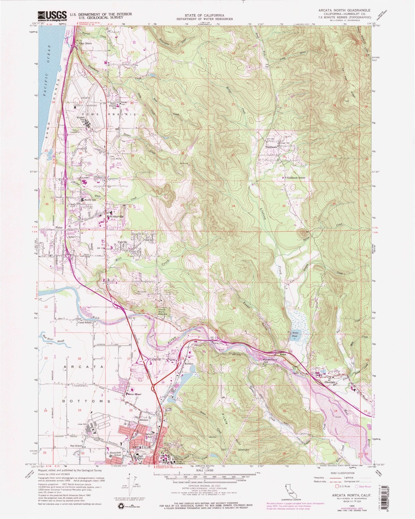
Classic USGS Arcata North California 7.5'x7.5' Topo Map
Couldn't load pickup availability
Historical USGS topographic quad map of Arcata North in the state of California. Typical map scale is 1:24,000, but may vary for certain years, if available. Print size: 24" x 27"
This quadrangle is in the following counties: Humboldt.
The map contains contour lines, roads, rivers, towns, and lakes. Printed on high-quality waterproof paper with UV fade-resistant inks, and shipped rolled.
Contains the following named places: Airport School, Arcata Bottoms, Azalea State Natural Reserve, Bay School, Bloomfield Elementary School, Calville, Canal School, Clam Beach, Dows Prairie, Dow's Prairie Elementary School, Duke Creek, Essex Gulch, Essex Pond, Fieldbrook, Fieldbrook Elementary School, Grassy Creek, Hall Creek, Humboldt State University, Janes Creek, Janes School, Jolly Giant Creek, Kelly Creek, Leggit Creek, Lindsay Creek, Mather Creek, Mill Creek, Mill Creek, Morris Elementary School, Noisy Creek, Patrick Creek, Squaw Creek, Sunset Elementary School, Vista Point, Warren Creek, Warren Creek School, Widow White Creek, Strawberry Creek, Rose Creek, California Redwood Coast-Humboldt County Airport, Alliance, Essex, Fisher, Glendale, Korblex, McKinleyville, Arcata 27 Dam, Alder Hall, Arthur H Gist Hall, Cedar Hall, Charles Fulkerson Recital Hall, Chinquapin Hall, Cornelius H Siemens Hall, Cypress Hall, Founders Hall, Hemlock Hall, Jenkins Hall, John Van Duzer Theatre, Jolly Giant Commons, Joseph M Forbes Physical Education Complex, Madrone Hall, Maple Hall, Nelson Hall, Pepperwood Hall, Redwood Bowl, Redwood Hall, Sunset Hall, Tan Oak Hall, University Center, Van Matre Hall, Clam Beach, Washington School (historical), Arcata High School, Glendale School (historical), Greenwood Cemetery, Lutheran Church of Arcata, Mad River Community Hospital, Pacific Union Elementary School, Saint Marys Catholic Church, Saint Marys Cemetery, Saint Mary's Catholic School, Stewart Elementary School, Valley West Shopping Center, Westwood Village Shopping Center, Abundant Life Center Assembly of God, Aldergrove Industrial Park, Arcata Community Forest, BeauPre Golf Course, Faith Temple Pentecostal Church of God, First United Pentecostal Church, Hiller Park, Larson Park, McKinleyville Church of Christ, McKinleyville Elementary School, McKinleyville High School, McKinleyville Post Office, McKinleyville Shopping Center, Ocean West Mobile Home Park, Pierson Park, Naval Auxiliary Air Station Arcata (historical), McKinleyville Census Designated Place, Coast Guard Air Station Humboldt Bay, Fieldbrook Census Designated Place, Arcata Fire Protection District Mad River Station, Arcata Fire Protection District McKinleyville Station, Fieldbrook Fire Department, Arcata Drive-In (historical), Humboldt County Sheriff's Office McKinleyville Station