MyTopo
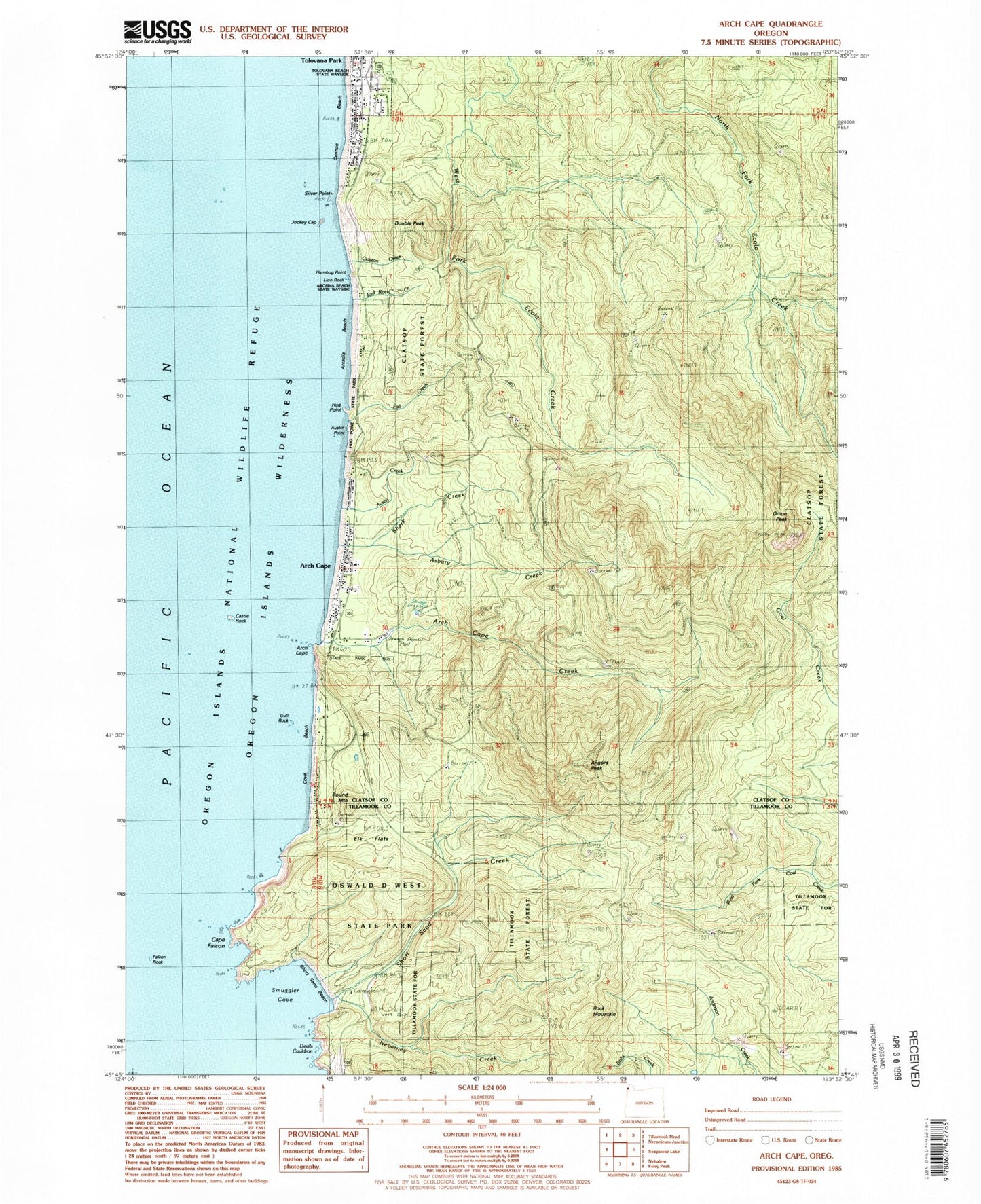
Classic USGS Arch Cape Oregon 7.5'x7.5' Topo Map
Couldn't load pickup availability
Historical USGS topographic quad map of Arch Cape in the state of Oregon. Typical map scale is 1:24,000, but may vary for certain years, if available. Print size: 24" x 27"
This quadrangle is in the following counties: Clatsop, Tillamook.
The map contains contour lines, roads, rivers, towns, and lakes. Printed on high-quality waterproof paper with UV fade-resistant inks, and shipped rolled.
Contains the following named places: Arcadia Beach, Arch Cape, Arch Cape, Arch Cape Creek, Armstead Memorial, Asbury Creek, Adair Point, Cape Falcon, Castle Rock, Cove Beach, Elk Flats, Falcon Rock, Fall Creek, Gull Rock, Hug Point, Humbug Point, Jockey Cap, Lion Rock, Necarney Creek, Onion Peak, Oswald West State Park, Red Rock Creek, Rock Mountain, Shark Creek, Short Sand Beach, Short Sand Creek, Silver Point, Tolovana Park, Griffin Creek, Mason Creek, Cedar Creek, Austin Creek, Hug Point State Park, Clayton Creek, Chisana Creek, Tolovana Beach State Park, Hug Creek, Devils Cauldron, Austin Point, Point Meriwether, Angora Peak, Double Peak, Round Mountain, Smuggler Cove, Cannon Beach Post Office (historical), Arch Cape Post Office, Tolovana Park Post Office, Treasure Cove, Arcadia Beach State Park, Nehalem Harwood Square, Fire Mountain School, Cannon Beach Rural Fire Protection District Arch Cape Station, Arch Cape Water and Sanitary District, Arch Cape Tunnel 2247, Dila Dairy