MyTopo
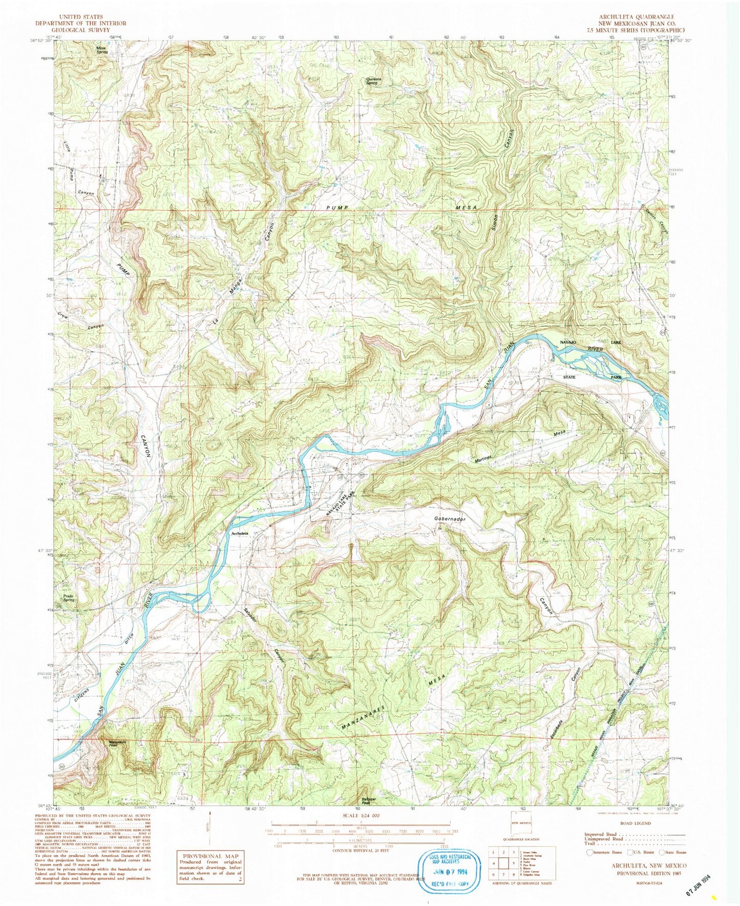
Classic USGS Archuleta New Mexico 7.5'x7.5' Topo Map
Couldn't load pickup availability
Historical USGS topographic quad map of Archuleta in the state of New Mexico. Map scale may vary for some years, but is generally around 1:24,000. Print size is approximately 24" x 27"
This quadrangle is in the following counties: San Juan.
The map contains contour lines, roads, rivers, towns, and lakes. Printed on high-quality waterproof paper with UV fade-resistant inks, and shipped rolled.
Contains the following named places: Archuleta, Baltazar Peak, Crow Canyon, Escarbada Canyon, Gobernador Canyon, Gobernador Canyon Arch, La Manga Canyon, Little Pump Canyon, Martinez Mesa, Melquadis Point, Minix Canyon, Minix Spring, Navajo Dam Census Designated Place, Navajo Dam Post Office, Navajo Lake Airport, Navajo Lake State Park, Our Lady of Guadalupe Cemetery, Prado Spring, Pump Canyon, Pump Mesa, Quintana Spring, Salvador Canyon, San Juan Basin Field, San Juan County Fire District 10 - Navajo Dam, Simon Canyon