MyTopo
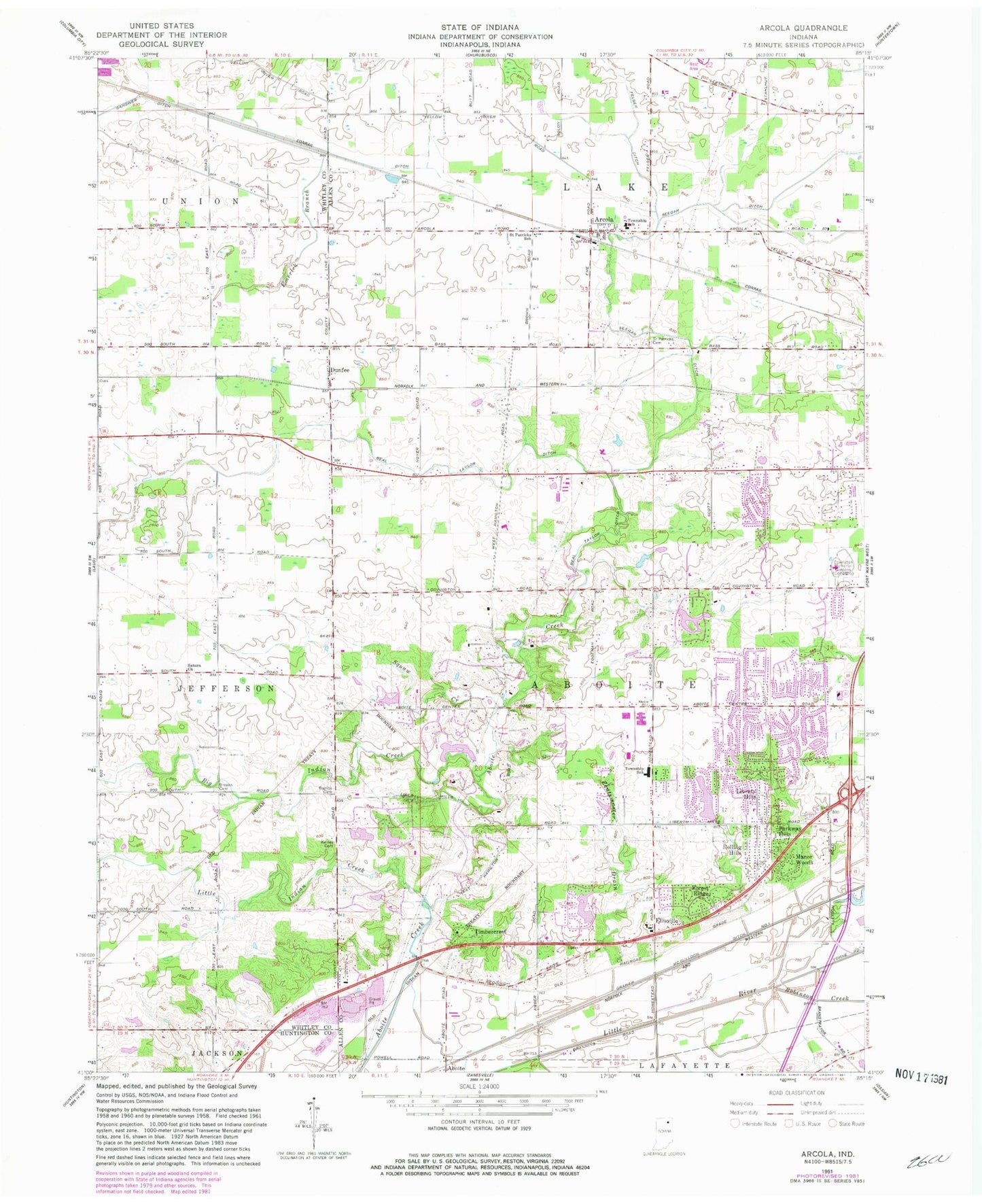
Classic USGS Arcola Indiana 7.5'x7.5' Topo Map
Couldn't load pickup availability
Historical USGS topographic quad map of Arcola in the state of Indiana. Map scale may vary for some years, but is generally around 1:24,000. Print size is approximately 24" x 27"
This quadrangle is in the following counties: Allen, Huntington, Whitley.
The map contains contour lines, roads, rivers, towns, and lakes. Printed on high-quality waterproof paper with UV fade-resistant inks, and shipped rolled.
Contains the following named places: Aboite, Aboite Township Fire Department, Arcola, Arcola Elementary School, Arcola Post Office, Arcola Volunteer Fire Department, Bayless Cemetery, Beal Taylor Ditch, Big Indian Creek, Broxon Cemetery, Cook Lougheed Wildlife Pond, Cook Lougheed Wildlife Pond Dam, Covington Lake, Covington Lake Dam, Covington Memorial Gardens, Dennis Airport, Dunfee, Ellison, Ellisville, Emerick Branch, Felger Ditch, Forest Ridge, Fort Wayne Fire Department Station 18, Fort Wayne Fire Department Station 19, Gerig's Field, Graham McCulloch Ditch Number One, Indiana State Police Department District 22, Kekingo Shores Lake, Kekionga Lake Dam, Liberty Hills, Little Indian Creek, Manor Woods, Parkway Hills, Pigeon River State Fish and Wildlife Area, Rehling Ditch, Roanoke Pit, Robinson Creek, Rolling Hills, Saint Patrick Roman Catholic Cemetery, Saturn, Saturn Church, Squaw Creek, Timbercrest, Township of Aboite, WKSY-FM (Columbia City), ZIP Codes: 46704, 46814