MyTopo
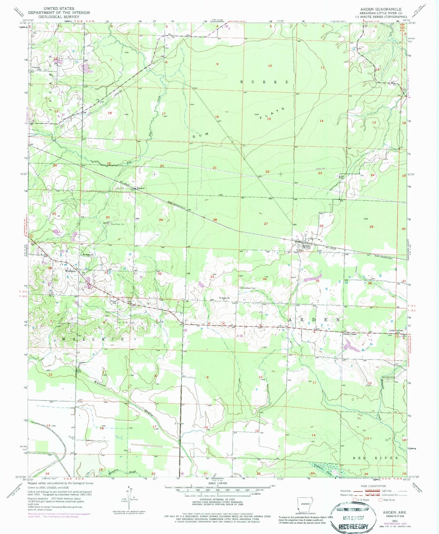
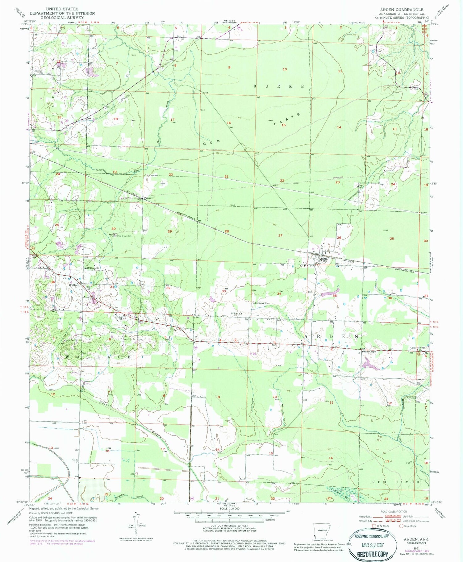
Classic USGS Arden Arkansas 7.5'x7.5' Topo Map
Couldn't load pickup availability
Historical USGS topographic quad map of Arden in the state of Arkansas. Map scale may vary for some years, but is generally around 1:24,000. Print size is approximately 24" x 27"
This quadrangle is in the following counties: Little River.
The map contains contour lines, roads, rivers, towns, and lakes. Printed on high-quality waterproof paper with UV fade-resistant inks, and shipped rolled.
Contains the following named places: Arden, Arden Cemetery, Arden School, Arden Volunteer Fire Department, Bradshaw Cemetery, Cedar Springs Baptist Church, Gravelly Cemetery, Gravelly Church, Gum Flats, Hemphill Cemetery, Hemphill Creek, Horseshoe Slough, Nolen School, Pankov, Pine Grove Cemetery, Pullen Lake, Pullen Lake Dam, Saint John Church, Saint Rest Missionary Baptist Church, Sivley Lake, Sivley Lake Dam, Township of Arden, Township of Wallace, Wade Chapel School, Wades Chapel, Wades Chapel United Methodist Church, Wallace, Wallace Volunteer Fire Department