MyTopo
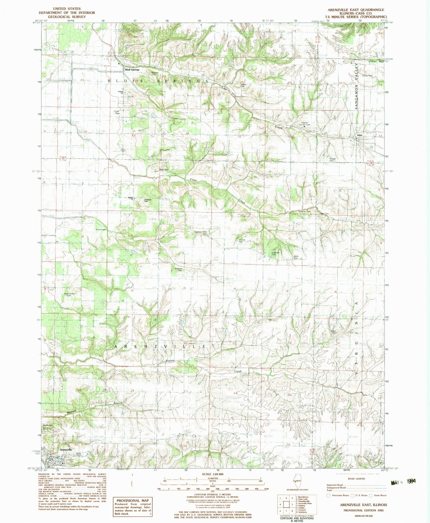
Classic USGS Arenzville East Illinois 7.5'x7.5' Topo Map
Couldn't load pickup availability
Historical USGS topographic quad map of Arenzville East in the state of Illinois. Map scale may vary for some years, but is generally around 1:24,000. Print size is approximately 24" x 27"
This quadrangle is in the following counties: Cass.
The map contains contour lines, roads, rivers, towns, and lakes. Printed on high-quality waterproof paper with UV fade-resistant inks, and shipped rolled.
Contains the following named places: Arenzville, Arenzville East Cemetery, Arenzville North Cemetery, Arenzville Post Office, Arenzville Volunteer Fire Department, Bethel Church, Bluff Springs, Bluff Springs Post Office, Bluff Springs School, Buck Cemetery, Buck School, Cass, Cauby Cemetery, Clark Cemetery, Dupes Cemetery, Green Krohe Cemetery, Huffman Cemetery, James Davis Cemetery, Jockisch Cemetery, Jules, Krohe Cemetery, Krohe School, Lee Cemetery, Lovecamp School, McLane Cemetery, Monroe Cemetery, Monroe School, Pleasant Hill School, Powell Cemetery, Providence School, Shick Shack Sand Pond Nature Preserve, Springer School, Township of Arenzville, Treadway Miller Cemetery, Trinity Lutheran Cemetery, Tureman Cemetery, Union Grove School, Union School, Village of Arenzville, Virginia Country Club, Warrior School, Wiggens Cemetery, William Nisbet Cemetery, ZIP Code: 62622