MyTopo
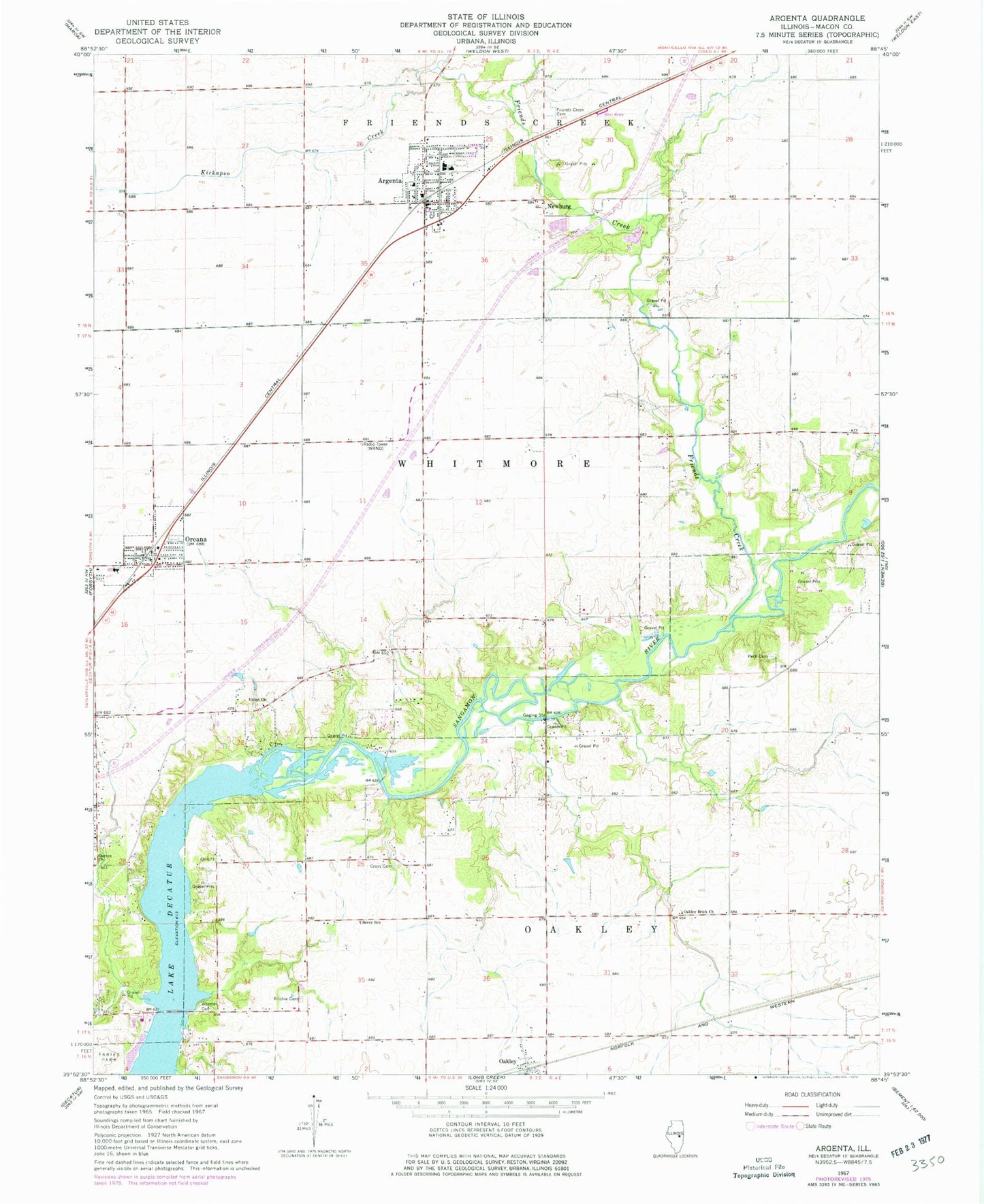
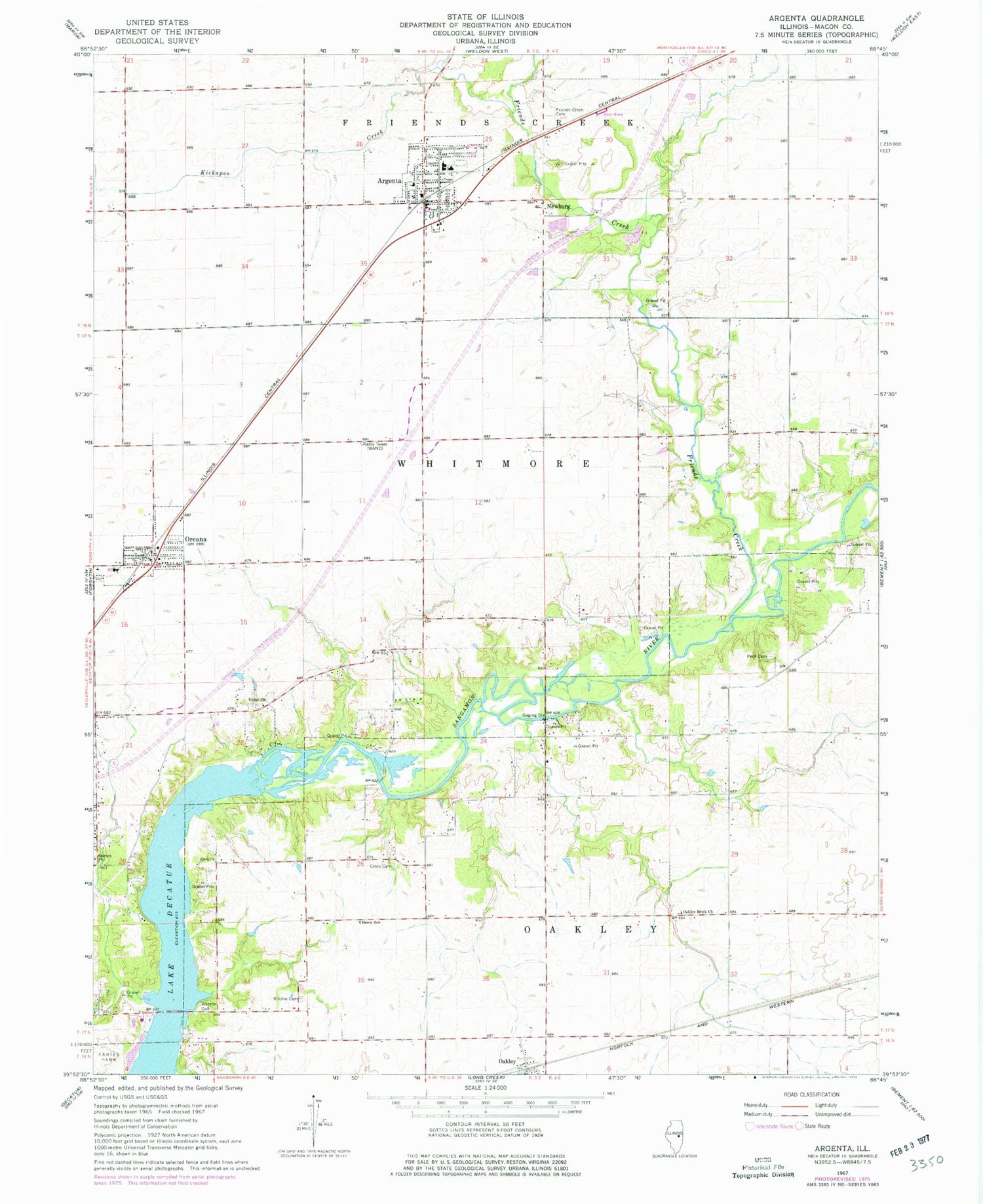
Classic USGS Argenta Illinois 7.5'x7.5' Topo Map
Couldn't load pickup availability
Historical USGS topographic quad map of Argenta in the state of Illinois. Map scale may vary for some years, but is generally around 1:24,000. Print size is approximately 24" x 27"
This quadrangle is in the following counties: Macon.
The map contains contour lines, roads, rivers, towns, and lakes. Printed on high-quality waterproof paper with UV fade-resistant inks, and shipped rolled.
Contains the following named places: Argenta, Argenta - Oreana Fire Department Station 2, Argenta - Oreana Fire Protection District Station 1, Argenta Police Department, Argenta Post Office, Argenta Primary School, Argenta-Oreana High School, Argenta-Oreana Middle School, Berry School, Central School, Chapin, Cross Cemetery, Fairview School, Friends Creek, Friends Creek Cemetery, Garven Church, Garver Cemetery, Hess School, Hufford Switch, Kickapoo Creek, Kirby School, New Argenta Grade School, Newburg, Oakley, Oakley Brick Church, Oreana, Oreana Grade School, Oreana Post Office, Peck Cemetery, Peck School, Progress School, Reas Bridge, Ritchie Cemetery, Township of Oakley, Township of Whitmore, Union Cemetery, Union Church, Village of Argenta, Village of Oreana, Walnut Grove College, WAND-TV (Decatur), WFHL-TV (Decatur), Wheeler Cemetery, Zion School, ZIP Code: 62501