MyTopo
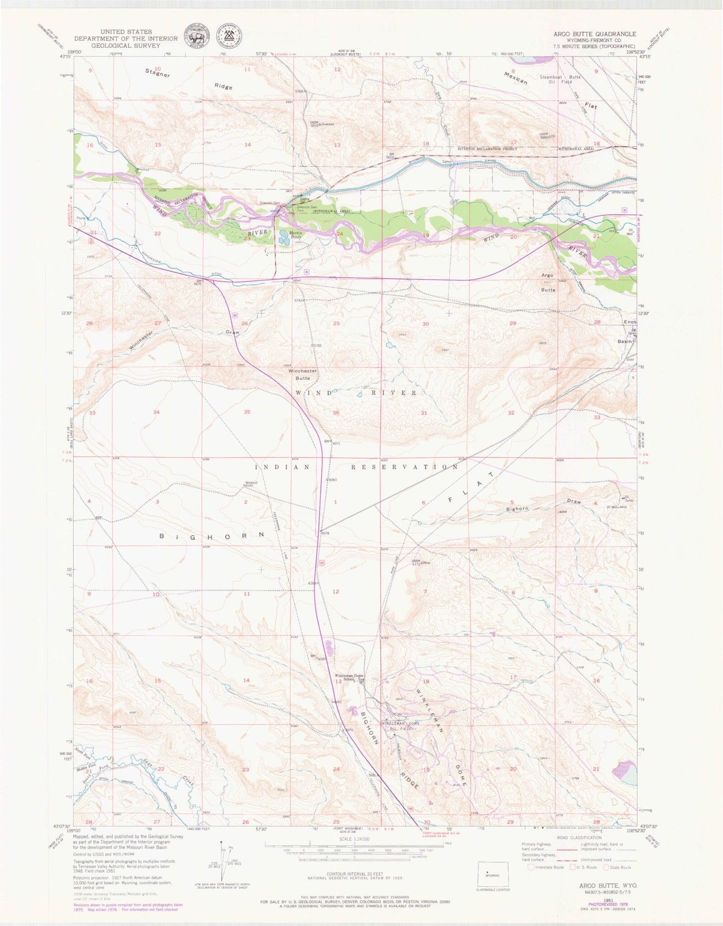
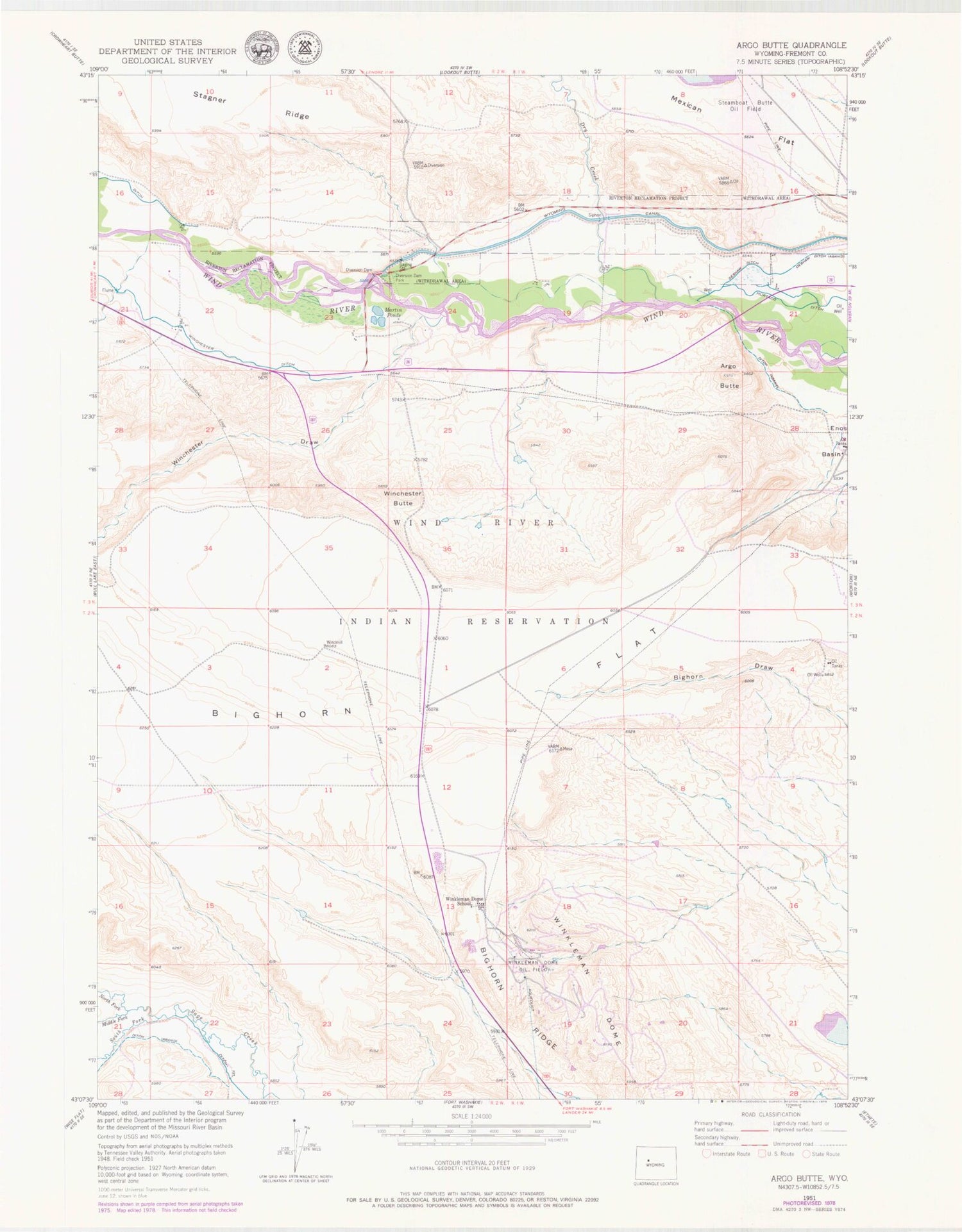
Classic USGS Argo Butte Wyoming 7.5'x7.5' Topo Map
Couldn't load pickup availability
Historical USGS topographic quad map of Argo Butte in the state of Wyoming. Map scale may vary for some years, but is generally around 1:24,000. Print size is approximately 24" x 27"
This quadrangle is in the following counties: Fremont.
The map contains contour lines, roads, rivers, towns, and lakes. Printed on high-quality waterproof paper with UV fade-resistant inks, and shipped rolled.
Contains the following named places: Argo Butte, Bighorn Flat, Deshaw Ditch, Diversion Dam, Diversion Dam Park, Dry Creek, Martin Ponds, Middle Fork Sage Creek, North Fork Canyon Number Two Mine, North Fork Sage Creek, South Fork Sage Creek, Winchester Butte, Winchester Ditch, Winchester Draw, Wind River Diversion Dam, Winkleman Dome, Winkleman Dome Oil Field, Winkleman Dome School