MyTopo
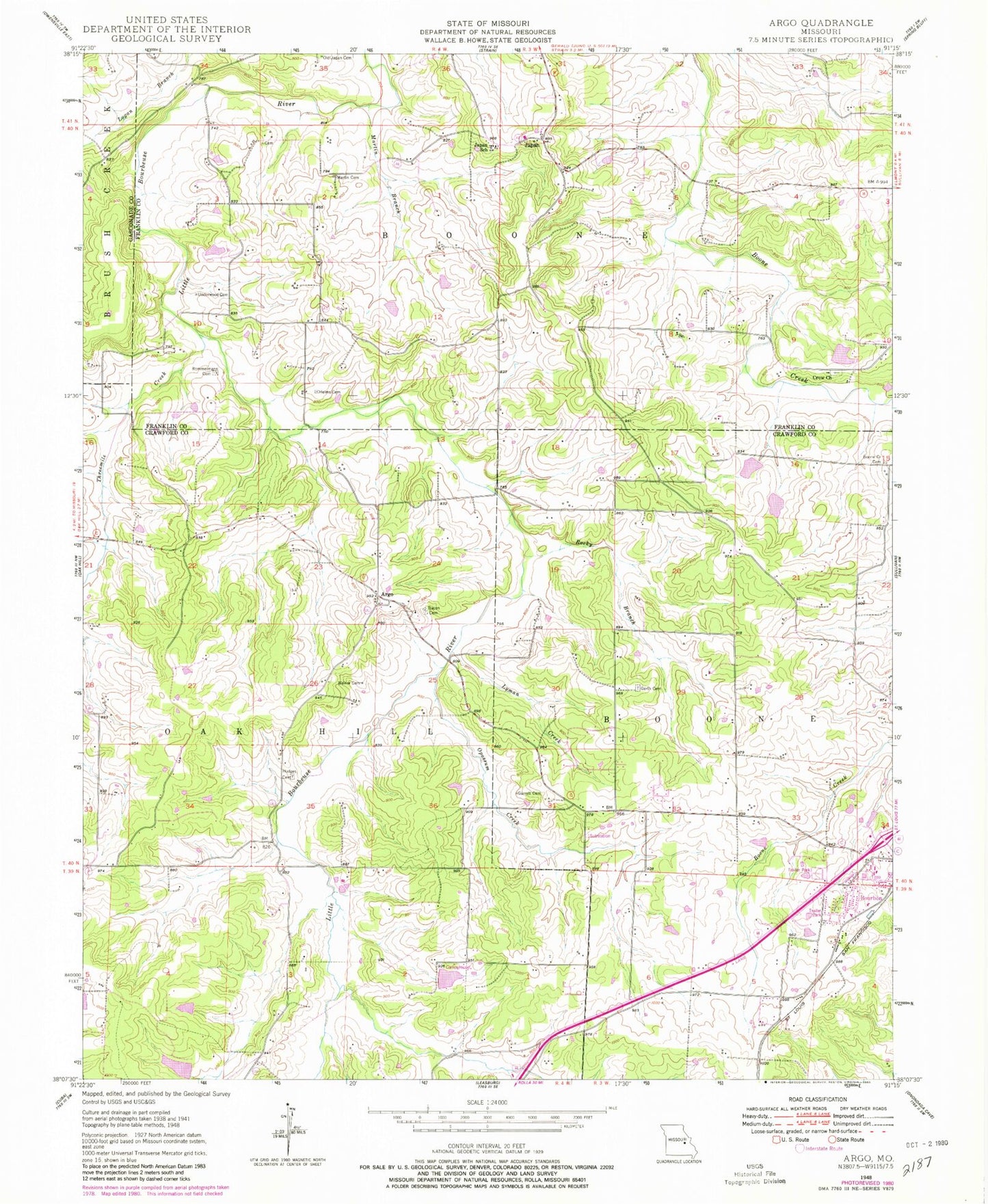
Classic USGS Argo Missouri 7.5'x7.5' Topo Map
Couldn't load pickup availability
Historical USGS topographic quad map of Argo in the state of Missouri. Map scale may vary for some years, but is generally around 1:24,000. Print size is approximately 24" x 27"
This quadrangle is in the following counties: Crawford, Franklin, Gasconade.
The map contains contour lines, roads, rivers, towns, and lakes. Printed on high-quality waterproof paper with UV fade-resistant inks, and shipped rolled.
Contains the following named places: Argo, Argo School, Bacon Cemetery, Boone Creek Baptist Church, Boone Creek Cemetery, Church of the Holy Martyrs of Japan, Crow Cemetery, Crow Church, Delhi, Delhi School, Dorson Lake, Fairview School, Garrett Cemetery, Gerth Cemetery, Gibbons Lake Dam, Helms Cemetery, Hodges Cemetery, Holmstrom North Lake, Holmstrom North Lake Dam, Jank Lake, Janks Lake Dam, Japan, Japan School, Lyman Creek, Martin Branch, Martin Cemetery, Mound School, Mount Calvary Church, Nolie Lake North, Nolie Lake North Dam, Nolie Lake South, Nolie Lake South Dam, Old Argo School, Old Japan Cemetery, Opossum Creek, Rocky Branch, Rommelmann Cemetery, Seminary School, Stringtown School, Sullivan Fire Protection District Station 3, Threemile Creek, Underwood Cemetery, Walker Cemetery